A tour around Marlenheim via Wangen and Odratzheim

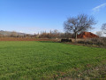
An easy walk with little elevation gain, exploring the outskirts of Marlenheim to the south between Wangen and Odratzheim. Discover a beautiful stables in Wangen, followed by a detour through the vineyards and a return across the fields to the starting point.

Details

6837826
Creation:
Last update:
Last review:
  • Walking
    Activity: Walking
  • ↔
    Distance: 5.75 mi
  • ◔
    Average duration: 2h 50 
  • ▲
    Difficulty: Easy

  • ⚐
    Back to start: Yes
  • ↗
    Ascent: + 200 ft
  • ↘
    Descent: - 207 ft

  • ▲
    Highest point: 794 ft
  • ▼
    Lowest point: 594 ft
  • ⚐ Country: France
  • ⚐ City: Marlenheim (67520)
  • ⚑
    Start/End: N 48.621374° / E 7.485058°
  • ❏
    IGN map(s): Ref. 3715ET, 3716ET, 3716ETR
  • Hour-by-hour weather

Photos

Description of the walk

The start and finish are in front of the “Arthur Metz” shop on Rue du Général de Gaulle. Plenty of parking available.

(S/E) Take Rue du Capitaine North, opposite the shop. At the bottom of the street, head straight on towards the community gardens and continue to the right through the tunnel under the road.

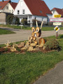
(1) At the tunnel exit, turn right then left towards the “Xavier Muller” estate. Take a moment to admire the view and spot the ten or so stork nests around you, as well as the animals at the entrance to the estate.

(2) Cross the small bridge and go round the building on the left. After asecond footbridge over La Mossig, carry on straight along the wide path towards the farm you can see in the distance. At the crossroads, go straight on until you reach the county road. Turn right and continue to the roundabout.

(3) Go straight across at the roundabout. Turn left and take thefirst dirt track on the right towards the equestrian centre.

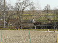
(4) Walk past the equestrian centre and admire the beautiful horses in the various fields. Continue straight on until you reach the junction with the tarmac D842 road, which comes from the village of Wangen on your right.

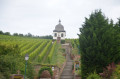
(5) At the junction, turn left and carry on to the D142 county road. Cross with care and take the Red Diamond-marked path slightly to the left for a walk through the vineyards. After three right-angle bends, you’ll reach a crossroads.

(6) Please note: at this point, turn left into the field behind the trees to join a path 30 metres away, still on the Red Diamond route. Walk up the small hill to join the D220 road.

(7) Cross the D220 with care, turn left and
50 m further on, turn right. Follow the path through the countryside until you reach the junction with the cycle path.

(8) Turn left until you reach the roundabout. Cross to the left at the pedestrian crossing and continue to Odratzheim along the cycle path. Carry on to the first junction and take Rue de la Chapelle, slightly to the left. Go straight on, crossing the fields to reach Kirchheim via Rue des Champs and arrive at the junction with the D220.

(9) Cross the D220 carefully and, keeping slightly to the left, join a small road that leads northwards through the fields again. At the junction, carry on in the same direction and, after a left-right turn, continue straight on. After a right-angle bend to the left and then to the right, you’ll reach the tennis courts.

(10) Along the way, spot the various animals around you: donkeys, goats and horses. After the tennis courts, turn right onto the road and walk through La Mossig. After the houses, take the road on the left, pass a fishing pond and you’ll reach the exit of the road tunnel.

(1) Turn right under the bridge you crossed at the start. Follow the path past the allotments and head up Rue du Capitaine North towards the finish at the Arthur Metz shop (S/E).

Waypoints

  1. S/E : mi 0 - alt. 620 ft - Arthur Metz shop
  2. 1 : mi 0.25 - alt. 600 ft - Tunnel
  3. 2 : mi 0.44 - alt. 604 ft - Domaine Xavier Muller – Bridge over the - Mossig (rivière)
  4. 3 : mi 0.81 - alt. 630 ft - Wangen roundabout
  5. 4 : mi 1.16 - alt. 659 ft - Equestrian centre
  6. 5 : mi 1.38 - alt. 719 ft - Road out of Wangen
  7. 6 : mi 2.37 - alt. 650 ft - Crossroads
  8. 7 : mi 2.67 - alt. 643 ft - Section D220
  9. 8 : mi 2.88 - alt. 604 ft - Cycle path
  10. 9 : mi 4.39 - alt. 604 ft - D220 junction
  11. 10 : mi 5 - alt. 594 ft - Tennis courts
  12. S/E : mi 5.75 - alt. 620 ft - Arthur Metz shop

Reviews and comments

4 / 5
Based on 4 reviews

Reliability of the description
3.8 / 5
Ease of following the route
4 / 5
Route interest
4.3 / 5
clebercle
clebercle

Overall rating : 4 / 5

Date of your route : Sep 29, 2024
Reliability of the description : ★★★★☆ Good
Ease of following the route : ★★★★☆ Good
Route interest : ★★★★☆ Good
Very busy route : No

A few additional comments on the text already provided… A lovely walk, particularly the section through the vineyards, but… a large part of it is along roads or tarmac cycle paths. The suggested route bypasses the village centres of Wangen, Odratzheim and Kirchheim, opting instead for paths through the fields. If you’d like to explore these villages, you’ll need to take a short detour each time – it’s very easy.
The total elevation gain is actually around 110 m, but that isn’t particularly significant.
Please note that after point 5, when crossing Road 142, the path branches off to the right at an angle after 30 metres, not to the left.

Machine-translated

endless-summer
endless-summer

Overall rating : 4.7 / 5

Date of your route : Apr 08, 2024
Reliability of the description : ★★★★☆ Good
Ease of following the route : ★★★★★ Very good
Route interest : ★★★★★ Very good
Very busy route : No

What a beautiful vineyard, and what superb views between Kronthal, the hills, the orchards and this vineyard......

Machine-translated

HABERACKER
HABERACKER

Overall rating : 4 / 5

Date of your route : Mar 21, 2024
Reliability of the description : ★★★★☆ Good
Ease of following the route : ★★★★☆ Good
Route interest : ★★★★☆ Good
Very busy route : No

A peaceful walk through the countryside and a little way through the vineyards.

Machine-translated

Saverti
Saverti

Overall rating : 3.3 / 5

Date of your route : Mar 04, 2022
Reliability of the description : ★★★☆☆ Average
Ease of following the route : ★★★☆☆ Average
Route interest : ★★★★☆ Good
Very busy route : No

The route as a whole is described quite well, though there’s a slight snag at points 6 and 7, where you have to rely a bit on a crystal ball: (7) along the D 220, you actually have to walk a good 500 metres before you find the path on the right (marked with a red diamond) that leads to the cycle path. There’s not much shade on this path, so it’s best avoided in the height of summer.

Machine-translated

Other walks in the area

For more walks, use our search engine .

The GPS track and description are the property of this route's author. Please do not copy them without permission.