Country:

 City:
City:


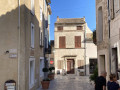

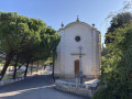
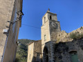
The start was at 330 Avenue Aristide Briand, near the mini-market.
Signposted with a blue arrow featuring a white cyclist inside, indicating ‘Apt’
(S/E) Take Rue des Bastides until you reach a multi-way junction. Take thesecond street on the left (Rue Pierre Casteau), then thesecond on the right (Chemin de la Glissette), and carry on straight ahead until you reach a roundabout. Turn right (Chemin du Carraire) and follow this road until you reach Rue de l’Église.
(1) Carry on to the right, towards the village centre, passing the church and then the cemetery on your right, and carry on straight ahead until you reach a roundabout.
(2) Head straight ahead onto Route d’Oppède, follow the D29, leave the village and arrive at a four-way junction.
(3) Turn right onto Chemin du Moure, then immediately turn left onto the dirt track. Follow this straight on and, when you reach the tarmac, turn right. At the entrance to the car park in the village of Oppède-le-Vieux, go straight on (one-way road) and head for the village centre.
(4) Continue straight on along the Route des Petitons Minguets. Leave the village, ignore the Chemin de Malpertuis and reach a three-way junction with a wayside cross. Turn right onto the Chemin des Gellis and join the D188.
(5) Turn right towards Ménerbes and follow the D188 until you enter the village. At the Stop sign, turn right towards Bonnieux and you’ll come to a junction with a statue in memory of the Resistance fighters on your left.
(6) Take the hairpin bend to the left and continue through the village, following the flow of traffic. On leaving the village, drive past the car parks on your left and head downhill until you reach the D3.
(7) Turn right towards Bonnieux and follow this road until you reach the D106 on the left.
(8) Take this road towards Lacoste and head into the village via the Town Hall.
(9) Carry on to the right and, at the next junction, take the hairpin bend onto the Route de Bonnieux (D109), towards Bonnieux. The start point is on the left of the Chemin de la Gardiole, situated on a wide, uphill right-hand bend in the road.
(10) Follow this path and, at the end, turn right to reach a roundabout and the church at the foot of the village of Bonnieux. Take the narrow street that climbs up, Rue d’Ittenhein, walk past a car park, Place Gambetta, then turn right onto Rue Pasteur, dismounting your bike (No Entry). At Place Carnot, turn left onto Rue Marceau and continue to the junction with the D36.
(11) Take the hairpin bend to the right, towards Pertuis. Leave the village, pass number 4 and, at the next three-way junction, turn left onto Chemin des Croix. A few metres further on, take the hairpin bend to the left and climb up to the cemetery, keeping to the right at the following junctions.
(12) After enjoying the view, return along the same route as far as the junction at the end of the D36.
(11) Continue straight on along theD30A towards Apt and, at the next junction, take a hairpin bend to the left onto the D3 towards Ménerbes. About a hundred metres before the church, turn right onto the D149 towards Roussillon. At the roundabout, take thesecond exit towards Pont Julien, which you’ll reach a few metres further on.
(13) Ignore it and turn left onto the Véloroute, towards Goult. This route follows the Calavon valley. Pass through the villages of Les Beaumetes and Coustelletet, and head for Robion. Cross the bridge over the Canal de Carpentras and you’ll come to a side street near a car park on your right.
(14) Turn left (Avenue de la Gare) and continue straight on. At the roundabout, take the left-hand exit towards Apt and proceed to the junction with Rue des Bastides (S/E).


 Tourist office
 Easy
Easy 
 Visorando Member
 Tourism professional