Circular route via Aurel, Montbrun-les-Bains and Ferrassières, starting from Sault

On your arrival in Sault, this pleasant little warm-up ride makes for a charming prelude to future rides between Drôme Provençale and Haut Vaucluse.

Details

33250073
Creation:
Last update:
Last review:
  • Touring/Gravel
    Activity: Touring/Gravel
  • ↔
    Distance: 18.66 mi
  • ◔
    Duration according to the author: 1.5 hrs 
  • ▲
    Difficulty: Easy

  • ⚐
    Back to start: Yes
  • ↗
    Ascent: + 1,302 ft
  • ↘
    Descent: - 1,302 ft

  • ▲
    Highest point: 3,084 ft
  • ▼
    Lowest point: 1,870 ft
  • ⚐ Country: France
  • ⚐
  • ⚐ City: Sault (84390)
  • ⚑
    Start/End: N 44.090621° / E 5.407184°
  • ❏
    IGN map(s): Ref. 3140ET, 3140ETR, 3240OT

  • ◶
    Type of surface:
  •  
     100% Road
  • Hour-by-hour weather

Photos

Description of the route

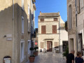
Start from the municipal car park on Rue Belle Vue, opposite the “Le Nesk” hotel.

(S/E) Leave the car park and head up Rue Belle Vue. At the Fork in the road, turn right onto Rue Route de Saint Marc and continue to a road junction.

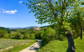
(1) Take the D942 straight ahead (slightly to the right), towards Aurel. A few kilometres to stretch your legs on a flat road, with the added bonus of a superb view of Mont Ventoux.

(2) In the pretty village of Aurel, continue along the D942 towards Montbrun-les-Bains on a downhill stretch.

(3) Enter the Drôme department and carry on along the road, which becomes the D542.

(4) Ignore the D72 on the left and carry on straight ahead on the D542 to Montbrun-les-Bains.

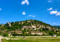
(5) At the junction with the D159, turn right and enjoy the magnificent panoramic view of Montbrun-les-Bains. Then carry on to the fork in the road at the corner of the Tourist Office.

(6) Turn right onto the D189, towards Ferrassières. Follow this road up a steady 6 km climb (average gradient 7%, with two sections at 9%), and at an altitude of 1,000 m you’ll reach a four-way junction at the foot of the village.

(7) Turn right onto the D63, towards Sault. Follow this road as it descends and continue on the D1 once you have entered the Vaucluse department. Ignore the D95 on the right and continue to the junction with the D950.

(8) Carry on to the right, towards Sault. At the roundabout, go straight on, enter the village and take thethird street on the right, Route des HLM Roumanes.

(9) Follow this road towards P1, P2. Go straight on, then turn right onto Place des Aires. Keep to the left-hand side of the square and continue along Rue des Aires. At the end, turn right onto Avenue de la Promenade and rejoin the route you have already taken.

(1) Take the hairpin bend to the left and arrive at the municipal car park on Rue Belle Vue (S/E).


Waypoints

  1. S/E : mi 0 - alt. 2,444 ft - Municipal car park, Rue Belle Vue - Nesque (rivière)
  2. 1 : mi 0.22 - alt. 2,487 ft - Road junction on the circular loop
  3. 2 : mi 3.03 - alt. 2,569 ft - Aurel
  4. 3 : mi 5.04 - alt. 2,139 ft - Drôme department, D542
  5. 4 : mi 6.65 - alt. 1,873 ft - D542. Near the - Toulourenc (rivière) - Affluent de l'Ouvèze
  6. 5 : mi 7.38 - alt. 1,906 ft - Montbrun-les-Bains after crossing the - Anary (cours d'eau) - Affluent du Toulourenc
  7. 6 : mi 7.82 - alt. 1,978 ft - D189 - Château des Dupuy-Montbrun
  8. 7 : mi 12.95 - alt. 3,068 ft - Ferrassières, D63
  9. 8 : mi 15.75 - alt. 2,671 ft - D950
  10. 9 : mi 18.13 - alt. 2,589 ft - Route des HLM Roumanes
  11. S/E : mi 18.66 - alt. 2,441 ft - Finish at the car park opposite Hôtel Le Nesk. Near the - Croc (torrent) - Affluent de la Nesque

Notes

Water points in Aurel, Montbrun-les-Bains and Ferrassières.

(5) In the morning, you can enjoy a coffee and a croissant at the bakery on the main road through the village.

Reviews and comments

5 / 5
Based on 2 reviews

Reliability of the description
5 / 5
Ease of following the route
5 / 5
Route interest
5 / 5
Ouichaoui
Ouichaoui

Overall rating : 5 / 5

Date of your route : Jul 14, 2025
Reliability of the description : ★★★★★ Very good
Ease of following the route : ★★★★★ Very good
Route interest : ★★★★★ Very good
Very busy route : No

A lovely outing in the fresh air without any major difficulties. We were able to buy some lavender honey, of course, from a producer in Ferrassiere. The scenery is magnificent and there is a wonderful smell of lavender all along the route

Machine-translated

GODILLOTSINDEP
GODILLOTSINDEP

Overall rating : 5 / 5

Date of your route : Jun 02, 2025
Reliability of the description : ★★★★★ Very good
Ease of following the route : ★★★★★ Very good
Route interest : ★★★★★ Very good
Very busy route : No

A lovely route well worth exploring – do avoid the hottest part of the year, as the paths are often exposed to the sun. Magnificent views, and the route is full of flowers in May.

Machine-translated

For more walks, use our search engine .

The GPS track and description are the property of this route's author. Please do not copy them without permission.