Country:
 City:


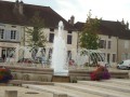
In Santenay, park at the edge of the Place du Jet d’Eau, which features a circular fountain.
(S/E) Head towards the side of the square opposite the fountain, towards the Domaine Evenstad, and carry on straight ahead on the right along Grande Rue. Before reaching the church, turn left onto Rue Sainte-Agathe to reach Place de la Mairie. Turn right, towards the cemetery. At the next junction, carry on straight ahead along Rue des Grands Murs, ignoring a road on your right.
(1) At the T-junction, with the château and its wooded grounds on your right (featuring a remarkable plane tree), turn left, still heading towards the cemetery, and shortly afterwards you’ll see a yellow sign on a lamppost, which you should follow for almost the entire route (mainly PR®26). Then stay on the small road, ignoring the path that heads straight on. At the crossroads, carry on straight ahead, following the yellow PR®25 markings, towards Haut Santenay.
(2) At the crossroads, turn left onto Rue de la Crée and you’ll soon reach the ‘Les Crais’ signpost. Head slightly to the right onto the path towards the PR®26. You’ll come to a street; follow it to the right. Ignore two streets on the left, then one on the right.
(3) At the junction of four streets, turn left onto Rue de la Charrière, then turn right immediately afterwards onto Rue de Foulot. Further on, the street becomes a track and you’ll reach a hamlet.
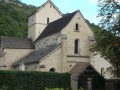
(4) For now, ignore the road on the left – you’ll take that later – and go straight on, then immediately turn left to see the Chapelle Saint-Jean, surrounded by its cemetery. Retrace your steps.
(4) Follow the road to the right and ignore a track on the left. Shortly afterwards, the tarmac ends.
(5) At the ‘Les Bras’ signpost, carry on straight ahead towards the PR®26. Ignore a path on the left (not shown on IGN maps), and at the next junction, carry on straight ahead towards the yellow arrow for Pays Beaunois 26.
(6) At the T-junction, turn right, following the yellow ‘Pays Beaunois 26’ arrow; you are also on the GRP® ‘Au fil des Vignes et Vallées’ trail, marked with red and yellow signs. You’ll come to a junction near a picnic area. Carry on straight ahead towards “Accès sommet”. After a final climb, you’ll reach the summit of the Montagne des Trois Croix, which features three rather unremarkable crosses and two information boards explaining the view. Near the second information board is the Montagne des Trois Croix signpost.
(7) Turn left towards the PR®26 (do not go straight on; the sign saying “PR®26 – do not enter private property” is misleading). You’ll come to a road at the La Chaume signpost. Carry on straight ahead.
(8) At the junction with the Dolmen du Cul Blanc signpost, where there is a path on the right marked in red and white by the GR®7, stay on the road for a return trip to the Dolmen du Cul Blanc, about 200 m from the next crossroads.
(9) Then retrace your steps.
(8) Follow the path to the left towards the PR®26 and GR®. At the Fork in the road at the La Combe Reuillot signpost, keep to the right towards the PR®26.
(10) At the ‘Poisot’ signpost, keep to the right again towards PR®26. Shortly afterwards, first turn left then right at the ‘En Poisot’ signpost, staying on the PR®26.
(11) At the ‘Bois de la Fée’ signpost, head up the path to the left towards the PR®26. Go straight on at the junction, following the ‘Pays Beaunois 26’ arrow.
(12) At the T-junction with a track, carry on straight ahead towards the ‘Pays Beaunois 26’ arrow.
(13) At the fork in the road, keep to the right. At the T-junction with a track, go straight on and you’ll soon reach another T-junction.
(14) Turn right. At the ‘Tirs aux Pigeons’ signpost, keep left.
(15) At the T-junction, go straight on, then ignore all side paths whilst following the yellow signposting.
(16) Follow a path branching off to the right signposted PR®26. Ignore a path on the left. You’ll come out onto a road.
(17) Continue straight on to enter Santenay. Turn slightly left onto Rue de la Bussière, leaving the yellow markings behind. Then continue straight on along Grande Rue until you reach the Place du Jet d’Eau (S/E).
 Visorando Member
 Difficult

 Easy