Country:
 City:
City:


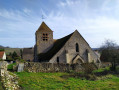
Parking is readily available near the Abbey Church of Saint-Ferréol, possibly in the car park along Rue du Jeu d’Arc.
(S/E) From the abbey church or the town hall opposite, take Rue du Jeu d’Arc for barely 200 metres and turn right at the first lane, just before the archery range. Continue to the stream, follow it to the right until you reach a path on the left.
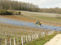
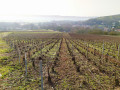
(1) You’ll soon come to a crossroads; turn left onto the path leading up towards the vineyards. Turn right, then left, and you’ll reach another crossroads at the edge of the vineyard.
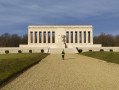
(2) Head off to the right, walk alongside the vineyards, then turn left into the woodland to reach the American Monument.
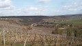
(3) After admiring this monumental structure and the view over the valley and its vineyard-covered slopes, walk round the building and follow the access road for about fifty metres (north-west). Leave this and take thefirst path on the left, heading west, then north-west through the forest before descending towards the vineyards. You’ll reach the entrance to the village of Vaux.
(4) Take the hairpin bend southwards along the path that runs along the foot of the vineyards.
When you reach the cemetery, turn right onto the small path to go down the embankment, then turn left onto the tarmac road. Cross a bridge and, at the junction, turn right onto the street that climbs up to the temple, which you’ll see on your right.
(5) Cross the street you came along to take the narrow lane (Rue des Closets), which turns into a path and climbs westwards through the fields. Follow the main path alongside the wooded area in the valley floor. Then turn left into the fields to reach the vineyards on the hillside.
(6) At the vineyards, turn right, then immediately left, then right again at a 120° angle, leaving the path that branches off opposite. Walk down through the vineyards to the tarmac road. Cross it and take the rough track opposite, which leads to the monument in memory of the painter Augustin Memin.
(7) Walk down Rue de la Croisette, joining the main road, Route de Villiers, through the hamlet of Crogis as far as the well-maintained wash house.
(8) Retrace your steps slightly to take the narrow lane on the left which descends and then turns right to join Rue du Bois du Loup. Follow it due south to the bridge, before heading back up on the opposite side.
(9) When the road bends left at the boundary between woodland and pasture, carry on straight ahead along the path which climbs into the forest. Just before the left-hand bend, turn right and continue climbing through the woods.
Take care here: on the IGN map, the fork is incorrectly marked – it’s 50 m before the actual point on the ground. Leave the woodland via a path nestled between two hedges, before arriving beneath a power line.
(10) Turn right onto the path, which may be muddy. Follow this power line more or less closely. At the crossroads, leave the line directly ahead and turn left into the unfenced meadow to avoid the tarmac, then head towards Mont de Bonneil via the farm track on the ridge.
(11) When you reach the centre of the hamlet, turn sharply left onto the street leading downhill and, at the right-hand bend, take thesecond path on the left which descends through the vineyards to Bonneil.
(12) Leave Bonneil church via the main street heading east. Turn right at the first street, then left at the first one, which passes in front of the cemetery. Once on the D151, take a short detour to the left to visit the large old wine press under its roof by the roadside. Retrace your steps along the D151 to the crossroads, then take the path branching off to the right at a 45° angle to the D151, heading due south for about a hundred metres, then turn left.
(13) Cross the D151 with care and walk alongside the orchard. At the track, turn right into the vineyards, then left. Ignore the first track on the right leading to a farm and take the second one, which leads to the main road, the D969, in Azy-sur-Marne.
(14) Take thefirst left after the church, then follow the red and white markings ofthe GR®11A. First turn onto thefirst path on the right at the edge of the vineyards, then take the first left, followed by the first right, and continue along the path which curves due north, still through the vineyards.
(15) At a crossroads where four main paths meet above the hamlet of Aulnoy, take the path that winds sharply to the left and leads to the edge of the forest.
Carry on straight ahead into the forest, then emerge to cross through the vineyards again, descending a gentle slope, until you reach another edge of the forest.
(16) Turn right at the hairpin bend, then at the next crossroads, turn left at the hairpin bend onto a path that becomes a road, leading to the town hall of Essomes-sur-Marne (S/E).




 Visorando Member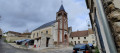

 Difficult