From Château-Thierry to Chézy-sur-Marne along the Dhuys Aqueduct

This is a walk that’s easily accessible by train and offers the chance to explore the Dhuys Aqueduct and the banks of the Marne.
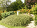
The Dhuys Aqueduct is an underground aqueduct, built between 1863 and 1865. When it was built, it supplied Paris with drinking water from the Dhuys. It runs for 128 km, almost entirely on a level course. It is a pleasant spot, closed to all traffic, grassy and well-maintained.

Details

3845287
Creation:
Last update:
Last review:
  • Walking
    Activity: Walking
  • ↔
    Distance: 11.06 mi
  • ◔
    Average duration: 5h 20 
  • ▲
    Difficulty: Moderate

  • ⚐
    Back to start: Yes
  • ↗
    Ascent: + 266 ft
  • ↘
    Descent: - 279 ft

  • ▲
    Highest point: 449 ft
  • ▼
    Lowest point: 190 ft

Photos

Description of the walk

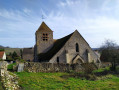
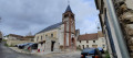
(S/E) The route starts from Château-Thierry railway station. Walk through the station and take the footbridge, then turn left at the foot of the footbridge and exit at the roundabout. Head towards Étampes-sur-Marne and walk straight on towards the church. Take the small flight of steps and walk alongside the church. Opposite, take Rue du Tilleul. At the end of the street, take a narrow path markedGR® almost directly opposite, which climbs towards the Dhuys Aqueduct.

(1) Once you reach the aqueduct, turn right and follow the aqueduct to the village of Nesles-la-Montagne.

(2) When you reach Rue Pasteur, turn left, then right twice, and follow Rue de Paris to Route de Montmirail.

(3) Cross the D1 with care and follow the Dhuys Aqueduct opposite. Walk 5 km along the aqueduct.

(4) When you reach a crossroads, turn right and head down towards Chézy-sur-Marne.

(5) Opposite the cemetery, cross the D15 with care and turn left.

(6) Take the first street on the right (D151), cross the railway line and then the bridge over the Marne.

(7) Head down to the riverbank via the steps on the left-hand side after the bridge. Pass under the bridge and walk eastwards. Follow the banks of the Marne for 5 km to Château-Thierry. You’ll arrive at the statue of Jean de la Fontaine.

(8) Cross the bridge, walk across the island, then cross the next bridge and walk to the roundabout.

(9) Turn left, then right, and walk to Château-Thierry station (S/E).

Waypoints

  1. S/E : mi 0 - alt. 207 ft - Gare de Château-Thierry
  2. 1 : mi 0.95 - alt. 413 ft - Aqueduc de la Dhuis
  3. 2 : mi 1.85 - alt. 417 ft - Rue Pasteur
  4. 3 : mi 2.19 - alt. 427 ft - D15
  5. 4 : mi 5.25 - alt. 413 ft - Path on the right leading downhill
  6. 5 : mi 5.55 - alt. 226 ft - Cemetery
  7. 6 : mi 5.69 - alt. 213 ft - Crossroads near Chézy railway station - Gare de Chézy-sur-Marne
  8. 7 : mi 6.45 - alt. 194 ft - Marne (la)
  9. 8 : mi 10.48 - alt. 210 ft - Bridge on the right - Marne (la)
  10. 9 : mi 10.77 - alt. 210 ft - Roundabout
  11. S/E : mi 11.06 - alt. 207 ft - Gare de Château-Thierry

Notes

This route can also be started from Chézy-sur-Marne station at (6) for those coming from the Paris region.

You can fill up with water at the Chézy cemetery.

Worth a visit

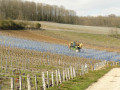
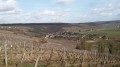
On the Dhuys Aqueduct, you’re walking under the trees, so there’s no view. Those wishing to enjoy views of the Marne and the Champagne vineyards can follow theGR®14from Nesles-la-Montagne to Chézy-sur-Marne. It runs slightly lower down than the aqueduct. Similarly, those who find the banks of the Marne a bit monotonous can take theGR®11A, which climbs up the hillside.
https://fr.wikipedia.org/wiki/Aqueduc_de...

Always be cautious and plan ahead when you're outdoors. Visorando and the author of this route cannot be held responsible for any accidents occurring on this route.

The GR® and PR® markings are the intellectual property of the Fédération Française de Randonnée Pédestre.

Reviews and comments

4.8 / 5
Based on 2 reviews

Reliability of the description
5 / 5
Ease of following the route
5 / 5
Route interest
4.5 / 5
virgule
virgule

Be careful – there’s quite a lot of traffic between 6 and 7

Yes, I agree. I did it the other day with a dog on a lead – it was a bit of a squeeze. But it’s the only way to get from one bank of the Marne to the other. I’m surprised it’s classified as a walking trail.

Machine-translated

ozogiminy
ozogiminy

Overall rating : 4.7 / 5

Date of your route : Sep 20, 2024
Reliability of the description : ★★★★★ Very good
Ease of following the route : ★★★★★ Very good
Route interest : ★★★★☆ Good
Very busy route : No

Please note, there’s quite a lot of traffic between 6 and 7
The return route along the banks of the Marne seems a bit long; I’d recommend taking the route through the vineyards up the hillsides.

Machine-translated

virgule
virgule

Hello,

I did part of this route again today. From (6) to (7), you’re on a GR trail, but it’s a fairly busy little road, especially at rush hour.

Machine-translated

virgule
virgule
• Edited:

Thank you for this kind review.

The Dhuys Aqueduct is a wonderful place. In my opinion, the prettiest spots are to the east of Château-Thierry, in the Marne Valley and the Surmelin Valley.

I’m planning a similar route from Chézy-sur-Marne to Nogent-l’Artaud. The idea is the same: walk along the aqueduct and return along the banks of the Marne, or through the vineyards for the more adventurous.

Machine-translated

Bonheur Frédéric
Bonheur Frédéric

Overall rating : 5 / 5

Date of your route : Aug 11, 2024
Reliability of the description : ★★★★★ Very good
Ease of following the route : ★★★★★ Very good
Route interest : ★★★★★ Very good
Very busy route : No

Hello,
A lovely walk, combining town and countryside. A very pleasant route, especially along the River Dhuis.

Machine-translated

virgule
virgule
• Edited:

Thank you for publishing this

Machine-translated

Other walks in the area

For more walks, use our search engine .

The GPS track and description are the property of this route's author. Please do not copy them without permission.