Country:
 City:
City:


Departure from Château-Thierry station. Trains depart from Paris-Est station every hour.
This walk consists of two sections, both starting from Château-Thierry station: (1) a circular route to explore the town of Château-Thierry and (2) a route from station to station to Nogent-L’Artaud. You can therefore choose to do just one of the two sections or both in succession.
Circular route in Château-Thierry.
(S) Leave the station towards the town centre (north). Take Avenue Wilson (red and white signposts).
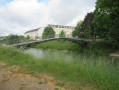
(1) At the junction with Avenue de la République, turn right then left into Rue des Bains. Turn right onto Quai Dupuis Delizy and take the footbridge to cross a branch of the Marne, then continue straight on. Follow the Marne on your right and cross it at the first bridge.
(2) Cross the roundabout (fable-themed) and continue (north) along Rue du Général de Gaulle. At Place de la Mairie, turn right then head up Rue du Château (yellow and blue markings), admiring the old houses and the Hôtel Dieu as you go.
.(3) At No. 33 bis, enter the citadel on the left. Just 50 metres off the route are the Jardin Riomet and the Porte Saint-Pierre. From the top of the ramparts, admire the town and, on the horizon, the route ahead.
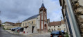
(4) Go down the stairs (Allée Victor Gardeur) and join the rampart walk on the right. At the end of this, turn left into Rue Jean de la Fontaine (the museum is on the right). Then turn right into Rue Saint Crépin, cross Rue de Soissons and head towards the church.
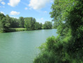
(5) After the sub-prefecture, turn left down Montée Saint-Crépin. Cross the car park and Avenue Jules Lefebvre, then head left towards the banks of the Marne. Walk along the riverbank on your right.
(2) At the bridge, cross the Marne again. Once off the bridge, continue straight ahead along Rue Carnot. At the roundabout, turn left onto Avenue de la République.
(1) Turn right and take Avenue Wilson again to reach the station (S).
Route from Château-Thierry station to Nogent-l’Artaud station.
(S) Take the footbridge over the tracks, then turn left and walk alongside the car park.
(6) At the roundabout, turn right and cross the D1003. Then take the path marked in white and red between two houses. Cross Rue Maurice Champion and take Rue du Clos des Lisses opposite. Turn left as the road bends and, at the stop sign, turn right into Rue Pierre Semard. At the junction with Rue de Chierry, take the steps, go round the church on the right and head into Rue du Tilleul. At the junction with Rue Adèle Simon, take the path opposite (still following the white and red markings).
(7) At the end of the path, turn right (ignore the marked path heading left). At the next junction, turn left uphill. At the Fork in the road, keep to your left. Follow the path; as you emerge from the copse, turn left and join theGR®14.
(8) Continue south-east and follow theGR®14(marked in white and red). At a fork in the road, take the right-hand path and pass under a power line. Head downhill along the edge of the woodland. Shortly after entering the woodland (elevation 188), turn right towards Nesles-la-Montagne.
(9) Cross the D866 road (take care). Head across the road to the left into Rue de l’Église, then left into Rue du 8 Mai 1945. Turn right into Ruelle des Recettes and, at the end, turn right. Then cross the Ru de Nesles to reach Rue des Grandes Maisons. At the junction with Rue de Paris, turn left, then turn right onto Chemin du Château. Continue straight on (there is a playground and fitness trail nearby). When you reach Route de Montmirail, turn right. After a few metres, cross the road (take care) and follow the path to the left (south-west, marked with red and white signs).
(10) Turn right, then left, continuing to follow theGR®14. On a slight incline, ignore a path branching off to the right. At the next junction, turn left and you’ll come to a monument commemorating a Napoleonic battle.
(11) Then turn right (south-west). At the end of the path, turn right. At the junction with Rue de la Charrière, turn sharply left uphill. After a reservoir, the path curves to the left.
(12) Turn right and continue to follow the red and white markings. Walk for some time south-west, then west-south-west along the embankment of the Dhuis aqueduct.
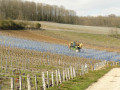
(13) Let theGR®14head off west-north-west and veer left (south-south-west) downhill. At the bottom of the descent, turn right and follow the path through the vineyards. Join theGR® again and follow it to the left.
(14) At the junction with the D15, turn left onto Avenue de la Libération in Chézy-sur-Marne (note: there is no pavement for 50 metres). After the Ru le Dolloir, turn left onto Rue du Vicariat; as you pass, admire a wash house depicting a fable by La Fontaine.
(15) Turn left into Grande Rue, then left into Rue des Carmes.
(16) At the roundabout, head left to admire the small stone bridge spanning the Dolloir. Retrace your steps.
(16) Go past the roundabout and, opposite the Fromagerie du Dolloir, take Rue du Jeu D’Arc. At the crossroads by the church, take the path opposite (west) leading up to the hamlet of Le Mont.
(17) Turn right and follow the road.
(18) At the junction with the D86, turn left. Leave the road and take a track on the right (south-west), heading down towards the Marne. Pass under a railway bridge, then turn left and follow the Marne on your right.
(19) When you reach the water tower, turn left and cross the bridge over the railway lines. Walk past a factory on your right. At the junction, turn right onto Rue du Crochet. Follow the sign for “Ruines de l’Abbaye”.
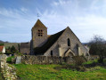
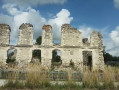
(20) Turn right into Rue des Écoles (the Abbey Ruins are in the bend). Turn left as the road curves, then turn right into Rue Leduc de la Tournelle. Then turn left and admire the 13th-century Saint-Germain Church on your right. At the stop sign, turn right onto Grande Rue. Continue straight ahead (on the left, a 15th-century house) then head towards Nogent l’Artaud station (E).




 Visorando Member
 Moderate