Country:
 City:
City:


Parking is available at Place du Cygne in Essômes-sur-Marne.
(S/E) Walk alongside the sports ground via Chemin du Marais and join Rue Jacques Fourrier. Cross the road and first turn right then left to take the path between the houses (gate). At the end of the path, turn left then right to go up Rue du Tartre. Pass the nursery school.
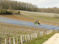
(1) Head downhill to the left, skirting the vineyards. Carry on straight ahead twice, then turn right before heading down Rue des Godeaux to its end.
(2) Turn right onto Rue Roosevelt (D969), then cross it carefully to follow the path on the left called Chemin des Paqueux, alongside the ornamental arboretum. Continue to the banks of the Marne.
(3) Take the path on the left and walk alongside the Marne for about a hundred metres before heading back up the path on the left. Then turn right onto Rue de la Marne, pass the market gardeners’ greenhouses and take the path on the left alongside the Ru des Rochets.
(4) Cross Avenue du Général de Gaulle and take a short first turn right then left to continue along the stream to the small bridge. Take the gravel path on the right (Rue de la Cote 204), then turn left at the junction to head up towards the vineyards as far as the Croix de l’Âne.
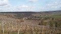
(5) Take the track on the right and, after a few metres, take the stony path up to the left and continue to the top, where it is no longer possible to go straight on and where there is a panoramic view over the valley.
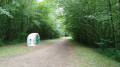
(6) Take the path on the right towards the American Monument. Before the fence, follow the path on the left through the woods for a few metres, then turn right.
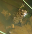
(7) Walk past the American Monument on the left (Chemin des Henry). Then turn left onto the Chemin de la Chapelle, which crosses the Bois de la Cote 204 through an area populated by yellow-bellied toads.
(8) Continue straight on. Once at the edge of the woodland, follow the Chemin de la Chapelle to reach Vaux. Take the right-hand bend at the first houses.
(9) Take the sharp left-hand bend to follow the old CSA railway line (Chemins de fer du Sud de l’Aisne). Pass the cemetery and, after the wine-making sheds, head down to the right into the centre of Monneaux via Rue Brûlée.
(10) Cross the D1390 with care and head back up towards the temple. Leave the temple on your right and turn left onto Rue des Closets. Continue left along Chemin des Vaches. After the building, turn left and carry on through the fields. Ignore one junction to reach a second T-junction.
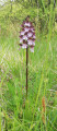
(11) Turn left, then head down towards Montcourt. Along the way, take in the calcareous grassland on the left.
(12) Take the path on the left. Once at the junction with the D1390, first turn right then left to join the track almost directly opposite, follow the Ru des Rochets and turn left onto Rue la Borde. Continue until the second right-hand bend.
(13) Take the fitness trail opposite to return directly to the starting point (S/E).



 Visorando Member

 Difficult