Around Château-Thierry

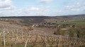
A picturesque walk through La Fontaine’s birthplace and the earliest vineyards of Champagne.

Details

1144775
Creation:
Last update:
Last review:
  • Walking
    Activity: Walking
  • ↔
    Distance: 9.06 mi
  • ◔
    Average duration: 4h 35 
  • ▲
    Difficulty: Moderate

  • ⚐
    Back to start: Yes
  • ↗
    Ascent: + 466 ft
  • ↘
    Descent: - 479 ft

  • ▲
    Highest point: 561 ft
  • ▼
    Lowest point: 190 ft

Photos

Description of the walk

Château-Thierry is accessible via the Francilien service from Gare de l’Est or via the A4 motorway.

(S/E) Leave the station via the town centre exit (north). Take Avenue Wilson, following the red and white signposts.

(1) At the junction with Avenue de la République, turn right then left into Rue des Bains. Turn right onto Quai Dupuis Delizy, take the footbridge to cross a branch of the Marne and continue straight on. Follow the Marne on your right and cross it at the first bridge.

(2) Go through the roundabout and continue (north) along Rue du Général De Gaulle.

No signposting

When you reach Place de la Mairie, turn left onto Grande Rue. Turn right onto Rue Jean de La Fontaine, passing the museum.

(3) In front of the former Cordeliers convent, take the steps on the right and follow the rampart walk, with the castle on your left.

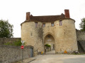
(4) As you climb the stairs, take the path on the left and head towards the tower. At the top of the tower, turn right into Allée Victor Gardeur. Enjoy the view over the town and its surroundings. Walk along the ramparts, pass through the Saint-Jean gate, and turn left into Rue du Château, with the Riomet Gardens on your right.

Then pass under the Porte Saint-Pierre. At the ‘Stop’ sign, turn right, cross Rue de la Barre, then head diagonally left into Rue de la Folie l’Abbé. Follow theGR® de Pays du Tour de l’Omois, marked in red and yellow. Continue straight ahead.

(5) At the next junction, turn right onto Route des Chopinettes. Please note that theGR® markings are virtually non-existent.

(6) Turn left, then right, and follow signs for “Parc Léo Lagrange”, walking past the houses on your right. Cross the stream and head uphill along the Chemin du Moulin Picard. At the junction with Rue Paul Doumer, head slightly straight ahead, going uphill along Rue Milton. Continue straight on.

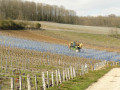
(7) Leave the tarmac and take the third path on the right into the vineyards. After a bend to the left, carry on straight ahead through the vineyards for about 2 km.

(8) At the junction, turn left into the vineyards (the climb is steep) then, at the top of the hill, take the first right. Carry on straight ahead.

(9) Turn right onto Rue de Champillon; there’s an orientation board on the right. Leave theGR® de Pays and follow the road downhill.

No signposting.

In the village of Gland, cross the D3, take Rue d’en Bas opposite, then turn slightly right onto Rue des Graviers.

(10) When you reach the Marne, turn right. Walk alongside the river for 4.5 km on your left.

(2) At the roundabout by the bridge, turn left to cross the Marne. Carry straight on along Rue Carnot. At the next roundabout, turn left onto Avenue de la République, then at the following junction, turn right onto Avenue Wilson, which will take you back to your starting point, the station (S/E).


Waypoints

  1. S/E : mi 0 - alt. 203 ft - Gare de Château-Thierry
  2. 1 : mi 0.11 - alt. 207 ft - Junction with Avenue de la République
  3. 2 : mi 0.69 - alt. 210 ft - Roundabout, junction of the circular loop
  4. 3 : mi 0.98 - alt. 246 ft - Stairs on the right, rampart walk
  5. 4 : mi 1.1 - alt. 315 ft - Stairs on the left
  6. 5 : mi 1.78 - alt. 331 ft - Junction, turn right
  7. 6 : mi 2.11 - alt. 230 ft - Les Courqueux crossroads
  8. 7 : mi 2.68 - alt. 430 ft - On the right, amongst the vineyards
  9. 8 : mi 4 - alt. 413 ft - Turn left as you go uphill
  10. 9 : mi 4.6 - alt. 558 ft - Junction, turn right
  11. 10 : mi 5.59 - alt. 203 ft - Towpath - Marne (la)
  12. S/E : mi 9.06 - alt. 203 ft - Gare de Château-Thierry

Notes

Train timetables.
(S/E) Château-Thierry station is served by trains departing from Gare de l’Est every hour (at 51 past the hour).
To check timetables or for other departure or return points, please visit the Transilien website.
Make sure you wear suitable walking shoes.
Bring a cap or hat, especially between points (6) and (9) (walk through the vineyards).

Worth a visit

Château-Thierry.

The Hôtel-Dieu (next to the Place de la Mairie, Rue du Château).
The La Fontaine Museum next to point (2).
The medieval castle and its birds of prey at point (3).

Always be cautious and plan ahead when you're outdoors. Visorando and the author of this route cannot be held responsible for any accidents occurring on this route.

The GR® and PR® markings are the intellectual property of the Fédération Française de Randonnée Pédestre.

Reviews and comments

4.3 / 5
Based on 3 reviews

Reliability of the description
4 / 5
Ease of following the route
4.7 / 5
Route interest
4.3 / 5
Chrisauber
Chrisauber

Overall rating : 4 / 5

Date of your route : Jun 21, 2020
Reliability of the description : ★★★★☆ Good
Ease of following the route : ★★★★☆ Good
Route interest : ★★★★☆ Good
Very busy route : No

Lovely views over the Marne Valley and its vineyards, but I found the route a bit monotonous

Machine-translated

Agnes1000
Agnes1000

Overall rating : 4.7 / 5

Date of your route : May 30, 2020
Reliability of the description : ★★★★☆ Good
Ease of following the route : ★★★★★ Very good
Route interest : ★★★★★ Very good
Very busy route : No

A route well worth taking: varied scenery, very pleasant

Machine-translated

virgule
virgule
• Edited:

Thanks for that information.

I’m keeping my fingers crossed that they don’t tarmac this grassy path…

I’m going to try out a route that follows the Dhuys aqueduct from Château-Thierry to Fossoy (it’s a wonderful place) and back along the right bank of the Marne, on the grassy path. I’ve already done it coming back along the left bank, but you’re in full sun then.

Machine-translated

ovil
ovil

Overall rating : 4.3 / 5

Date of your route : Aug 20, 2019
Reliability of the description : ★★★★☆ Good
Ease of following the route : ★★★★★ Very good
Route interest : ★★★★☆ Good

A walk along lovely paths in the sunshine.
As we arrived early at point 9, we carried on to Mont Saint Père for a picnic by the banks of the Marne. We returned through the vineyards to rejoin the route below the viewpoint.
The route description lists the names of all the streets we took, but the street signs are sometimes missing or located at the other end of the street (la Folie l’Abbé, Chopinette, Milton).
To answer the previous question, the towpath is a wide grassy path, shaded in the late afternoon at this time of year. You’ll also come across cyclists there.
A local who was telling us about his region mentioned that there is a plan to extend the cycle path along the Marne, but as the Aisne department is poorer than the Marne, the project is currently at a standstill.

Machine-translated

virgule
virgule

Hello,

Is the path along the banks of the Marne tarmac-surfaced? Is there any shade along it?

Machine-translated

virgule
virgule

To be continued

Château Thierry can also be reached from Épernay or Dormans via the TER Vallée de la Marne.

Machine-translated

Other walks in the area

For more walks, use our search engine .

The GPS track and description are the property of this route's author. Please do not copy them without permission.