Crogis Circular Loop

This circular walk will take you on a tour of the hamlet of Crogis. Pass by the Montcourt wild orchid slope, explore its unspoilt waterways, enjoy the superb panoramic views from the heights and discover the local heritage of this charming hamlet.

Details

n°41599404
Creation:
Last update:
Last review:
  • Walking
    Activity: Walking
  • ↔
    Distance: 1.80 mi
  • ◔
    Average duration: 1h 00 
  • ▲
    Difficulty: Easy

  • ⚐
    Back to start: Yes
  • ↗
    Ascent: + 190 ft
  • ↘
    Descent: - 187 ft

  • ▲
    Highest point: 522 ft
  • ▼
    Lowest point: 322 ft

Photos

Description of the walk

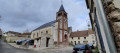
The walk starts from Place Auguste Mémin in the heart of the hamlet of Crogis in the commune of Essômes-sur-Marne. Parking is readily available there.

(S/E) Walk down Rue de la Croisette to the end. Cross Route de Villiers and walk down Rue du Chêne on the opposite side to the end.

(1) Take the path furthest to the right, which runs alongside the stream. At the bridge, carry on straight ahead. At the end of the path, turn left to walk up Rue du Loup for about twenty metres, then turn into the first path on the right. Continue to the next junction and turn left uphill to come out onto Route de Villiers at the wash house.

(2) Cross over and head up Rue du Lavoir on the opposite side. At the top, turn right to follow Route du Thiolet, then take the second left, Chemin de Montcourt. You’ll come to a junction.

(3) Turn left and follow the track uphill for about 450 m: at the start of the climb, after the shed, take the track that goes straight up. At the junction, turn left and continue along the track surrounded by fields. At the crossroads, carry on straight ahead and stay on the track that leads downhill to the next junction.

(4) Turn right and join a wide stony track.

(5) Turn left to head downhill, cross the Route du Thiolet and take the path opposite, slightly to the left, which leads down alongside the pasture. Cross the footbridge and carry on straight ahead. At the junction, head straight on and continue along the path to Place Auguste Mémin (S/E).

Waypoints

  1. S/E : mi 0 - alt. 397 ft - Place Augustin Mémin
  2. 1 : mi 0.14 - alt. 335 ft - Path at the bottom of Rue du Chêne - Cours d'eau 01 de Montcourt (cours d'eau) - Affluent du Ru des Rochers
  3. 2 : mi 0.32 - alt. 364 ft - Route de Villiers
  4. 3 : mi 0.78 - alt. 344 ft - Junction with Chemin de Montcourt
  5. 4 : mi 1.28 - alt. 486 ft - Junction in the vineyards
  6. 5 : mi 1.47 - alt. 486 ft - Gravel path
  7. S/E : mi 1.8 - alt. 397 ft - Place Augustin Mémin

Worth a visit

Winegrowers can be found along the route.

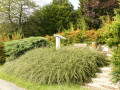
(S/E) A memorial dedicated to Augustin Mémin, a local artist.

(2) Crogis wash house.

After (3), on the uphill stretch, on the right-hand side is the Montcourt orchid slope, a protected calcareous meadow where many varieties of wild orchids bloom.

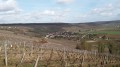
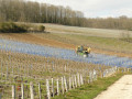
Before (4), a viewpoint overlooking the Marne Valley and the Champagne vineyards.

For further information, please visit the website of the municipality ofEssômes-sur-Marne

Reviews and comments

3.7 / 5
Based on 2 reviews

Reliability of the description
4 / 5
Ease of following the route
3.5 / 5
Route interest
3.5 / 5
Jéhu02
Jéhu02

Overall rating : 3.7 / 5

Date of your route : Jun 17, 2026
Reliability of the description : ★★★★☆ Good
Ease of following the route : ★★★☆☆ Average
Route interest : ★★★★☆ Good
Very busy route : No

This route has clearly not been used for some time, as the path is overgrown with stinging nettles and brambles (cross the Route du Thiolet to take the path opposite, slightly to the left, which leads down alongside the pasture to point 5, which is difficult to navigate).

Machine-translated

bcr
bcr

Overall rating : 3.7 / 5

Date of your route : Jan 14, 2024
Reliability of the description : ★★★★☆ Good
Ease of following the route : ★★★★☆ Good
Route interest : ★★★☆☆ Average
Very busy route : No

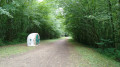
This route is quite varied. The most interesting parts are the start in the village and, above all, the return to the village at the end of the route; there’s a lovely view from the vineyards and the walk through the pleasant little wood. As for the rest, I found it less appealing: a 450-metre uphill stretch along a path lined with bushes (dogwoods, etc.) with no view other than the path itself… followed by a stretch across the top of the hill with no views… the protected area glimpsed as you pass doesn’t really encourage a visit as it seems rather isolated. If the weather is wet when you’re out walking, there are two ‘muddy’ sections.

Machine-translated

Other walks in the area

For more walks, use our search engine .

The GPS track and description are the property of this route's author. Please do not copy them without permission.