Country:
 City:
City:


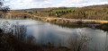
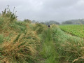
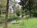
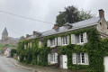
Park in the car-sharing car park at the entrance to Rue du Temple in 4520 Longpré (municipality of Wanze), or 50 m further on, in the village hall car park. Follow the route in a clockwise direction.
(S/E) From the car park, continue along Rue du Temple (passing a quarry) until you reach the Fork in the road, 400 m further on.
(1) Turn left. The road leads to a large farm and, after crossing the stream, continues as a stony farm track that begins to climb through meadows and (further on) woodland.
(2) Just before the top, take the path on the left between the meadow and the woodland. This path climbs up to the motorway, turns left and runs alongside it for 500 m (tarmac section, lovely view of the village) before entering a copse (footpath) and coming out onto a tarmac road.
(3) Turn right, cross the bridge over the motorway and continue between the fields along the farm track.
(4) At the first junction, turn right again onto the road leading to Huccorgne. Follow it for 1 km and turn left at the next junction. After 200 m (opposite the entrance to the prison), take the road on the right.
(5) When the road curves to the left, continue straight on along a farm track. As the farm track leaves the plateau and begins to descend, keep to the right at the Fork in the road and continue down towards Huccorgne.
(6) At the bottom of the track (gravel road), take the grassy path on the left, below the first street. This path continues as a street and soon joins a main road (Rue du Lavoir). Carry on straight ahead and cross the Mehaigne.
(7) Turn right onto the tarmac footpath running between the main road and the stream. Pass under the viaduct.
(8) Take the bridge on the right to join Rue Robiewez. As this street begins to climb, take the path on the left, passing below the houses. The path rejoins the road you left earlier shortly afterwards.
(9) This then continues as a forest track that follows the valley floor (GR® 564). The track leads to a quarry entrance.
(10) Continue straight on, still on the right bank of the Mehaigne.
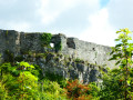
(11) As the village of Moha comes into view, head up to the right (against the flow of traffic) along the grassy slope which takes you round the castle ruins on the right. At the top, go back down the steps to the road which leads back to the one you left earlier and the tourist office.
(12) Cross the bridge and turn immediately right onto Rue du Madot, which runs alongside the Ruisseau de Fosseroûle. Follow it to the end.
(13) When you reach the end of the tarmac road (stone blocks and signs providing information about the quarry), turn left onto the path leading uphill between the woods and the meadows, which takes you to a viewpoint overlooking the quarry and its ecological features.
(14) Retrace your steps and return to the path running alongside the Fosseroûle stream.
(13) Turn left onto it. As it moves away from the stream and begins to climb, turn left at the next junction to follow the stream once more (on its right bank this time). The path soon passes a large building (the Fosseroûle farmhouse-castle) before reaching the junction you passed on the way out.
(1) Follow the route back in the opposite direction to return to the car park (S/E).


 Visorando Member
 Easy
Easy