Country:
 City:
City:


Car park at the rear of the Salle Plein Vent in Couthuin, 32 Rue Pravée, 4218 Héron.
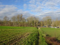
(S/E) From the car park, head towards the woods by crossing the recreation area, keeping to the right to join the path leading into the woods. The path comes out at the end of a street and a house.
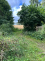
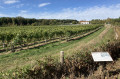
(1) Take the path on the left, then keep to the right 50 metres further on, following the gently sloping path. At the junction with a wider path, continue straight on along a less obvious path. Follow this for about fifty metres and, at the end, turn left onto the forest track. This soon bends to the right and joins a farm track running alongside a vineyard.
(2) Facing the vineyard, head down to the right for 100 metres along the track running alongside it and the woodland. Keep left onto the path as soon as you enter the woodland (the main track, meanwhile, leads to a private plot!).
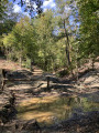
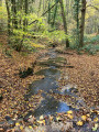
(3) At the next junction, carry on straight ahead to begin the descent towards the foot of the slope. After 500 metres, the path curves to the left and continues downhill, reaching a stream (Ruisseau de Bourie) at the bottom.
(4) Cross the stream and turn right onto the path leading to the railway line. Follow (to the left) the gravel track running alongside the railway line: it takes a detour through the woods and ends up next to the road bridge.
(5) Take the road on the left, heading down towards the hamlet of Java. At the bottom of the road, walk straight up for about fifty metres and turn right onto the small path behind house no. 11.
(6) After the church, and before the last house on the lane, head up to the left into the woods. The slope is quite steep and leads at the top to a field bordered (on the right) by the wooded hillside. Follow this path for 200 metres, go round the ‘wooded spur’ and you will soon find yourself back in the wooded hillside. Follow the path all the way down. It soon runs alongside a long pasture before leading to a house and the end of a tarmac road.
(7) Take the path which climbs up to the left along the hillside, following the stream (Ruisseau de Basenge). At the top, the path bends to the right and soon runs behind a row of houses. It eventually leads onto a tarmac road (Rue Bois le Prêtre). Turn left onto this road and follow it for 100 metres.
(8) Follow Rue Graindorge to the left for a good kilometre. This road runs alongside a residential area, bends to the right and then to the left, runs alongside pastures and then joins another small cluster of houses. It then continues as a gravel farm track, which soon passes in front of a flying club (Piper Club de Bas-Oha). After the junction, the farm track skirts a large field whilst running alongside the edge of a woodland, eventually reaching the hamlet of Les Basses Thrixhes after a good kilometre.
(9) In the hamlet, keep left twice to turn onto Rue des Croupettes (signposted ‘dead end’). After the last houses, this road continues as a grassy track heading towards the woods. Walk all the way down to the bottom, then continue left along the stream (which is barely visible). The path emerges at the foot of the vineyard and skirts around it: follow the path wedged between the vineyard and the edge of the woods until it enters the woods again and reaches a junction you passed on the way out.
(3) Take the path immediately to the right at an acute angle, heading uphill towards the vineyard. The path, which shortly afterwards becomes a farm track, crosses the estate uphill. After the last rows of vines, keep to the right onto the small, tree-lined path, continuing uphill. It emerges at a bend in a small tarmac road (picnic table).
(10) Turn left onto this road, then turn right towards the woods onto the straight path running along the top of the vineyard and a pasture. At the edge of the woods, take the path on the right, running alongside the woods and the pasture. Continue to the houses and take the road on the left to return to the car park and the starting point (S/E).
 Visorando Member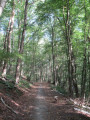


 Easy
Easy 
 Tourist office