Country:
 City:
City:


Car park: at the entrance to Rue du Pressoir in Bas-Oha, between the railway line and the football pitches.
(S/E) Leave Rue du Pressoir and take the ramp opposite which crosses back over the railway line. At the junction, take the street on the right; then, about a hundred metres further on, turn left into Rue des Moutons and follow it to the end. This street continues as a footpath which leads out onto a road.
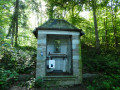
(1) Walk down the street on the left, then back up it to reach Rue Pierreuse, which you should take on the left. At the top, turn right onto Rue des Écoles. Cross the large car park diagonally and head towards the roundabout. Continue straight on along Rue Fond du Ri. After 500 metres, the road curves to the right, then begins a gentle climb before running alongside a wood and finally emerging onto a street opposite the Chapelle Saint-Pierre (hamlet of Lamalle).
(2) Turn left onto Rue Armand Bertrand. This road curves to the right and runs alongside the boundary of a large farm. Turn immediately left onto Rue Norbert Graindorge. The road goes round the farm, then turns right (do not start the descent opposite!). Rue Norbert Graindorge runs alongside a residential area, bends to the right, then to the left, and then runs along the ridge, past fields and meadows. It goes round a small cluster of houses, then turns into a farm track.
(3) Shortly after the flying club (Piper Club de Bas-Oha), at the junction, carry on straight ahead. The track soon runs alongside a woodland, then takes two bends to the right: make sure you stay on the farm track between the woodland and the field. The farm track continues as Rue Gerdave.
(4) At the start of the street (house no. 1), turn left twice, then take Rue des Croupettes (signposted ‘dead end’). After the last houses, the street becomes a footpath and begins the descent towards the woodland. At its lowest point, the footpath crosses a damp area, then climbs back up towards a clearing.
(5) The clearing faces the edge of a vineyard (Vins de Cinq estate – XXV) surrounded by a fence: go round the vineyard on the left, between the fence and the edge of the woodland. After the vineyard, the path leads back into the woodland.
(6) At the junction, about fifty metres further on, take the forest track to the left. This begins a long descent towards the bottom of the slope (ignore the private forest tracks branching off to the side). Once at the bottom, cross the stream and turn right, towards the railway line (dog club on the right). Continue along the forest track running alongside the railway line; it veers away from it for a while, then draws closer again and leads onto a road that crosses back over the railway line.
(7)Ignore the bridge! Walk down this street to the left, heading towards the houses. Ignore the first street on the right; continue straight up and, after about fifty metres, take the small concrete path that leads back down towards the church.
(8) After the church, at the bottom of the street but before the bend, take the footpath on the left which climbs up the hillside (a steep climb of about 40 metres). At the top, the path leads to the corner of a field and runs alongside the woodland. Continue along the edge of the woodland for about 300 metres until you reach a rocky outcrop, which is extended by a dirt track.
(9) Go well round this spur and continue along the edge of the woodland. Shortly afterwards, at the far end of the field, the path enters the woodland, takes a left-hand bend and begins a long descent down the slope. At the foot of the wooded slope, it runs alongside a long meadow before leading to a house.
(10) Turn right, cross the level crossing (!) then the road, and make a quick first turn right then left to reach the concrete path running along the bank of the Meuse. Follow it to the left for 500 m.
(11) When the road becomes visible again from the path (low concrete structures), head towards it, cross it and take the street running under the railway line (Rue Fond du Ry). Before the bridge, turn right onto the footpath running alongside the railway line, and follow it for just under two kilometres to reach the car park (S/E).


 Visorando Member