Country:

 City:
City:


Park in a lay-by along the Route Stratégique de Restefond: space for four to five vehicles.
(S/E) Head towards the bend, then take a track on the left which runs level with the road. Follow it for over a kilometre, keeping an eye out for the ‘Lac Verdet’ sign.
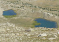
(1) Take the small path that climbs up to the left; this serves as a shortcut compared to the signposted trail. Join the signposted trail again and follow it to the left to reach Lac Verdet.
(2) Continue along the correct signposted path to the Pas de Touréis, a red-rock pass clearly visible from the lake, marked by a large cairn.
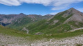
(3) Immediately take a track that branches off to the right and passes beneath the Chevalier ridge. Follow it until you reach the Col de Ventebrun (red rock and cairn), with an altitude of 2,758 m.
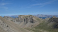
(4) Head west to climb the Ventebrun. After a short, steep climb along a path, follow the cairns carefully; then, a few metres before the highest point of the Ventebrun (2,881 m), join the ridge on the left. Reach the summit via the ridge, which is easy but where you must still take care. Descend slightly on the other side, then continue to reach the clearly visible cross (2,872 m) overlooking the great south face of the Ventebrun.
(5) Retrace your steps to return to the Col du Ventebrun.
(4) Follow the ascent route in the opposite direction to return to the car park (S/E).
 Visorando Member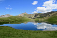
 Easy
Easy 
 Moderate