


Kinart

 Visorando Member
 Premium user
 Sign up:
Published route(s)
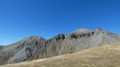
 Mont Riounet from the village of Roya
 8.94 mi
 +3,343 ft
 -3,353 ft
 7h 00
7h 00
 Difficult
 Departure from Saint-Étienne-de-Tinée (Alpes-Maritimes)
Starting from Roya, a hike through a wild valley to Mont Riounet, which overlooks the resort of Auron and offers a beautiful panorama of the surrounding area (the Tinée peaks, the Mounier chain, the Mercantour-Argentera massif) and other more distant peaks to the north (Col de la Bonette, Aiguille and Brec de Chambeyron, Tête de Moïse, Pics de la Font Sancte, Mont Viso, etc.). Ideal in autumn, to admire the colours and, with a little luck, to hear and see the deer bellowing.
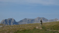
Ventebrun via Lac Verdet
 6.43 mi
+1,722 ft
-1,726 ft
4h 25
Difficult
Departure from Jausiers (Alpes-de-Haute-Provence)
6.43 mi
+1,722 ft
-1,726 ft
4h 25
Difficult
Departure from Jausiers (Alpes-de-Haute-Provence)
A splendid hike that takes you over two beautiful red-rock passes and a summit, passing by a lovely lake, all complemented by views of the Cayolle and Ubaye mountains and, in the distance, the Pelvoux, the Ailefroide and so on.