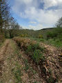
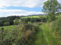
Vendranges, its greenery and rolling hills

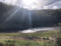
An easy walk with a few gentle climbs! It offers magnificent views across the whole of the Roanne region and much of the Loire department. You’ll come across cows, horses and sheep along the way (not to mention chickens).

Details

n°57364711
Creation:
Last update:
Last review:
  • Walking
    Activity: Walking
  • ↔
    Distance: 7.89 mi
  • ◔
    Average duration: 4h 45 
  • ▲
    Difficulty: Moderate

  • ⚐
    Back to start: Yes
  • ↗
    Ascent: + 1,257 ft
  • ↘
    Descent: - 1,270 ft

  • ▲
    Highest point: 1,985 ft
  • ▼
    Lowest point: 1,234 ft

Description of the walk

Start from the car park by the town hall and church in Vendranges (limited spaces available).

(S/E) With your back to the Town Hall, turn right and, directly opposite the restaurant, take Rue de la Châtaigne on the left. Cross a road (Rue de la Route Bleue), head straight ahead between two houses, and continue along the signposted path. When you reach the tarmac, turn left, walk past the hamlet of La Croix on your left and you’ll come to a fork in the path.

(1) Turn right towards Gros Beau (clearly signposted) and reach the hamlet.

(2) Pass to the left of the houses and follow the path to a fork near the road (D1082).

(3) Ignore the road and turn left onto the path below, which runs alongside it. Cross a track and continue to the Croix Bouquin car park and picnic area.

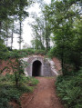
(4) Head towards the gate of the Loire Departmental Hunting Federation’s Training Centre and, just before the gate, on its right-hand side, take the path. Go through the tunnel under the N82 and climb up to a small road (Chemin des Garennes).

(5) Follow it to the right until you reach the junction with the cross.

(6) Take the hairpin bend to the left towards the Sentier des Crêts (Chemin de Terrolier), and reach thefirstpath on the left.

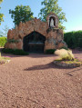
(7) Take this path, which offers some lovely views over the Roannais region. Pass a statue of the Virgin Mary on your right and a radio relay station at the foot of the hill on your left, and you’ll reach a four-way junction.

(8) Turn left and you’ll reach a road.

(9) Cross it diagonally and continue along the path downhill. Pass through a wood, then, when you reach the road, turn left and arrive at the hamlet of Fragny.

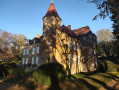
(10) Take the road on the right, Chemin de Fragny, and make a short round trip to see the façade of the large stately home (with beautiful hydrangeas) and its outbuildings. Then return to the crossroads.

(10) Head right onto Chemin Darmezin, then straight on along Route de Thély. Pass number 2115 and take thefirst path on the left.

(11) Follow this path downhill and continue through a small valley where the Grand Val stream flows, almost invisible due to the trees surrounding it. Reach the next crossroads of paths, near the dual carriageway.

(12) Turn right and follow the path which takes you through the tunnel under the N82. Carry on until you reach the hamlet of La Croix and rejoin the route you took earlier.

(1) Head right and follow the path back the way you came, arriving at the church and the town hall in Vendranges (S/E).

Waypoints

  1. S/E : mi 0 - alt. 1,578 ft - Vendranges Church and Town Hall
  2. 1 : mi 0.52 - alt. 1,545 ft - Junction at the end of the circular loop
  3. 2 : mi 0.95 - alt. 1,532 ft - Gros Beau hamlet
  4. 3 : mi 1.52 - alt. 1,703 ft - Junction near the road
  5. 4 : mi 1.91 - alt. 1,749 ft - Croix-Bouquin car park.
  6. 5 : mi 2.85 - alt. 1,841 ft - Small road
  7. 6 : mi 3.21 - alt. 1,890 ft - Junction with a cross
  8. 7 : mi 3.45 - alt. 1,854 ft - Path on the left
  9. 8 : mi 4.33 - alt. 1,900 ft - Crossroads of footpaths after the statue of the Virgin Mary.
  10. 9 : mi 4.45 - alt. 1,834 ft - Route
  11. 10 : mi 4.93 - alt. 1,726 ft - The hamlet of Fragny.
  12. 11 : mi 6.02 - alt. 1,539 ft - Path on the left
  13. 12 : mi 7.12 - alt. 1,388 ft - Junction
  14. S/E : mi 7.89 - alt. 1,578 ft - Vendranges Church and Town Hall

Notes

Important note. The Copler walk (No. 32) is often mentioned. This route takes you along sections of paths that are no longer in use and does not pass through the village centre.

(4) If you are travelling in several cars, it is best to park at the small lay-by at La Croix Bouquin, on the side of the D1082. Two picnic tables are available.

On the way back to Vendranges, there is a bench where you can have a picnic if you turn right onto Rue de la Route Bleue.

Worth a visit

(S/E) In the village square, take a look at the beautiful chancel of Saint-Genest Church, the cross and the charming Town Hall.
(1) The cross in the hamlet of La Croix.
(10) In the hamlet of Fragny, a large town house with charming outbuildings.

Reviews and comments

4.7 / 5
Based on 2 reviews

Reliability of the description
4.5 / 5
Ease of following the route
5 / 5
Route interest
4.5 / 5
abouamine42
abouamine42

Overall rating : 5 / 5

Date of your route : Nov 16, 2026
Reliability of the description : ★★★★★ Very good
Ease of following the route : ★★★★★ Very good
Route interest : ★★★★★ Very good
Very busy route : No

A nice little walk, not too difficult, which took 3 hours at a leisurely pace.
Thanks to the author.

Machine-translated

TotoB
TotoB
• Edited:

Good evening,
For Netra’s attention: More reliable on a computer??? That’s odd – Visorando gives 309 metres, VisuGPX gives 369 metres, OpenRunner gives 383 metres, all based on the same track and all on a computer!!!
Whether you like it or not, only a GPS with a barometer (calibrated, of course) comes closest to the actual elevation gain… without being perfectly accurate to the metre (other factors come into play).
No hard feelings.

P.S.: Please do believe me when I say that I didn’t just read the track in VisuGPX; I also know how to read contour lines on an IGN map!!!

Machine-translated

Elizabeth
Elizabeth

• TotoB, who completed this walk, estimated the elevation gain at 420 metres and, in their comment dated 20 August, explains how they arrived at this figure. They were surprised to find that the elevation gain was more than 100 metres greater than the figure given.

Machine-translated

Netra
Netra ★

Hello,

The elevation gain calculated by computer – that is, the figure shown on the hike details page – is more reliable than that estimated in real time whilst recording a track. When recording a track, the estimation of altitudes, and therefore elevation gains, is subject to significant inaccuracies.

The elevation gain to be relied upon is therefore that given on the route description: 309 m.

Machine-translated

Elizabeth
Elizabeth

• Please note regarding the ELEVATION GAIN.
• The walk is listed as having 306 metres of elevation gain. HOWEVER, I’d like to point out that when I did this walk, my GPS showed 460 metres.
• I’d like to point this out for anyone who can’t manage too much elevation gain!
• Elizabeth Evelyne

Machine-translated

Elizabeth
Elizabeth

• This raises the question of how to assess the level of difficulty, because for me – someone who is nearly eighty and has only been hiking for 14 years – I found it easy. But I have sometimes chosen walks classified as ‘moderate’ and found them difficult, not because of the distance, because when you see 25 km or 1,000 m of elevation gain, you know what to expect, but because of technical difficulties, such as very high steps to climb, or a ‘mini-cliff’ where you have to find footholds, or where there’s a cable but you have to spread your legs to find handholds (my partner goes first and places my feet in the small notches!), or where there are ‘balcony-style’ sections with a precipice below!
• On the Véroncle Gorges walk (then classified as ‘moderate’), my companion had to go ahead of me on the descent down the small cliff to position my feet in the notches, and I’d posted comments on Visorando recounting my experience (I’d gone two hours without being able to eat because my throat and tongue were so dry after the descent! All I could do was drink!), and I’ve noticed that since then, the walk has been classified as ‘difficult’.
• That’s why I appreciate Visorando, because what matters most to me are the comments from Visorando users who highlight the difficulties they’ve encountered, just like yours! When someone points out a difficulty not mentioned in the description, I think to myself: ‘Right, well, that’s not for me – no point in asking for trouble! We’ve got a choice, so we might as well pick something without any technical difficulties!’ And Visorando is the only site with such a wealth of hike reviews.
• The FFRP now has a 5-level system which I think is excellent.

Machine-translated

TotoB
TotoB

And you were right to do so, as there really was a climb of over 308 metres!!!
Never mind, the walk is pleasant and quite interesting (including some aggressive horseflies – I’ve tried them out!!!). However, for those looking for gentle walks without too much difficulty, the difference may be significant.
Have a good day.

Machine-translated

Elizabeth
Elizabeth

This confirms what I’d noticed on several occasions. I hadn’t dared tell my partner that we’d only covered 308 metres; I’d added a few metres because he likes it when there’s a bit of elevation gain!

Machine-translated

TotoB
TotoB

Hello,
Well, yes and no, according to VisuGPX (which is less reliable than a GPS fitted with a proper barometer):
- at km 0.32, the altitude rises from 464 to 489 metres, a rise of 25 metres,
- at km 1.92, the altitude rises from 459 to 535 metres, a rise of 75 metres (I’m rounding up...),
- at km 3.93, the altitude rises from 466 to 603 metres, a rise of 140 metres (rounded the other way – we’ll land on our feet!!!),
- at km 7.92, the elevation rises from 513 to 525 metres, an increase of 10 metres,
- at km 10.55, the elevation rises from 384 to 494 metres, a rise of 110 metres,
- and, finally, at km 12.2, we tackle the little climb from the start again, adding a further 25 metres.
So, in total and at the very least, we’ll cover a total elevation gain of around 390 metres (my GPS, which records all changes in altitude, puts it at 420 metres).
Have a good day.

P.S.: VisoRando is more than a little optimistic about elevation gains (optimistic in the sense that it grossly underestimates them): I stopped trusting this app on this point a long time ago!!!

Machine-translated

Elizabeth
Elizabeth

Hello Totob,
When I mapped out the walk using my CompeGPS app from TwoNaw, it showed an elevation gain of 440 metres. When I did the route using the Visorando app, it came out at 308 metres! You start at an altitude of 478 metres, climb to 602 metres and then head back down. There’s just a short climb at the end of the route to reach the village. On the Copler website, where the route is slightly different but the altitudes are the same, it’s given as 350 metres. I often notice this sort of discrepancy between different GPS apps.

Machine-translated

TotoB
TotoB

Overall rating : 4.3 / 5

Date of your route : Aug 20, 2024
Reliability of the description : ★★★★☆ Good
Ease of following the route : ★★★★★ Very good
Route interest : ★★★★☆ Good
Very busy route : No

A walk quite rightly classified as ‘moderate’ in terms of difficulty… In fact, the actual elevation gain is 420 metres, not 310 (it’s been a long time since we came across such an error on a Visorando walk!!!), which makes it – although interesting – a bit of a ‘challenge’ when you’re not expecting it!!!
All in all, a lovely walk, lovely villages, lovely scenery – no regrets.

Machine-translated

Other walks in the area

For more walks, use our search engine .

The GPS track and description are the property of this route's author. Please do not copy them without permission.