


Refine your search for walks in Vauziron (ruisseau) - Affluent de la Doré
Vauziron (ruisseau) - Affluent de la Doré walks


 Visorando Member
Walks near Vauziron (ruisseau) - Affluent de la Doré
 Saint-Victor-Montvianeix – Arconsat
 Association / Club / Walk leader
 11.87 mi
 +2,172 ft
 -1,909 ft
 7h 20
 Moderate
 Departure from Saint-Victor-Montvianeix (Puy-de-Dôme)
Stage4 of the circular mid-mountain loop linking the Monts de la Madeleine, Bois Noirs and the northern Livradois – picturesque hilltop villages nestled in deep gorges carved out by rivers, from the beautiful Muratte Dam to the village of Arconsat: explore the wooded and unspoilt countryside on the Auvergne side of the Puy de Montoncel. This stage very often follows the routes of the Espace VTT Bois Noirs, guaranteeing that you’ll find open, signposted trails.
Laprugne – Saint-Victor-Montvianeix
 12.93 mi
+2,195 ft
-2,169 ft
7h 50
 Difficult
Departure from Laprugne (Allier)
Third stage of the Rez de Sol circular route, straddling the Monts de la Madeleine, the Bois Noirs and the northern Livradois. There is a stark contrast as you cross from the Allier into the Puy-de-Dôme: from pretty mid-mountain hamlets as far as Lavoine, then a landscape dominated by forests cascading down deep gorges from which a few hilltop villages emerge, seeming timeless, towards St-Victor-Montvianeix (a very extensive commune covering 4,500 ha). An optional detour takes you to the Rez de Sol (1.6 km). Omitting this route reduces the length of the stage by the same distance.
Arconsat – Cherier
 13.12 mi
+2,336 ft
-2,041 ft
8h 05
Difficult
Departure from Arconsat (Puy-de-Dôme)
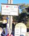
The fifth stage of the Boucle du Rez de Sol route, where you leave the Auvergne to return to the Loire region by crossing the Col Saint-Thomas, famous for its sign reading “Here ends France, here begins the Auvergne”. You leave the Bois Noirs to pass through the pretty hamlets of Chausseterre and then Saint-Just-en-Chevalet. A long climb leads up to the Pras plateau at an altitude of 1,000 metres (in the commune of Cherier), involving a 400-metre ascent in the second half of the day, along lovely little shaded paths well maintained by the Urfé Community of Communes. Discover numerous isolated houses, beautifully restored by those who love solitude.
Thiers - Les Quatre Vents
11.38 mi
+1,998 ft
-1,526 ft
7h 00
Difficult
Departure from Thiers (Puy-de-Dôme)
This first stage of the Chemin de Sainte-Agathe gives us the opportunity to take different PR®® trails. We pass through charming little hamlets: Lamouroux, Sardier, Grand Cognet, Laurençon and cross a few streams. Beautiful trees line the route, as well as numerous views of the Chaîne des Puys.From the village of Vollore-Ville, passing close to the castle, we descend towards the plain and reach the Gîte des Quatre Vents via the hamlet of Sauvetat.
André Monnot Trail and Vichy parks
7.74 mi
+33 ft
-98 ft
3h 35
Moderate
Departure from Saint-Yorre (Allier)
A hike dedicated to water. Flowing water, Ruisseau des Andraux, Allier. Water to drink, Saint-Yorre bottling plant, Source des Célestins. Water with healing properties, Hall des Sources and Grand Établissement Thermal de Vichy. And, depending on the weather, perhaps water falling from the sky?This hike can also be done as a round trip, difficulty: difficult (24 km).
From the Loge des Gardes to Point du Jour
 11.96 mi
+1,368 ft
-2,044 ft
6h 40
Moderate
Departure from Laprugne (Allier)
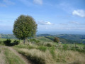
Departure from the Loge des Gardes sports centre. Start the day in the beautiful beech undergrowth of the Assise State Forest, above 1,000 metres altitude, before descending to the more open plateaus of La Tuilière and Cherier, with beautiful views. End at the Refuge du Point du Jour lodge (overnight stay and meals made with farm produce) (altitude 870 metres).
Saint-Just-en-Saltire – Laprugne
 11.35 mi
+1,594 ft
-1,296 ft
6h 35
Moderate
Departure from Saint-Just-en-Chevalet (Loire)
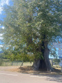
Second stage of a 5-day horse-riding route across the Monts de la Madeleine, the Bois Noirs and the northern Livradois. A typical mid-mountain route, featuring open countryside used for livestock farming, deciduous forests, lively villages, and quiet, well-maintained paths. The start involves little elevation gain (La Tuilière plateau), but most of the climb comes towards the end, after crossing into the Allier.