Alternative route around the Wiesensteig

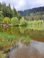
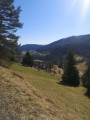
A hike alternating between forests and sloping pastures in the typical Black Forest landscape, with lovely green valleys and babbling brooks.
More accessible all year round from the Dollenberg car park (accessible via the B28 road), this alternative route is slightly longer than the official 13.4 km ‘Wiesensteig’ route recommended by the Bad Peterstal Griesbach Tourist Office.

Details

2815116
Creation:
Last update:
Last review:
  • Walking
    Activity: Walking
  • ↔
    Distance: 9.54 mi
  • ◔
    Average duration: 6h 10 
  • ▲
    Difficulty: Moderate

  • ⚐
    Back to start: Yes
  • ↗
    Ascent: + 2,080 ft
  • ↘
    Descent: - 2,093 ft

  • ▲
    Highest point: 2,690 ft
  • ▼
    Lowest point: 1,703 ft

Photos

Description of the walk

Dollenberg car park (accessible via the B28 road).

(S/E) Walk down the road leading to the car park.

(1) Take the first tarmac road to the right and pass between (behind and in front of) a few houses.

(2) Head down the first unpaved track to the left and follow it until you join the official Wiesensteig route at around km 9 (this path is signposted in both directions but the kilometre markers are shown in an anti-clockwise direction).

(3) Take the track on the left and head down to the hamlet below. Follow the road for about twenty metres.

(4) Turn right into what looks rather like the entrance to a private property. Turn right under the porch and then straight left. Take the grassy path that climbs the hill. Follow the Wiesensteig markings (a diamond with a pictogram representing a meadow, sometimes overprinted with a W) until you reach a small tarmac road.

(5) Cross the road and head straight up the path opposite. Note that the Wiesensteig route (2019 version) veers off to the right into the forest before rejoining this same path a little further up, just before the farm. Go round the top of the farm along the edge of the forest and head towards the bench visible to the south-west at the top of the pasture. Join the path (which you left after the farm) and follow it to the left. At the junction with the path coming from the left, continue to the right.

(6) Go round the first building and head up the path to the right through the pastures. Turn left at the edge of the woods and continue to the Haberer Hütte.

(7) Turn right and head towards a Y-junction.

(8) Follow the left-hand branch signposted ‘Wiesensteig’ and continue until you are near the Martinshof.

(9) Turn onto the path that climbs to the right and follow it past the Renchtalhütte.

(10) Take the middle path and follow it – ignoring, much further on, a path that descends to the right – until you reach the junction between the Wiesensteig and the Renchtalsteig.

(11) At the junction, take the path on the right at right angles. Ignore the adjacent paths until you reach the Fischfelsenhütte near a torrent rushing down to the left.

(12) Continue along the main path to the Weiherplatz, the official starting point of the Wiesensteig hike. There is a picnic area and information boards.

(13) Shortly afterwards, take the path leading down to the right towards the stream. Cross it whilst admiring the magnificent wetland area upstream. Turn left and follow the path down the right bank. Cross the bridge (max 6t) and head for the Herbstwasen inn, where you’ll need to walk slightly uphill along the road until you reach the middle of the bend.

(14) Turn right across the meadows. Admire the view of the opposite hillside and enter the woodland. Head downhill and go round a building until you spot a sawmill and its old water channel to the right, further down.

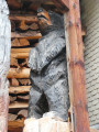
(15) Marked by a chainsaw-carved sculpture of a chainsaw, the path climbs to the left here. Follow it to the ford, climb a few steps to reach the stream, then cross it over a few flagstones.

(16) Leave the Wiesensteig and head up the (somewhat overgrown) path to the left. It soon curves to the right, turning into a forest track, then curves further on, climbing to the left. Take the track suitable for vehicles to the right. It leads gently downhill back to the junction from the outward journey.

(2). Return to the starting point by following the route in the opposite direction to the outward journey (S/E).


Waypoints

  1. S/E : mi 0 - alt. 2,064 ft - Car park at Dollenberg: Access via the B28
  2. 1 : mi 0.07 - alt. 2,051 ft - First road on the right further down
  3. 2 : mi 0.17 - alt. 1,988 ft - Junction after the last building
  4. 3 : mi 0.49 - alt. 1,762 ft - Wiesensteig
  5. 4 : mi 0.62 - alt. 1,703 ft - Hamlet
  6. 5 : mi 1.01 - alt. 1,998 ft - Crossing of a ‘tarmac path’
  7. 6 : mi 2.12 - alt. 2,067 ft - Kirchberg
  8. 7 : mi 2.31 - alt. 2,231 ft - Haberer Hütte
  9. 8 : mi 2.7 - alt. 2,388 ft - Three-way junction
  10. 9 : mi 3.16 - alt. 2,251 ft - Martinshof
  11. 10 : mi 3.75 - alt. 2,520 ft - Y-junction
  12. 11 : mi 5.21 - alt. 2,608 ft - Junction between the Wiesensteig and the Renchtalsteig
  13. 12 : mi 5.84 - alt. 2,349 ft - Fischfelsenhütte
  14. 13 : mi 6.29 - alt. 2,182 ft - Weiherplatz
  15. 14 : mi 6.97 - alt. 2,024 ft - Herbstwasen
  16. 15 : mi 7.51 - alt. 1,952 ft - Chainsaw (sculpture)
  17. 16 : mi 8.08 - alt. 2,149 ft - Ford
  18. S/E : mi 9.54 - alt. 2,064 ft - Car park at Dollenberg

Notes

As its German name suggests, this walk passes partly through meadows and wetlands. The rest of the route is through woodland, including a ford (16), so good (waterproof) walking boots are strongly recommended, especially after heavy rain or when the snow is melting.
There are quite a few benches along the route, as well as the odd picnic area, notably near Weiherplatz.
There is a playground for young children at Dollenberg and another at the Renchtalhütte.
There are no shops, but a few inns are scattered along the route. Check their opening periods and times.
It is important to note that, on the ground, the route of the Wiesensteig hike differs in places from what is shown on the base map.

Worth a visit

Visit the Dollenberg estate and its flower gardens in season (free access).
Woodcarvers near the sawmill.
The wild Rench and its rushing waters.

Reviews and comments

4.7 / 5
Based on 3 reviews

Reliability of the description
4.7 / 5
Ease of following the route
4.7 / 5
Route interest
4.7 / 5
Helmbacher Michel
Helmbacher Michel

Overall rating : 5 / 5

Date of your route : Oct 27, 2024
Reliability of the description : ★★★★★ Very good
Ease of following the route : ★★★★★ Very good
Route interest : ★★★★★ Very good
Very busy route : No

As I prepared for our last walk, I read in a brochure: "When you go hiking on the top-class trails of Bad Peterstal-Griesbach in the Black Forest, you'll have time to think...".
Hello everyone!
I'd rather tell you that you don't need to buy the 100 must-see wonders of your life, because beauty can be poached anywhere. And we were able to verify this once again last Sunday on a 'pleasure-premium' trail of the Sinfoniesteig (Hiking Symphony), one of the 42 trails labelled 'Bollenhut' ('Hat with 11 red pompoms') in the Black Forest.
Indeed, after having been charmed by an initial experience near Sasbachwalden, in the Sasbach valley, the previous weekend, and which the Schwarzwaldverein (compared to the Club Vosgien in our country) calls a "Genisspfad", which I will translate literally as "Trail that you can only appreciate", we had, This time, we went up the valley of the Rench to Bad Griesbach, then up the valley of the Wilde Rench to Weiherplatz, which is considered to be the official entrance or starting point, albeit a circuit, of the "Wiesensteig" walking route, less than an hour's drive from our home in Rosheim, via Offenburg.
I can tell you that it kept us on our toes from start to finish, in a manner of speaking; all we had to do was walk at a gentle pace, the kind that opens us up to the beauties and secrets of the places we pass through...
I'll leave you to discover it via the link to the slideshow below, in the hope that, as with each of my mailings, it will inspire you to take a little stroll there for the pleasure of hiking.
Enjoy the rest!
Michel Helmbacher
2024.10.27 Bad Griesbach/Black Forest/Wilde Rench Valley/Wiesensteig route "Google-Photos
https://photos.app.goo.gl/FYcd6UrGMGnA2A...

Machine-translated

Helmbacher Michel
Helmbacher Michel

Overall rating : 5 / 5

Date of your route : Oct 27, 2024
Reliability of the description : ★★★★★ Very good
Ease of following the route : ★★★★★ Very good
Route interest : ★★★★★ Very good
Very busy route : No

As I prepared for our last walk, I read in a brochure: "When you go hiking on the top-class trails of Bad Peterstal-Griesbach in the Black Forest, you'll have time to think...".
Hello everyone!
I'd rather tell you that you don't need to buy the 100 must-see wonders of your life, because beauty can be poached anywhere. And we were able to verify this once again last Sunday on a 'pleasure-premium' trail of the Sinfoniesteig (Hiking Symphony), one of the 42 trails labelled 'Bollenhut' ('Hat with 11 red pompoms') in the Black Forest.
Indeed, after having been charmed by an initial experience near Sasbachwalden, in the Sasbach valley, the previous weekend, and which the Schwarzwaldverein (compared to the Club Vosgien in our country) calls a "Genisspfad", which I will translate literally as "Trail that you can only appreciate", we had, This time, we went up the valley of the Rench to Bad Griesbach, then up the valley of the Wilde Rench to Weiherplatz, which is considered to be the official entrance or starting point, albeit a circuit, of the "Wiesensteig" walking route, less than an hour's drive from our home in Rosheim, via Offenburg.
I can tell you that it kept us on our toes from start to finish, in a manner of speaking; all we had to do was walk at a gentle pace, the kind that opens us up to the beauties and secrets of the places we pass through...
I'll leave you to discover it via the link to the slideshow below, in the hope that, as with each of my mailings, it will inspire you to take a little stroll there for the pleasure of hiking.
Enjoy the rest!
Michel Helmbacher
2024.10.27 Bad Griesbach/Black Forest walk/Wilde Rench valley/Wiesensteig route "Google-Photos".
<a href="https://photos.app.goo.gl/FYcd6UrGMGnA2AUy7<img src="https://www.visorando.com/images/smileys/love.gif" border="0" class="smiley" alt="" />" title="https://photos.app.goo.gl/FYcd6UrGMGnA2AUy7<img src="https://www.visorando.com/images/smileys/love.gif" border="0" class="smiley" alt="" />">https://photos.app.goo.gl/FYcd6UrGMGnA2A...

Machine-translated

PARUSSOM
PARUSSOM

Overall rating : 4 / 5

Date of your route : Jul 03, 2023
Reliability of the description : ★★★★☆ Good
Ease of following the route : ★★★★☆ Good
Route interest : ★★★★☆ Good
Very busy route : No

It's a lovely walk between meadows and forests, a condensation of the spirit of the Black Forest over just a few kilometres with no major difficulties!

Machine-translated

Other walks in the area

For more walks, use our search engine .

The GPS track and description are the property of this route's author. Please do not copy them without permission.