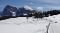
Vallunga – Puez Hütte circular loop

A superb hike in Val Gardena, starting from the resort of Selva Gardena. You’ll be entering a UNESCO World Heritage Site. The scenery along the suggested route is incredibly varied.
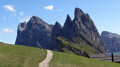
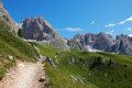
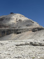
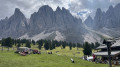
The Chedul valley opens out onto the Gruppo Cir and its magnificent peaks. At Passo Crespeina, you can admire the impressive lunar landscape as you head towards the Puez Hütte. After the refuge, the terrain becomes gentler for the return journey via the Langental.

Details

n°2522013
Creation:
Last update:
Last review:
  • Walking
    Activity: Walking
  • ↔
    Distance: 9.56 mi
  • ◔
    Average duration: 7h 30 
  • ▲
    Difficulty: Difficult

  • ⚐
    Back to start: Yes
  • ↗
    Ascent: + 3,566 ft
  • ↘
    Descent: - 3,553 ft

  • ▲
    Highest point: 8,264 ft
  • ▼
    Lowest point: 5,308 ft

Photos

Description of the walk

The starting point for this hike is at the north-eastern end of Selva Gardena. From the centre of Selva, head towards Streda Val, which ends at the Vallunga car park (a dead-end road and the park entrance).

(S/E) From the Vallunga car park, enter the Langental Park, which is marked by a barrier. Continue to the first junction with path No. 14 (signposted ‘Puez Hütte’).

(1) Turn right onto path No. 14, heading towards the Sylvesterkapelle chapel (marked on the map as ‘Ciapela’: Latin for ‘chapel’).

(2) To the right of the chapel, follow path No. 12 alongside a stream. Signpost No. 12 Val Chedul. Leave the wooded valley and reach a junction with a path coming from Passo Cir.

(3) Continue along Path No. 12 and cross another ridge path (Alta Via No. 2 Dolomiti) also coming from Passo Cir. Walk on, admiring the peaks of the Gruppo Cir on your right.

(4) Still on Trail No. 12, climb the three hairpin bends leading to Passo Crespeina.

(5) Take a break to enjoy the views at this pass. The orderly landscape of the Cir peaks and Val Chedul to the west contrasts magnificently with the chaos to the east. From this point, it is difficult to make out the route to follow.
From Passo Crespeina, heading north, take Trail No. 2 (which is also the Alta Via No. 2 of the Dolomites), and continue to Forcella di Ciampei.

(6) Stay on Trail No. 2 as you head straight ahead. Continue the walk through this fantastic scenery to the Rifugio Puez.

(7) The Rifugio Puez is the ideal spot for a contemplative break to take in all the surrounding mountain ranges. Admire the Langental directly opposite and the two mountain walls forming a narrow, gorge-like opening over Selva Gardena.
Walk past the refuge and, heading south-west, rejoin path No. 2, which runs along a ridge, until you reach another junction with path No. 16.

(8) Leave Path No. 2 on your right and take Path No. 16 on your left (signposted ‘Langental’), which begins a descent along a rock face. Despite its steep gradient, this path is particularly pleasant. The difficult sections have been fitted with steps, making for a comfortable walk. Descend the entire valley to reach Path No. 14.

(9) Continue to the right along path No. 14 heading south-west until you reach another junction.

(10) Stay on the track to the right.

(1) Return to the car park, leaving this wonderful Langental Park behind (E).

Waypoints

  1. S/E : mi 0 - alt. 5,335 ft - Vallunga car park
  2. 1 : mi 0.04 - alt. 5,315 ft - Fork in the road 14
  3. 2 : mi 0.29 - alt. 5,387 ft - On the right, Chedul Tal
  4. 3 : mi 2.43 - alt. 7,756 ft - Carry on straight ahead along path 12
  5. 4 : mi 2.75 - alt. 8,146 ft - Junction of trails 12 and 2
  6. 5 : mi 2.83 - alt. 8,264 ft - Passo Creispeina
  7. 6 : mi 4.19 - alt. 7,769 ft - Forcella di Ciampei
  8. 7 : mi 5.42 - alt. 8,133 ft - Rifugio Puez
  9. 8 : mi 6.18 - alt. 7,907 ft - Trail 16 Langental
  10. 9 : mi 7.79 - alt. 5,873 ft - Trail 14
  11. 10 : mi 8.88 - alt. 5,518 ft - Right-hand track
  12. S/E : mi 9.56 - alt. 5,322 ft - Vallunga car park

Notes

  • There are no water points along the entire route.
  • Food and refreshments are available at Rifugio Puez (at km 9, just over halfway along the route).

Worth a visit

  • Val Gardena
  • Puez Hut (Rifugio Puez)
  • Langkofel
  • Schlern and Santner Turm
  • Geisler Group
  • Puez Group
  • Cir Group
  • Sella Group

Reviews and comments

4.7 / 5
Based on 1 review

Reliability of the description
5 / 5
Ease of following the route
4 / 5
Route interest
5 / 5
Sommy69
Sommy69

Overall rating : 4.7 / 5

Date of your route : Sep 01, 2025
Reliability of the description : ★★★★★ Very good
Ease of following the route : ★★★★☆ Good
Route interest : ★★★★★ Very good
Very busy route : No

A very beautiful hike with varied landscapes; quite a steep climb in the first part (up to marker No. 5), the rest is easier. The descent is quite long, so it's a good idea to fill your water bottles at the refuge.

Machine-translated

Other walks in the area

For more walks, use our search engine .

The GPS track and description are the property of this route's author. Please do not copy them without permission.