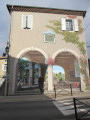
Barrès Valley and Forest

This hike will take you on a journey of discovery through holm oaks, downy oaks, Scots pines and maples, as well as many species introduced into the Barrès Forest, such as black pines, Atlas cedars, Mediterranean firs and Douglas firs.

Details

10598632
Creation:
Last update:
Last review:
  • Walking
    Activity: Walking
  • ↔
    Distance: 7.59 mi
  • ◔
    Average duration: 4h 25 
  • ▲
    Difficulty: Moderate

  • ⚐
    Back to start: Yes
  • ↗
    Ascent: + 1,076 ft
  • ↘
    Descent: - 1,070 ft

  • ▲
    Highest point: 1,624 ft
  • ▼
    Lowest point: 738 ft

Description of the walk

Departure from the Place de la Mairie in Saint-Vincent-de-Barrès.

(S/E) From the square, walk down the street, "Montée du Village", for a few metres, then take the path opposite the fountain and the steps leading to it and the square. Cross a small bridge and arrive at a place called Bourge, on a tarmac road.

(1) Continue along the road, passing the hamlet of Vignal. After Vignal, continue to the crossroads with Chemin de Tinteron.

(2) Turn right onto this tarmac road. After a right-hand bend, turn left towards the hamlet of Tinteron. Follow this road until you reach a dead end.

(3) Continue right along a small stony path through the pine trees. At the wide path, continue left and join a tarmac road at a bend. As you climb, enjoy the lovely view of the village of Saint-Vincent-de-Barrès and the Andance mountain. Turn right at the hairpin bend until you reach the edge of the woods.

(4) Continue straight ahead, pass under the high-voltage line and follow the signs for Saint-Lager-Bressac. Keep to the right at the crossroads and climb until you reach the sign for "Forêt Domaniale du Barrès".

(5) At the sign, leave the main road and follow a small road on the right, uphill.

(6) At the small pass, continue on theGR®42opposite and, 100 metres further on, you will find a hiking information point and benches on the right. Continue south on the forest track. Ignore a turn-off to the left, pass under a high-voltage power line and reach a fork at Col de Duranne (under another high-voltage power line).

(7) Continue straight ahead and stay on the forest track and theGR®42. After the ONF barrier, stay on this forest track until you leave the forest.

(8) Take a small path on the right, still on theGR®42, and continue through the undergrowth. Ignore the secondary paths on either side. You will reach a fork when the slope levels out.

(9) Leave theGR® trail and descend to the right, heading north, on a wide stony path lined with oak, boxwood and juniper trees overlooking the valley. Pass through the hamlet of Le Geai and reach the Château du Chevalier.

(10) Continue along the ridge after going around the hamlet on the right and reach Saint-Vincent-de-Barrés via the tarmac road (S/E).

Waypoints

  1. S/E : mi 0 - alt. 902 ft - Saint-Vincent-de-Barrés
  2. 1 : mi 0.26 - alt. 827 ft - Bourges, towards Saint-Lager-de-Bressac
  3. 2 : mi 0.98 - alt. 755 ft - Chemin de Tinteron
  4. 3 : mi 1.42 - alt. 971 ft - Tinteron, towards Saint-Lager-de-Bressac
  5. 4 : mi 2.05 - alt. 1,063 ft - La Bourse
  6. 5 : mi 2.79 - alt. 1,230 ft - Chemin de Sichier, towards Cruas
  7. 6 : mi 3.29 - alt. 1,493 ft - Grande Côte intersection, follow the hiking information signs.
  8. 7 : mi 4.51 - alt. 1,509 ft - Col de Duranne, towards Saint-Vincent-de-Barrés
  9. 8 : mi 4.82 - alt. 1,506 ft - Les Aires, towards Meysse
  10. 9 : mi 6.09 - alt. 1,194 ft - Croix de Queyrot, towards St-Vincent-de-Barrés
  11. 10 : mi 7.11 - alt. 915 ft - Château du Chevalier
  12. S/E : mi 7.59 - alt. 902 ft - Saint-Vincent-de-Barrés

Always be cautious and plan ahead when you're outdoors. Visorando and the author of this route cannot be held responsible for any accidents occurring on this route.

The GR® and PR® markings are the intellectual property of the Fédération Française de Randonnée Pédestre.

Reviews and comments

4.3 / 5
Based on 11 reviews

Reliability of the description
4.2 / 5
Ease of following the route
4.4 / 5
Route interest
4.5 / 5
Gibus01
Gibus01

Overall rating : 5 / 5

Date of your route : Mar 23, 2026
Reliability of the description : ★★★★★ Very good
Ease of following the route : ★★★★★ Very good
Route interest : ★★★★★ Very good
Very busy route : No

A pleasant route with very little tarmac and a very pretty village

Machine-translated

DidierRando26
DidierRando26

Overall rating : 4.3 / 5

Date of your route : Oct 05, 2025
Reliability of the description : ★★★★☆ Good
Ease of following the route : ★★★★★ Very good
Route interest : ★★★★☆ Good
Very busy route : No

Hike on Sunday, 5 October, during the day. Very beautiful village of St Vincent.
Pleasant hike between valley and forest. Good markings on the GR trails, with signposts at intersections. Beautiful walks through the woods and undergrowth.
A bit too much tarmac for my liking...
A hunt in progress but no inconvenience for hikers.

Machine-translated

JacquesWaller
JacquesWaller

Overall rating : 4.7 / 5

Date of your route : Apr 18, 2025
Reliability of the description : ★★★★★ Very good
Ease of following the route : ★★★★★ Very good
Route interest : ★★★★☆ Good
Very busy route : No

lovely village, nice walk, fairly quiet, beautiful scenery

Machine-translated

christinet
christinet

Overall rating : 4 / 5

Date of your route : Mar 05, 2025
Reliability of the description : ★★★★☆ Good
Ease of following the route : ★★★★☆ Good
Route interest : ★★★★☆ Good
Very busy route : No

A very pleasant, easy hike with beautiful scenery.
Note that there is major forestry work underway from point 7 onwards. The path is very muddy after rain.

Machine-translated

alarg
alarg

Overall rating : 4 / 5

Date of your route : Jan 31, 2024
Reliability of the description : ★★★★☆ Good
Ease of following the route : ★★★★☆ Good
Route interest : ★★★★☆ Good
Very busy route : No

At point 8, take the path on the left, not the right...
A pleasant hike along small roads and paths. The village of St Vincent de Barrès is magnificent.
At the Serre du Buis sign, be careful not to head towards St Vincent de Barrès.

Machine-translated

Monique 2607
Monique 2607

Overall rating : 5 / 5

Date of your route : Sep 28, 2023
Reliability of the description : ★★★★★ Very good
Ease of following the route : ★★★★★ Very good
Route interest : ★★★★★ Very good
Very busy route : No

Beautiful views of the village of Saint Vincent de Barrès in the first quarter of the hike. Mostly shaded.
On the way back, on the descent, the path is very stony and seems to be deteriorating due to bad weather.

Machine-translated

catche
catche

Overall rating : 4 / 5

Date of your route : Oct 17, 2022
Reliability of the description : ★★★★☆ Good
Ease of following the route : ★★★★☆ Good
Route interest : ★★★★☆ Good
Very busy route : No

A lovely route with beautiful views.
It is best to follow the route using the app on your phone to avoid getting lost.

Machine-translated

casalis
casalis

Overall rating : 3 / 5

Date of your route : Apr 14, 2022
Reliability of the description : ★★☆☆☆ Disappointing
Ease of following the route : ★★★☆☆ Average
Route interest : ★★★★☆ Good
Very busy route : No

At first, we couldn't find the path opposite the fountain, which leads down to the small bridge.
We took the path on the right and then the road to reach the small bridge.
A beautiful hike, but with a lot of road at the beginning.

Machine-translated

tronchenko
tronchenko

Overall rating : 3.7 / 5

Date of your route : Nov 14, 2021
Reliability of the description : ★★★☆☆ Average
Ease of following the route : ★★★☆☆ Average
Route interest : ★★★★★ Very good
Very busy route : No

A beautiful and interesting walk, even though we got lost twice: at point 4, you simply have to continue along the road. Having mistakenly taken the GR at point 4 due to misreading the yellow directional signs, we climbed a steep, rocky path and ended up directly at point 6, where there was a large gathering of hunters. The second mistake was probably before point 9, where we couldn't find the Queyrot cross (it seems that a side path avoids it) and found ourselves still on the GR but much too far away, heading towards Meysse instead of back towards St Vincent de Barrès. Some very friendly hunters equipped with walkie-talkies put us back on the right track, as there was no mobile phone reception in the forest. The evening light was beautiful, as it was getting late for the return journey!

Machine-translated

jerfa84
jerfa84

Overall rating : 5 / 5

Date of your route : Oct 10, 2021
Reliability of the description : ★★★★★ Very good
Ease of following the route : ★★★★★ Very good
Route interest : ★★★★★ Very good
Very busy route : No

We encountered hunters scattered along a track in the beautiful Barrès forest and had the opportunity to chat with some of them.
A very pleasant hike.

Machine-translated

lebig24
lebig24

Overall rating : 5 / 5

Date of your route : Aug 28, 2021
Reliability of the description : ★★★★★ Very good
Ease of following the route : ★★★★★ Very good
Route interest : ★★★★★ Very good
Very busy route : Yes

A very beautiful hike with varied terrain – asphalt, tracks, trails, pebbles – in very pretty landscapes. And at this time of year, we enjoyed blackberries at the very beginning and end of the route...

Machine-translated

Other walks in the area

For more walks, use our search engine .

The GPS track and description are the property of this route's author. Please do not copy them without permission.