Geological discovery trail between Saint-Pierre and Saint-Martin

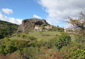
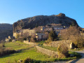
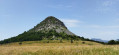
This walk, which takes place in the municipalities of Saint-Pierre-la-Roche and Saint-Martin-sur-Lavezon, offers splendid panoramic views and will amaze you with the various geological features visible close to the path.

Details

10309090
Creation:
Last update:
Last review:
  • Walking
    Activity: Walking
  • ↔
    Distance: 5.25 mi
  • ◔
    Average duration: 2h 50 
  • ▲
    Difficulty: Easy

  • ⚐
    Back to start: Yes
  • ↗
    Ascent: + 472 ft
  • ↘
    Descent: - 486 ft

  • ▲
    Highest point: 1,811 ft
  • ▼
    Lowest point: 1,519 ft

Description of the walk

Park near the church of Saint-Pierre-la-Roche.

(S/E) From the church, head down the D213 and, at the first hairpin bend, leave the tarmac road to join the path on your left.

(1) Continue along the path on your left, where you’ll be able to observe various geological features: at the start of the path, a few landslides, then, about a hundred metres further on, the plateau’s large cliffs, formed of black basalt. Below, impressive ravines have been carved out by rainfall. An information board will help you understand these natural phenomena.

(2) The path leads out onto a tarmac road; head up to the Col des Tribles. Its name probably comes from the fact that three paths meet here.

(3) Leave the road again and take the wide path on your left; a little further on, you’ll be treated to a stunning view: in the foreground, the Barrès forest, the plain and the village of Saint-Vincent-de-Barrès; in the background, the southern Vercors (Grand Veymont), the Trois Becs, Montagne d’Angèle, Montagne de Glandasse and the Devoluy massif (on a clear day).

As you continue along this path, you’ll see impressive scree slopes of basalt rocks. A sign will help you understand how they were formed.

(4) Y-junction: Beauthéac, follow signs for Saint-Bauzile. Here, a sign will provide information on the distinctive features of the Coiron plateau. Continue along this path, passing further scree slopes.

(5) As you cross the Rieutord stream, you’ll pass close to the ‘gour de fromage’, which is situated 50 metres above the path. Legend has it that people used to store their cheese in the gour to keep it cool.
Carry on a little further until you reach the basalt organ pipes.

(6) At Riou, turn back and retrace your steps along the same path to return to the starting point (S/E).

Waypoints

  1. S/E : mi 0 - alt. 1,703 ft - Car park - Église Saint-Pierre (Saint-Pierre-la-Roche)
  2. 1 : mi 0.31 - alt. 1,588 ft - Turn left at the fork
  3. 2 : mi 0.9 - alt. 1,545 ft - Tarmac road junction
  4. 3 : mi 1.32 - alt. 1,667 ft - Junction - Col de Tribles
  5. 4 : mi 2.06 - alt. 1,808 ft - Junction between Beauthéac and Saint-Bauzile
  6. 5 : mi 2.3 - alt. 1,788 ft - Cross the - Rieutord (cours d'eau)
  7. 6 : mi 2.63 - alt. 1,745 ft - Riou
  8. S/E : mi 5.25 - alt. 1,703 ft - Car park - Église Saint-Pierre (Saint-Pierre-la-Roche)

Reviews and comments

4.3 / 5
Based on 3 reviews

Reliability of the description
5 / 5
Ease of following the route
5 / 5
Route interest
3 / 5
JuliaM
JuliaM

Overall rating : 5 / 5

Date of your route : Jan 21, 2025
Reliability of the description : ★★★★★ Very good
Ease of following the route : ★★★★★ Very good
Route interest : ★★★★★ Very good
Very busy route : No

A lovely, enjoyable walk (done today in cloudy weather) offering views over beautiful countryside. Stunning views of the Vercors, the Trois Becs, the Saoû syncline, etc. A great variety of scenery all along the trail. Breathtaking views down into the ravines. Several impressive rock formations dot the trail. Charming woodland with century-old chestnut trees in unusual shapes, not to mention the gentle pastures… Very pleasant. I’d highly recommend it. Thank you for sharing.

Machine-translated

Vegevi
Vegevi

Overall rating : 3.7 / 5

Date of your route : Jun 12, 2023
Reliability of the description : ★★★★★ Very good
Ease of following the route : ★★★★★ Very good
Route interest : ★☆☆☆☆ Very disappointing
Very busy route : No

A very disappointing walk in terms of geological interest. Lots of basalt but no impressive columnar joints. The only information board is illegible. A few lovely views.

Machine-translated

dougere
dougere
• Edited:

Overall rating : 4.3 / 5

Date of your route : May 15, 2023
Reliability of the description : ★★★★★ Very good
Ease of following the route : ★★★★★ Very good
Route interest : ★★★☆☆ Average
Very busy route : No

Lovely scenery up to 3. The first information sign has been completely worn away by the sun.
After that, if you like the forest, the path is pleasant up to marker 4 or even 5.
Don’t go much further than that – there’s no point in turning back at 6. We saw two houses, two cats and loads of ‘private property’ signs.
The walk takes 2 hours 10 minutes and the elevation gain is only about 150 m.

Machine-translated

Other walks in the area

For more walks, use our search engine .

The GPS track and description are the property of this route's author. Please do not copy them without permission.