Vallée de Languidou

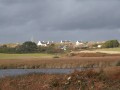
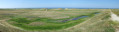
This route takes you into the valley that extends into the Étang de Kergalan.
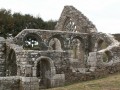
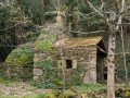
On the way back, you will pass by the Languidou Chapel, a ruined chapel that never fails to amaze with its architecture and magnificent stone lace rose window.

Details

365318
Creation:
Last update:
Last review:
  • Walking
    Activity: Walking
  • ↔
    Distance: 6.64 mi
  • ◔
    Average duration: 3h 15 
  • ▲
    Difficulty: Moderate

  • ⚐
    Back to start: Yes
  • ↗
    Ascent: + 230 ft
  • ↘
    Descent: - 223 ft

  • ▲
    Highest point: 154 ft
  • ▼
    Lowest point: 16 ft
  • ⚐ Country: France
  • ⚐ City: Plovan (29720)
  • ⚑
    Start/End: N 47.915716° / W 4.361362°
  • ❏
    IGN map(s): Ref. 0419ET, 0519OT
  • Hour-by-hour weather

Photos

Description of the walk

Start: Town hall car park.

(S/E) With your back to the car park, cross the grassy area with two picnic tables and turn left onto the first street, which continues as a dirt track.

YellowPR®® signposting (Languidou Ponds route)

Reach a small road and follow it for a few metres.

(1) At the junction, turn right, pass Ty Broc’h (the badger’s house) and, at the next three-way junction, take the left-hand road and carry on. At the signpost, ignore the path leading down to the right (return route)

YellowPR®® signposting (in the opposite direction)

Carry on to the bend.

(2) Follow the sign for Moulin Henry to the right. After this old mill, continue through the valley for about 1 km.

(3) Opposite the entrance to the farm in the hamlet of Tréfranc (with a fountain and washhouse on the left), turn 90° to the right onto a sunken track lined with cider apple trees. Follow this narrow path, which veers to the right, to cross a stream via a bridge made of large stone slabs.

(4) Begin a climb of about 700 m along a wide farm track until you reach a road at the Kergamet farm. Follow this road, ignoring the track on the left leading to other farms.

(5) Keep to the right, then continue straight on until you reach a crossroads.

(6) Turn left towards the village of Tréogat, follow Rue des Alizés, turn right onto Rue de la Gare, then right again towards the entrance to the Marcassins de Tréogat Stadium.

(7) Enter the stadium and head left into a park with picnic tables, children’s play equipment and sports facilities – ideal for a break (the map background is inaccurate at this point). Walk alongside the park, then turn right along the football pitch and, at the corner, turn left to cross a small wood, emerging near a crossroads.

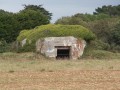
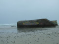
(6) Turn left, passing the hamlet of Kerlafine and then Kerligou. Look out for four blockhouses on the left, which formed the second line of coastal defence. Continue to the hamlet of Tourne-Ici.

(8) At the road, opposite ‘L’Oasis, banquets, weddings’, turn right and follow the edge of the road for 400 m (take care). At the first road (signposted Lespoul), turn right and continue to the next junction.

(9) Turn right onto a path between fields. Follow a short circular path to the right (the path is not very visible) then veer left towards Kerligou Farm on your right.

(10) The route then follows a path for about 600 metres at the bottom of the valley – the wildest part of the route – which leads out at a bridge. This section can be tricky in winter. Follow the road to the right.

(11) At the signpost, turn right onto a grassy section followed by a narrow stony path which climbs up to a small road.
Turn left and, at the three-way junction, head down to the left to reach the site of the Languidou Chapel. (Take a moment to admire this ruined chapel, which is very well preserved, as is the beautiful rose window).

(12) Turn back and head up the road to the left, which overlooks the chapel site.

Off the marked route

(1) Turn left and, following the route in reverse to the one taken on the way there, head back to the town hall car park (S/E).

Waypoints

  1. S/E : mi 0 - alt. 75 ft - Town hall car park
  2. 1 : mi 0.44 - alt. 89 ft - Turn right
  3. 2 : mi 0.77 - alt. 69 ft - Towards Moulin Henry
  4. 3 : mi 1.62 - alt. 92 ft - The hamlet of Tréfranc
  5. 4 : mi 1.96 - alt. 30 ft - Bridge made of large stones
  6. 5 : mi 2.45 - alt. 121 ft - Access to Kerlever Farm
  7. 6 : mi 2.67 - alt. 121 ft - Crossroads
  8. 7 : mi 2.94 - alt. 148 ft - Entrance to the Stade des Marcassins in Tréogat
  9. 8 : mi 4.07 - alt. 112 ft - Turn right at the road
  10. 9 : mi 4.5 - alt. 108 ft - Junction at Tourne-Ici
  11. 10 : mi 4.92 - alt. 69 ft - Descent into the valley
  12. 11 : mi 5.58 - alt. 16 ft - Leave the road
  13. 12 : mi 5.89 - alt. 30 ft - Languidou Chapel
  14. S/E : mi 6.64 - alt. 75 ft - Town hall car park

Notes

Toilets at the car park at the start of the walk + picnic tables.
Some sections can be very wet in winter.
Alternating between small roads and shaded paths.

The yellow markings are not always consistent.

Worth a visit

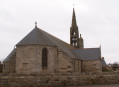
Plovan Church
Lnguidou Chapel

Near the car park, there is a reconstruction of a 1950s primary school classroom, open in July and August (free admission).

Always be cautious and plan ahead when you're outdoors. Visorando and the author of this route cannot be held responsible for any accidents occurring on this route.

The GR® and PR® markings are the intellectual property of the Fédération Française de Randonnée Pédestre.

Reviews and comments

4.7 / 5
Based on 1 review

Reliability of the description
4 / 5
Ease of following the route
5 / 5
Route interest
5 / 5
FLOCH
FLOCH ★

Thank you for your comment.
I completely agree with your comment: between (5) and (6), the small road is a bit monotonous.
Passing through Kerligou does not seem to be permitted. On the aerial view, there is a path, but it crosses the farm buildings.
I also completely agree with the +++
I have known the Languidou chapel for a long time and never tire of rediscovering it.
The village of Plovan is very pleasant, but I haven't yet found the church open.
A discovery for me: the passage through the two valleys, especially the one after Kerligou.

Best regards

FLOCH

Machine-translated

JS29
JS29

Overall rating : 4.7 / 5

Date of your route : Sep 26, 2016
Reliability of the description : ★★★★☆ Good
Ease of following the route : ★★★★★ Very good
Route interest : ★★★★★ Very good

A beautiful hike on 25 September in dry weather.
Surprising contrast between the deep valleys (very pleasant) and the small connecting roads, which are a bit monotonous in places, particularly between points 5 and 6.
It's a shame not to be able to "cut" from Kergamet mark 5 to Kerligou mark 8.
In this case, we could extend from Plovan to Audièrne Bay, Crumuni GR34 for example?
The plus points
The Languidou chapel: take the time to walk around and look at the details, it's really beautiful.
Plovan and its church in particular (it was open), this little village is beautiful, clean and well located between land and sea...
The valleys that plunge deep with unexpected drops are the highlight of the walk.
I'll definitely be doing it again, and thank you for suggesting it.
Jean

Machine-translated

Other walks in the area

For more walks, use our search engine .

The GPS track and description are the property of this route's author. Please do not copy them without permission.