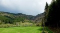
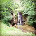
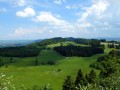
The Reverotte Valley and its waterfalls

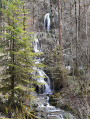
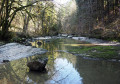
A walk starting from the village of Pierrefontaine-les-Varans towards the Second World War memorial, where sculptures are on display along the route. The walk continues towards the lovely little village of Le Saucet and its beautiful chapel. The route now descends into the Dessoubre and Reverotte valleys, passing through the hamlet of Gigot. Head back up the Reverotte valley, following the river and its waterfalls, to the village where you started.

Details

37262616
Creation:
Last update:
Last review:
  • Walking
    Activity: Walking
  • ↔
    Distance: 11.49 mi
  • ◔
    Average duration: 6h 35 
  • ▲
    Difficulty: Moderate

  • ⚐
    Back to start: Yes
  • ↗
    Ascent: + 1,535 ft
  • ↘
    Descent: - 1,516 ft

  • ▲
    Highest point: 2,766 ft
  • ▼
    Lowest point: 1,499 ft

Photos

Description of the walk

Park in the car park opposite the cemetery, on Rue du Repos in Pierrefontaine-les-Varans.

(S/E) Take Rue du Repos eastwards to the junction with Rue du Val. Continue straight on towards the FFI memorial sign, along Rue des Sorbiers and then Rue du Belmont. Head for the village exit.

::1: Carry on along the road until you reach a Y-junction.

(2) Turn right towards the FFI memorial and begin a long climb up the road. At a hairpin bend in a place called La Lue, you’ll reach a path junction.

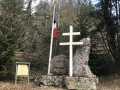
(3) Carry on to the left and keep an eye out for the sides – there is the occasional sculpture. Reach the summit at the Second World War Memorial.

(4) Turn right onto the path leading up from the main road. Stay on this path, ignoring all other paths or tracks branching off to the right or left. You’ll reach the junction with the path leading to the Combe du Frêne.

(5) Carry on and head uphill, following the sign for ‘Circular Gigot’. From there, follow the track carefully as several paths can be misleading. At the next junction with a main track, take the path marked No. 30 straight ahead. After a short flat stretch, begin a descent down to a main track.

(6) Turn left onto it and leave the woods. Follow this lovely track, with a view of the Dessoubre valley to your right. You’ll reach the small village of Le Saucet,

(7) Turn right into Rue de la Chapelle, continue along Rue du Paon and reach its end.

(8) Turn right onto the path, which descends – at times steeply – and, through the woods, joins a wide track. Turn left onto this track and follow it until you reach a crossroads of footpaths.

(9) Turn right onto this path and, after a few hairpin bends, you’ll come out onto a road and reach a multi-way junction near the Hôtel Restaurant de Gigot.

(10) Here, head straight ahead onto the Route du Chapeau Rouge – this is the D20. Walk along the verges, which are clear, safe and have little traffic. Follow the left bank of the Reverotte and, at a designated rest area, reach a junction of roads.

(11) Stay on the D20 until you reach another junction at the Défilé des Épais.

(12) Continue along the D20 until you reach the confluence of the Reverotte and the Ruisseau du Val.

(13) Turn right, cross the bridge and, shortly afterwards, take the path along the right bank of the Ruisseau du Val. Head towards the Grande Waterfall.

(14) Carry on, turn right onto the road, pass the source of the Val and you’ll come to a path junction.

(15) Turn right here and, after a steep climb, return to the junction you passed on the way out.

(1) Turn left and retrace your steps along the route you took on the way there to return to the car park at the Pierrefontaine-les-Varans cemetery (S/E).

Waypoints

  1. S/E : mi 0 - alt. 2,277 ft - Pierrefontaine-les-Varans cemetery car park
  2. 1 : mi 0.54 - alt. 2,270 ft - Crossroads marking the end of the circular loop
  3. 2 : mi 0.77 - alt. 2,303 ft - Memorial crossroads
  4. 3 : mi 1.34 - alt. 2,539 ft - A place called La Lue
  5. 4 : mi 1.87 - alt. 2,756 ft - Memorial
  6. 5 : mi 3.14 - alt. 2,539 ft - Combe du Frêne
  7. 6 : mi 3.85 - alt. 2,415 ft - Wide crossroads on the path
  8. 7 : mi 4.96 - alt. 2,297 ft - Le Saucet
  9. 8 : mi 5.21 - alt. 2,198 ft - End point: Rue du Paon
  10. 9 : mi 5.97 - alt. 1,729 ft - Road-path junction
  11. 10 : mi 6.27 - alt. 1,499 ft - Hôtel-Restaurant de Gigot - Reverotte (rivière)
  12. 11 : mi 8.33 - alt. 1,611 ft - Designated rest area
  13. 12 : mi 9.18 - alt. 1,693 ft - Défilé des Épais
  14. 13 : mi 9.65 - alt. 1,755 ft - Val Stream
  15. 14 : mi 10.51 - alt. 2,008 ft - Grande Waterfall du Val
  16. 15 : mi 10.81 - alt. 2,156 ft - Road-path junction
  17. S/E : mi 11.49 - alt. 2,277 ft - Pierrefontaine-les-Varans cemetery car park

Worth a visit

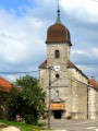
(7) Le Saucet: make the most of this visit to see some beautiful houses, statues, a statue of the Virgin Mary and her chapel.
Between (13) and (14), take in several waterfalls.

Reviews and comments

4.1 / 5
Based on 3 reviews

Reliability of the description
4 / 5
Ease of following the route
4 / 5
Route interest
4.3 / 5
randobisontin
randobisontin

Overall rating : 3.7 / 5

Date of your route : Jul 19, 2024
Reliability of the description : ★★★★☆ Good
Ease of following the route : ★★★☆☆ Average
Route interest : ★★★★☆ Good
Very busy route : No

Between points 5 and 6, there is no longer a marked route on the ground and the GPS track does not match.
From point 10 to beyond point 13, the route is of no interest as it runs along the RD 20, where vehicles are travelling and there is no hard shoulder on which to walk safely.

Machine-translated

Le Baladeur
Le Baladeur

Overall rating : 4 / 5

Date of your route : Oct 23, 2023
Reliability of the description : ★★★★☆ Good
Ease of following the route : ★★★★☆ Good
Route interest : ★★★★☆ Good
Very busy route : No

Walk taken in mid-October 2023.
Interesting, but a lot of tarmac and quite long (5 km), although it is possible to do it as a circular route.
It gave me the chance to explore the surrounding area, with some lovely views from the higher ground.

Machine-translated

46497477
46497477

A simple but very useful description.

Machine-translated

46497477
46497477

Overall rating : 4.7 / 5

Date of your route : Aug 21, 2023
Reliability of the description : ★★★★☆ Good
Ease of following the route : ★★★★★ Very good
Route interest : ★★★★★ Very good
Very busy route : Yes

Hello,
Brilliant… the shade is really lovely, though unfortunately there isn’t enough water at the moment – but that will sort itself out, so I’d definitely recommend this magnificent walk.
Enjoy your walk
Pierre

Machine-translated

Other walks in the area

For more walks, use our search engine .

The GPS track and description are the property of this route's author. Please do not copy them without permission.