Refine your search for walks in Vachères (rivière)
Vachères (rivière) walks


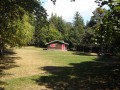
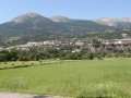
 Embrun - From the lake to the cliff
 Visorando Member
 5.40 mi
 +98 ft
 -102 ft
 2h 35
 Easy
 Departure from Embrun (Hautes-Alpes)
A lovely little walk, almost entirely flat, which takes you from the shores of Lake Serre-Ponçon to the foot of the Embrun cliff.Views of the lake as well as the gardens and orchards at the foot of the cliff.
The RTM dams on the Torrent des Vachères
 1.05 mi
+272 ft
-272 ft
0h 45
Easy
Departure from Saint-Sauveur (Hautes-Alpes)
A hike that allows you to discover France’s first experimental site run by the ONF’s Mountain Land Restoration Service (RTM). The first dam built to curb erosion caused by the torrent dates back to 1868 and, following its success, this example was replicated throughout France. Along the trail, you’ll find fun, interactive explanations in hidden caches. This is the Sens’Actions Trail. A delight for young and old alike.
A short circular heritage loop around the hamlets, starting from Les Ribes
 2.14 mi
+541 ft
-541 ft
1h 25
Easy
Departure from Les Orres (Hautes-Alpes)
A short walk near Les Orres, fairly shaded in summer, offering the chance to discover the ‘martelières’ and the heritage of the hamlets you pass through: a ruined castle, small chapels, an old school and fountains. After crossing a stream, there’s a climb to warm you up – but it’s all worth it for the descent!
The Parpaillon Tunnel from the Grand Vallon via the Col de Girabeau
 5.27 mi
+2,448 ft
-2,454 ft
3h 20
 Moderate
Departure from Les Orres (Hautes-Alpes)
Starting from the Grand Vallon, the route climbs to the Col de Girabeau before reaching the legendary Parpaillon Tunnel (currently sealed off). The route offers sweeping panoramic views and is a lovely, nature-filled alternative to the Piste de Crévoux, which is very busy with motor vehicles in summer.
Walks near Vachères (rivière)
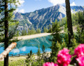
In the cool shade of the larch trees at Les Orres
 Tourist office
 2.96 mi
+246 ft
-2,123 ft
1h 35
Easy
Departure from Les Orres (Hautes-Alpes)
A long, cool downhill walk through the larch forest, passing through Grand-Clos, where the water reservoir transforms into a mirror-like lake.
This walk is a downhill route from the top of the Pic Vert chairlift to the 1650 resort (L’Épervière car park).
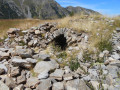
Lac Sainte-Marguerite and Source de Jérusalem
 5.97 mi
+1,903 ft
-2,156 ft
4h 25
Moderate
Departure from Les Orres (Hautes-Alpes)
A very pleasant circular above Les Orres resort, allowing you to discover a beautiful lake, Sainte-Marguerite, and the springs that feed Les Orres, named Jerusalem.
From Pra Loup 1600 via Coste Belle to La Dalle en Pente
2.45 mi
+1,594 ft
-430 ft
2h 30
Moderate
Departure from Uvernet-Fours (Alpes-de-Haute-Provence)
A good walk to work up an appetite! Set off from Pra Loup to the La Dalle en Pente restaurant and return via the Chappe chairlift.
Circuit of the Chapeau de Gendarme via the north face
7.38 mi
+2,385 ft
-3,999 ft
5h 30
 Difficult
Departure from Enchastrayes (Alpes-de-Haute-Provence)
A lovely hike starting from Super Sauze. The route via the north face of the Chapeau de Gendarme is not recommended for children; the east face is preferable.
Saint-Ours – Larche
 Association / Club / Walk leader
 5.26 mi
+1,102 ft
-1,417 ft
3h 25
Moderate
Departure from Meyronnes (Alpes-de-Haute-Provence)
Return to the starting point in Larche via theGRP® de la Frontière Fortifiée.
Allos Mountain Hut – Petit Col du Talon – Bayasse
 15.80 mi
+3,504 ft
-4,836 ft
10 hrs
 Very difficult
Departure from Uvernet-Fours (Alpes-de-Haute-Provence)
The third stage is very difficult due to its length of nearly 26 km, with a few technical sections – particularly when carrying a rucksack – which will put your body to the test. This is why I have classified this stage as ‘very difficult’. However, this stage is one of the most beautiful on this route: wild, technical, with stunning panoramic views.
You’ll cross pastures, wooded areas, mountain pastures and very rocky high-mountain sections between the two highest peaks of the Mercantour: Mont Pelat (3,051 m) and Le Cimet (3,020 m).
You’ll be crossing the northern part of the Mercantour National Park.
Allow between 8 and 10 hours for this challenging stage.
Trek around Chambeyron Mountain Range (1) Fouillouse - Refuge du Chambeyron
 3.88 mi
+2,470 ft
-36 ft
3h 55
Moderate
Departure from Saint-Paul-sur-Ubaye (Alpes-de-Haute-Provence)
First stage around the Chambeyron Mountain Range which, after a steady climb, takes you to the shelter with the same name. You'll end up in a breath-taking setting, at the foot of Brec de Chambeyron.
Trek around Chambeyron Mountain Range
 36.21 mi
+13,120 ft
-13,783 ft
5 days
Difficult
Departure from Saint-Paul-sur-Ubaye (Alpes-de-Haute-Provence)
Reaching over 3000 metres in altitude, Aiguilles de Chambeyron and Brec de Chambeyron form an impressive mountain range halfway between Queyras and the Moncantour. This hike offers a trek with no techincal difficulty, with passes over 2700 m in altitude and a summit of over 3000 m. Set in an outstanding landscape and for the most part within a high mountain setting.
From Fouillouse to Bousiéyas
 21.25 mi
+6,686 ft
-6,667 ft
15h 35
Very difficult
Departure from Saint-Paul-sur-Ubaye (Alpes-de-Haute-Provence)
This sixteenth stage completes the crossing of the Chambeyron Massif and, after Larche, enters the Mercantour Massif. From Les Granges de Fouillouse, the GR®5 follows the Riou de Fouillouse upstream, passing the ruins of Fort de Plate Lombarde, then, via the Plate Lombarde valley, reaches the Col du Vallonnet. It then descends to Lac du Vallonnet Inférieur, where it heads due south to join an old military road that climbs towards the Viraysse barracks. From there, the GR®5 crosses the Col de Mallemort and descends to the hamlet of Larche. The route follows the Ubayette, then crosses it and reaches the Pont Rouge car park, which marks the entrance to the Mercantour National Park. It then heads due south, climbing to Lac du Lauzanier, then on to Lac de Derrière la Croix, before reaching the Pas de la Cavale. The descent starts off quite steep but then becomes gentler. After the Salse Morene plateau, the path climbs the Col des Fourches and, from the Camp des Fourches, reaches the hamlet of Bousiéyas.