Country:
 City:
City:


Head to the Beausset stadium in the town centre. Park in the large car park at the stadium, opposite the École Jean Gavot.
(S/E) Set off heading south, initially along the Chemin du Rouve.
(1) At the crossroads, take the second road on the left (Chemin du Beausset Vieux), towards “Chemin des Oratoires”, which starts to climb more steeply. Shortly after the water towers, leave the tarmac road and take a path on the left, clearly signposted “Chemin des Oratoires”, which overlooks a cluster of houses before opening out onto a wide, open pass, where a valley begins to descend to the right towards the east, featuring an arpent of cultivated land and a small hut.
(2) Continue straight ahead.
(3) After passing a bench, near a wayside shrine (Saint-Roch), turn left onto the path that climbs through the woodland. Climb past two or three wayside shrines until you reach the Sainte-Marie Wayside Shrine, then turn right towards the priory.
(4) Leave the road on your right which climbs up to the priory buildings and take the track that passes above the priest’s pretty little garden.
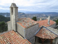
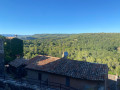
(5) You’ll reach a clearing bordered to the north by a concrete cistern; take the steps towards the priory and emerge onto a lovely panoramic square where a mission cross stands. Continue towards the buildings and climb a beautiful flight of steps to the viewpoint, which overlooks not only the roofs of the priory but also the vast landscape surrounding Le Beausset. Go back down the steps to the open space.
(5) To the left of the small water tower, take the red-and-white-marked path (part of the GR®) which descends through the pine forest towards the north. This path sometimes runs horizontally along the edge of old terraces, and sometimes descends steeply, cutting across them. At the bottom of the slope, you’ll come to a junction of several paths: to the left, a path runs horizontally westwards; opposite, a steep descent leads, for those interested, to the Trou de la Vierge; to the right, head towards the Oratoire Saint-Roch.
(3) Then head back northwards for about fifty metres. Turn onto the path branching off to the left: this is the Chemin de la Venturone. It initially runs alongside a wire fence, passes close to the shed on the small cultivated plot, and continues beneath the pine trees until it reaches a metal gate, which can be opened by pushing it. Carry on past the gate. The path overlooks a villa, then soon descends via a flight of steps.
(6) At the bottom of the steps, turn sharp right onto the now-paved path, until you reach a house which you’ll walk past on the left, this time along a narrow path between a wall and a wire fence, before rejoining a wide, paved path further on.
(7) After passing a path on the right that climbs towards a private property, a little further on leave the path on the right that continues along the Chemin de la Venturone and rejoins our ascent route fairly quickly; instead, take the wide, partially tarmac-surfaced path that heads west, first skirting a vast grassy plateau. Soon, magnificent views open up in the background: of Le Beausset to the right and the hilltop village of La Cadière opposite. You’ll soon reach the old Chemin du Rouve; turn right onto it to rejoin the street from your ascent route.
(1) Turn left to return to the car park where we started (S/E).


 Visorando Member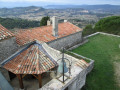


 Moderate