A variant of the Chapels Trail in Rabastens

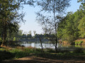
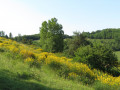
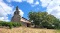
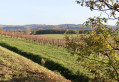
Visit the chapels and castles (unfortunately rarely open) north of Rabastens (81), starting from Vertus Church, whilst exploring the surrounding countryside.

Details

47907151
Creation:
Last update:
Last review:
  • Walking
    Activity: Walking
  • ↔
    Distance: 11.39 mi
  • ◔
    Average duration: 6h 15 
  • ▲
    Difficulty: Moderate

  • ⚐
    Back to start: Yes
  • ↗
    Ascent: + 1,181 ft
  • ↘
    Descent: - 1,175 ft

  • ▲
    Highest point: 761 ft
  • ▼
    Lowest point: 482 ft
  • ⚐ Country: France
  • ⚐ City: Rabastens (81800)
  • ⚑
    Start/End: N 43.868381° / E 1.735478°
  • ❏
    IGN map(s): Ref. 2142E
  • Hour-by-hour weather

Description of the walk

Car park at Vertus Church in Rabastens on the D20.

(S/E) Walk past the cemetery on the left to reach the D20 and turn left onto the road, continuing for 700 m, ignoring a road on the right.

(1) At the Fork in the road, take the next turn-off immediately towards La Bouriasse, then head uphill to La Tour.

(2) Walk past the building, then follow the grassy path to Les Vériès, where you’ll come straight onto a short stretch of tarmac road which quickly turns into another grassy path.
You’ll come out onto a tarmac road again.

(3) Then turn right onto the grassy path and follow it, skirting the vineyard to the right; at the end, head left uphill to rejoin the road, level with the church of Saint-Martin de Mours.

(4) Turn right. As you pass, take a look at the church and, after about 50 m, take the path on the left, past the vineyard. Walk down to the bottom and, at the end of the path, turn right to head steeply uphill. At the top, veer left to rejoin the road.

(5) Head off to the right, pass Les Perelles and, at the next wide bend, continue straight ahead along the track. Cross Les Rigoussels and Le Rival and join a main road.

(6) Turn right. Cross the bridge over the Ruisseau de Passe and head up the road furthest to the left to Château de Mareux, then head back down to the left until you reach the D28.

(7) Cross it carefully and take the Impasse de Mareux opposite, for about 100 metres.
You can make a short detour of about a hundred metres to the Chapelle Saint-André.
Alternatively, head down to the right onto the grassy path, continuing straight on until you reach the tarmac road.

(8) Turn right onto this road, heading towards Raust (way of the cross on your right).

(9) At the junction at the bottom of the village, turn left towards the Saint-Pierre Chapel and the cemetery, then continue along the road to Les Boyers.

(10) Turn onto the path on the right and head down to the Ruisseau de Raust. Then head back up, pass the wash house and arrive at the village of Raust. Join the road in the hamlet.

(11) Head down to the right and continue to the junction you passed earlier.

(9) Turn left and, after the wayside cross, head into the field on the left and follow the stream’s edge until you reach the road; continue straight on along it until you reach a Y-junction at Randuriès.

(12) Turn slightly to the right and carry on straight ahead along the road until you reach the D28.

(13) Follow it to the left. Caution: heavy traffic for about 1 km, as far as Favet.

(14) Take the track on the right and join a cross-road after Les Truilers.

(15) Turn left and head uphill to Château de la Case. Ignore thefirst path leading up to the château and carry on, mainly along the road, until you reach the next access point on the right.

(16) Walk up to the lake and take the path on the right, which goes behind the château and joins a tarmac road.

(17) Set off along the road to the right. At La Belle Basse, go straight on to cross the hamlet and continue along the path that descends to the Ruisseau de Passe.

(18) Cross the stream, then turn right and follow it for about a hundred metres before heading back up the path on the left, between two fields, towards Saint-Caprais.

(19) Follow the road through the grounds of the former observatory and, at thefirst junction, turn left and follow the road for about 1.5 km until you reach the junction with the D20.

(20) Head downhill to the right towards Vertus Church and return to the starting point (S/E).

Waypoints

  1. S/E : mi 0 - alt. 577 ft - Vertus Church in Rabastens
  2. 1 : mi 0.47 - alt. 512 ft - Fork in the road near Bouriasse
  3. 2 : mi 0.72 - alt. 571 ft - La Tour
  4. 3 : mi 1.24 - alt. 482 ft - Towards the vineyards
  5. 4 : mi 1.53 - alt. 620 ft - Saint-Martin de Mours
  6. 5 : mi 2.44 - alt. 692 ft - Towards Les Peyrelles
  7. 6 : mi 3.17 - alt. 502 ft - Towards the Ruisseau de Passe
  8. 7 : mi 3.79 - alt. 643 ft - Junction with the D28
  9. 8 : mi 4.35 - alt. 515 ft - Towards Raust
  10. 9 : mi 4.83 - alt. 535 ft - Road junction. Calvary
  11. 10 : mi 5.09 - alt. 574 ft - Les Boyers
  12. 11 : mi 5.38 - alt. 607 ft - Raust
  13. 12 : mi 5.8 - alt. 531 ft - Hiking routes
  14. 13 : mi 6.21 - alt. 679 ft - New junction with the D28
  15. 14 : mi 6.8 - alt. 712 ft - Favet
  16. 15 : mi 7.26 - alt. 538 ft - Les Truilers
  17. 16 : mi 8.11 - alt. 600 ft - Case Castle
  18. 17 : mi 8.61 - alt. 748 ft - Towards La Belle Basse
  19. 18 : mi 9.51 - alt. 545 ft - Passe Stream
  20. 19 : mi 9.78 - alt. 614 ft - Saint-Caprais Observatory
  21. 20 : mi 10.94 - alt. 666 ft - Towards Vertus
  22. S/E : mi 11.39 - alt. 584 ft - Vertus Church

Notes

Much of this trail is marked in yellow as it follows an officialPR® route.
There are picnic spots at Mareux Chapel (7) and the Raust washhouse (11).

Worth a visit

Always be cautious and plan ahead when you're outdoors. Visorando and the author of this route cannot be held responsible for any accidents occurring on this route.

The GR® and PR® markings are the intellectual property of the Fédération Française de Randonnée Pédestre.

Reviews and comments

4.2 / 5
Based on 3 reviews

Reliability of the description
4.3 / 5
Ease of following the route
4.3 / 5
Route interest
4 / 5
STRIDULE
STRIDULE

Overall rating : 4.7 / 5

Date of your route : Sep 08, 2025
Reliability of the description : ★★★★★ Very good
Ease of following the route : ★★★★★ Very good
Route interest : ★★★★☆ Good
Very busy route : Yes

Lovely views but quite a few tarmac roads.

Machine-translated

angmann
angmann

Overall rating : 4.3 / 5

Date of your route : Aug 16, 2024
Reliability of the description : ★★★★☆ Good
Ease of following the route : ★★★★☆ Good
Route interest : ★★★★★ Very good
Very busy route : No

A pleasant walk, suitable for everyone, with views over the Tarn Valley.

Machine-translated

iSenior
iSenior
• Edited:

Overall rating : 3.7 / 5

Date of your route : May 29, 2024
Reliability of the description : ★★★★☆ Good
Ease of following the route : ★★★★☆ Good
Route interest : ★★★☆☆ Average
Very busy route : No

It’s a shame that this walk through the rolling countryside north of Rabastens follows too much tarmac, particularly in the second half. Tall grass sometimes obscures the paths and tracks across the fields, and a few short sections are muddy – mostly at the bottom of the valleys – due to the ruts left by farm machinery. Churches and castles add to the charm of the route, but there’s no shade at all along the entire circular route – so be careful in hot weather! The route description is generally accurate, but more detail would be useful when walking past private properties, for example. That said, thank you to the route planner.

Machine-translated

Other walks in the area

For more walks, use our search engine .

The GPS track and description are the property of this route's author. Please do not copy them without permission.