Country:

 City:
City:


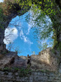
Park in Chirens, for example in the car park on Route de la Cascade.
(S/E) Turn onto Rue des Rampeaux towards the village centre.
(1) Cross the D1075 at the pedestrian crossing and continue straight ahead onto Avenue du 19 Mars 1962. Walk past the boules court and the cemetery, then continue along the path that goes round the tennis court until you reach Chemin de l’Ainan.
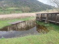
(2) Turn right onto this path, then right again 30 metres further on, to enter the Marais de l’Ainan Sensitive Natural Area, marked by a small wooden gate and an information board. Follow the footpath or wooden walkways through the marsh.
(3) Take a short detour to the left to see the exposed pond and observe the marsh’s flora and fauna. Then continue straight ahead to reach the Chemin de Beaudiné.
(4) Turn left onto this path and, following a level route, reach the Route du Touvat.
(5) Turn left towards the Arsenal, then first turn right then left onto the D82. Follow the Chemin du Lavoir to the D1075.
(6) Cross this very busy road with great care, then head uphill opposite along the Chemin du Petit Bois to the hamlet of La Guilletière.
(7) Walk through the hamlet and leave via the Chemin du Bois du Gros. Walk uphill to the spot known as la Fontaine du Loup. Then walk down into the valley to the hamlet of Bozon.
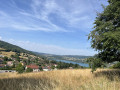
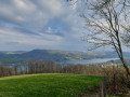
(8) Take the small road on the right and head back up through another valley. Reach the Croix des Cochettes , where you can enjoy a magnificent panoramic view of Lake Paladru.
(9) Set off again along the path on the left and climb up to the crossroads at Bois du Grand Platon.
(10) Turn left downhill and then veer right at a place called Le Châtelar to reach the Motte Castrale.
(11) Walk down into the small ditch that surrounds this motte and follow it round to the entrance on the western side. Set off again along the path descending steeply on the western side. At a hairpin bend, join a new path.
(12) Turn left onto this less steep path. At the end of this path, take the road that continues it and follow it to the village of Clermont.
(13) Turn right and continue straight ahead along the Chemin de la Tour, which starts as a tarmac road and then becomes a country track. You’ll reach a crossroads of footpaths.
(14) Please note: do not follow the route shown on the IGN map straight ahead, but instead follow the OSM (OpenStreetMap) route to reach the Tower of Clermont-Tonnerre, now in ruins and the sole remnant of a feudal castle.
(15) Continue along the path to the north. There is a short but fairly steep descent. The path then descends gently to the Eyguebelle crossroads.
(16) Carry on to the left, skirting the hamlet of La Contamine, then reach the Route du Guillermet.
(17) Follow this road straight ahead until you reach the hairpin bend to the right. Leave the road here and take the path opposite, through the fields of Les Fontenettes. After a circular bend, you’ll reach the edge of the D50a.
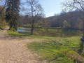
(18) Continue along the path running alongside the River Fure on your right. Turn off the path and keep right at the next junction to reach another Y-junction.
(19) Turn right to reach Chirens and the car park on Rue de la Cascade (S/E).


 Visorando Member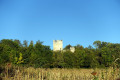


 Easy
Easy 
 Tourist office
 Difficult