A circular walk between Estillac and Aubiac

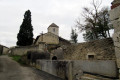
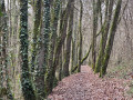
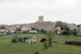
From the church in Estillac, this route – which partly follows semi-urban roads – leads to the village of Aubiac and its plateau, dominated by its water tower.

Details

n°30286814
Creation:
Last update:
Last review:
  • Walking
    Activity: Walking
  • ↔
    Distance: 6.25 mi
  • ◔
    Average duration: 3h 20 
  • ▲
    Difficulty: Moderate

  • ⚐
    Back to start: Yes
  • ↗
    Ascent: + 548 ft
  • ↘
    Descent: - 551 ft

  • ▲
    Highest point: 574 ft
  • ▼
    Lowest point: 259 ft
  • ⚐ Country: France
  • ⚐ City: Estillac (47310)
  • ⚑
    Start/End: N 44.157207° / E 0.564206°
  • ❏
    IGN map(s): Ref. 1840SB
  • Hour-by-hour weather

Photos

Description of the walk

Park in the car park at Estillac Church, on Rue du Château.

(S/E) Set off along the road for a good hundred metres with your back to the church, then turn right at the first junction onto Chemin de Borde-Basse, which you should follow for about 800 metres.

(1) On the descent, after several bends, when the road turns sharply to the right, take the tarmac track opposite (Chemin du Roc) into the village of Aubiac. Continue for 100 metres, turn right onto a stony, grassy track, then turn left and follow this track.

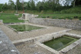
(2) At the junction with a path on the right marked in yellow, carry on straight ahead until you reach a small road at a place called Le Moulin à Eau. Continue along this road to the village of Aubiac. When you reach the school square, turn left, walk past the town hall and continue along Rue du Placier until you reach the junction with the D931.

(3) Cross carefully at the traffic lights and continue straight ahead along Chemin du Baqué until you reach the junction with Chemin de Mourat, on the left, a stony, uphill track. Turn left to follow it.

(4) When you reach the top of the hill, at Route des Moulins, turn right until you reach a four-way junction.

(5) Follow the road to the left towards Moirax for 2.5 km.

(6) At the hamlet of Ringuet, ignore the Chemin de la Fontaine de Navarre on the right and turn left onto the Route de Massée, which forms part of theGR®652. Continue to the hamlet of Bourrut.

(7) At the entrance, take a descending dirt track on the left marked with orange signposts and the red and white markings ofthe GR®652. As you emerge from the woods, go round a fenced-off field and continue along the edge, following a ditch through an area that may be muddy. Follow the red and white markings ofthe GR®652.

(8) Take the path on the left, cross the ford and continue to a road, following it for about 100 metres whilst maintaining the same direction.

(9) At the junction with the Chemin de la Jarroussette, take this road to the right. Continue along the stony path uphill to the hamlet of Mariotte, then take the Chemin de Mariotte, which leads onto the D931.

(10) Cross the road carefully and walk up Chemin de l’Église to reach the car park (S/E).

Waypoints

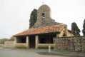
  1. S/E : mi 0 - alt. 518 ft - Car park at the - Église Saint-Jean-Baptiste (Estillac)
  2. 1 : mi 0.57 - alt. 308 ft - Chemin du Roc
  3. 2 : mi 0.88 - alt. 269 ft - Yellow signpost junction
  4. 3 : mi 1.68 - alt. 338 ft - D931.
  5. 4 : mi 2.1 - alt. 531 ft - Route des Moulins
  6. 5 : mi 2.61 - alt. 558 ft - Route de Laplume junction.
  7. 6 : mi 4.15 - alt. 472 ft - Junction with the GR®652
  8. 7 : mi 4.84 - alt. 417 ft - Bourrut
  9. 8 : mi 5.48 - alt. 266 ft - Fording point
  10. 9 : mi 5.67 - alt. 328 ft - Chemin de la Jarroussette.
  11. 10 : mi 6.1 - alt. 427 ft - D931.
  12. S/E : mi 6.25 - alt. 518 ft - Estillac church car park. Near the - Château d'Estillac

Notes

(S/E) Public toilets next to the cemetery entrance.

Worth a visit

(S/E) The church is open during the day.

Always be cautious and plan ahead when you're outdoors. Visorando and the author of this route cannot be held responsible for any accidents occurring on this route.

The GR® and PR® markings are the intellectual property of the Fédération Française de Randonnée Pédestre.

Reviews and comments

4.7 / 5
Based on 1 review

Reliability of the description
5 / 5
Ease of following the route
5 / 5
Route interest
4 / 5
pierredagen
pierredagen

Thank you for pointing out this error in the description. I’ve corrected it straight away. Enjoy your walks in our department. Pierre

Machine-translated

dogara
dogara

Overall rating : 4.7 / 5

Date of your route : May 16, 2023
Reliability of the description : ★★★★★ Very good
Ease of following the route : ★★★★★ Very good
Route interest : ★★★★☆ Good
Very busy route : Yes

Please note! There’s a small error at the start of the description: the walk starts from Estillac, as you can see on the map.
A lovely walk along small roads, just as advertised. It’s perfect for our group at the moment as the paths are very muddy.

Machine-translated

Other walks in the area

For more walks, use our search engine .

The GPS track and description are the property of this route's author. Please do not copy them without permission.