An afternoon with Mamé in Aiguilles

This hike is designed as a walk for someone who is not as alert as they used to be but who still loves the mountains, the smell of larch trees and the sound of cowbells.
Note: as the walk starts from the car park of the EHPAD and the Foyer d'Accueil Médicalisé, Mamé is a generic name.
NB: given the slight incline and long flat distances, this route can also be used for jogging, at a very different pace.

Details

88315641
Creation:
Last update:
Last review:
  • Walking
    Activity: Walking
  • ↔
    Distance: 3.77 mi
  • ◔
    Average duration: 2h 00 
  • ▲
    Difficulty: Easy

  • ⚐
    Back to start: Yes
  • ↗
    Ascent: + 351 ft
  • ↘
    Descent: - 341 ft

  • ▲
    Highest point: 4,961 ft
  • ▼
    Lowest point: 4,672 ft

Photos

Description of the walk

We set off from the car park, which serves both the local hospital and the primary school.

(S/E) Cross the road (at the pedestrian crossing), then head towards the Ribes plain in the direction of the restaurant, which is now closed. From there, cross the footbridge and you’ll find yourself in the snow play area. Walk along the bottom edge of this, which makes it easy to cross the Peynin torrent.

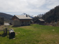
(1) Opposite the snow groomer building, you can park a car, which will come in handy if the walk proves too strenuous for Mamé.
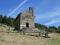
If Mamé is struggling on the ascent, follow the trail as it climbs towards the chapel.
If she finds the descent more difficult, head in the opposite direction, down this tarmac road. After the chapel, the climb becomes less steep and turns into an almost flat track suitable for vehicles.

(2) When it starts to climb again, take the very well-marked path on level ground. From there, the support car can no longer follow.

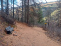
(3) You’ll reach a bench at the highest point of the walk. A well-deserved break is in order before the descent, along a wide, stoneless path that is not suitable for vehicles.

(4) You rejoin the road – and thus the option of a lift back by car – at the fenced-off campsite. Turn right onto this almost flat tarmac road, which passes a sheep farm until you reach the footbridge for vehicles. From there, a short climb takes you back to the original crossroads.

(1) We head back to the car park on the left (S/E) via the same route we took on the way out, and we’d like to take this opportunity to say: well done, Mamé!

Waypoints

  1. S/E : mi 0 - alt. 4,764 ft - Local hospital car park
  2. 1 : mi 0.45 - alt. 4,774 ft - Parking for the support vehicle
  3. 2 : mi 0.98 - alt. 4,961 ft - End of the climb, junction on the path
  4. 3 : mi 1.8 - alt. 4,905 ft - The bench, start of the descent
  5. 4 : mi 2.13 - alt. 4,672 ft - End of the descent, back on the tarmac
  6. S/E : mi 3.77 - alt. 4,764 ft - Detour via the swimming pool to return to the car park

Notes

Take your water bottle as there are no fountains along the way. The Ribes restaurant serves ice cream in summer.

Note: when there are footballers or sheep on the Ribes plain, go around via the swimming pool.

Reviews and comments

4.3 / 5
Based on 1 review

Reliability of the description
5 / 5
Ease of following the route
5 / 5
Route interest
3 / 5
User 28170846

Overall rating : 4.3 / 5

Date of your route : Dec 22, 2025
Reliability of the description : ★★★★★ Very good
Ease of following the route : ★★★★★ Very good
Route interest : ★★★☆☆ Average
Very busy route : Yes

A walk accessible to all levels.

Machine-translated

Other walks in the area

For more walks, use our search engine .

The GPS track and description are the property of this route's author. Please do not copy them without permission.