Three villages on a Jura circular route

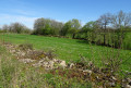
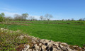
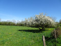
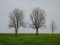
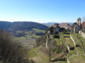
Le Fied, Fay-en-Montagne and Picarreau: three villages in the Jura on the first Jura plateau. These three villages on the heights of Poligny are brought together here for a nature walk exploring the shared natural environment that surrounds them. This natural environment consists of the meadows lining the paths, sometimes bordered by very old dry-stone walls, typical of the region.

Details

48042271
Creation:
Last update:
Last review:
  • Walking
    Activity: Walking
  • ↔
    Distance: 6.10 mi
  • ◔
    Average duration: 2h 50 
  • ▲
    Difficulty: Moderate

  • ⚐
    Back to start: Yes
  • ↗
    Ascent: + 62 ft
  • ↘
    Descent: - 62 ft

  • ▲
    Highest point: 1,811 ft
  • ▼
    Lowest point: 1,722 ft

Photos

Description of the walk

Car park located at the junction of Rue de la Mairie and Rue de la Fromagerie (D 68), in Le Fied.

(S/E) Take Rue de la Fromagerie, running alongside the car park, until you reach a fork in the road.

(1) Carry on to the right (D68), ignoring all other streets branching off to the left or right; pass the school and you’ll reach the D5.

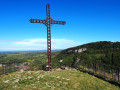
(2) Turn left, then take the first road on the right (D260). Once you reach Fay-en-Montagne, at the first junction, carry on straight ahead (D4) for about a hundred metres until you reach a crossroads with a cross.

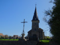
(3) Take the path on the left, which leads to the rear of a farm. This path curves and joins another. Follow this one to the left until you reach the Route de Picarreau (D4). Turn right and, 50 metres further on, take the path leading behind another farm. It is signposted ‘private road’ but is accessible to pedestrians. After the farm, the path climbs to the right and becomes a farm track, running between the meadows. Follow it until you reach a junction. Turn left, walk past the church and the Picarreau cemetery until you reach the Grande Rue (D5). Follow it to the left until you reach the junction, about 100 metres further on.

(4) Take the road opposite (Chemin des Crozets). Follow it until you reach a Fork in the road with a house on the corner. Turn left and join the old Roman road.

(5) Turn left onto this road. Follow it for a long distance, until you reach the first farm track branching off diagonally to the right.

(6) Take this track. Further on, you’ll pass the edge of a wood: ignore the path leading into it. Your track turns right, then left, then makes a right-angle turn to the right. Stop

(7) Do not turn right! Directly ahead of you, in line with the track, before the bend, you’ll find a meadow with a closed entrance.

(7) On the right-hand side of the post supporting the gate, there is a small, zigzagging passage, very narrow, which allows walkers to pass through. Once in the meadow, follow the right-hand side until you reach the exit of the meadow and another zigzag passage, even narrower and more hidden too. You’ll come to a wider path.

(8) This farm track curves slightly and comes to a T-junction. Turn right. As you emerge from the woods, continue straight ahead towards a post with a red top. There, turn left towards another post, also painted red, then turn right until you reach the old building at a place called Les Baraques.

(9) Turn left and follow the Chemin des Baraques uphill until you reach two consecutive junctions.

(10) At the first junction, where the old Roman road crosses, cross over and carry on straight ahead.
At the second junction, take the left-hand branch (Chemin des Carriaux) and, further on, you’ll come back to the original fork in the road.

(1) Turn right and head up Rue de la Fromagerie to the car park (S/E).

Waypoints

  1. S/E : mi 0 - alt. 1,749 ft - Car park at Le Field near the town hall
  2. 1 : mi 0.17 - alt. 1,726 ft - Common junction (outward and return routes)
  3. 2 : mi 0.63 - alt. 1,736 ft - D5
  4. 3 : mi 1.45 - alt. 1,729 ft - Fayt-en-Montagne – farm track
  5. 4 : mi 2.65 - alt. 1,811 ft - Picarreau. Junction. Chemin des Crozets
  6. 5 : mi 2.86 - alt. 1,798 ft - Ancient Roman road
  7. 6 : mi 3.74 - alt. 1,759 ft - Crossroads.
  8. 7 : mi 4.08 - alt. 1,775 ft - Entrance chicane into the meadow
  9. 8 : mi 4.2 - alt. 1,791 ft - Exit chicane from the meadow
  10. 9 : mi 4.47 - alt. 1,791 ft - Chemin des Baraques
  11. 10 : mi 5.5 - alt. 1,755 ft - Ancient Roman road
  12. S/E : mi 6.1 - alt. 1,749 ft - Car park at Le Field near the town hall

Notes

Between (3) and (4), the farm track marked ‘private road’ running behind the farm is indeed open to pedestrians. This has been confirmed with the farmer.

Please note that the path is not accessible to bicycles or pushchairs due to the section through the meadow (very narrow entry and exit chicanes). For these, you should continue straight ahead along the old Roman road at point (6) and turn left at point (10).

Worth a visit

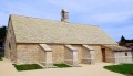
  • Take the time to walk round Picarreau Church.
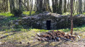
  • And take a moment to examine the many dry-stone walls, mainly located along the old Roman road (of which there are no remains apart from the name).

Reviews and comments

4.2 / 5
Based on 3 reviews

Reliability of the description
4 / 5
Ease of following the route
4.7 / 5
Route interest
4 / 5
Patrick Vanbellinghen

Thanks, Jimmy, and here’s to more great discoveries.
Patrick

Machine-translated

Jimmy71
Jimmy71
• Edited:

Overall rating : 4 / 5

Date of your route : Jun 26, 2024
Reliability of the description : ★★★★☆ Good
Ease of following the route : ★★★★★ Very good
Route interest : ★★★☆☆ Average
Very busy route : No

A lovely little walk.

Machine-translated

Patrick Vanbellinghen

Yes, unfortunately. When we were planning the route, near the school, we had set off to the right into the fields to take the country lanes on the opposite side after crossing the main road, but they were signposted ‘private road’ and we had to adjust our route by cutting out the circular route and the pleasant paths. However, according to locals, it seems pedestrians could still have used them, as the restriction appears to apply to vehicles only. As I wasn’t sure, I preferred to respect other people’s property.

Enjoy your walks.
Patrick

Machine-translated

miketrain26
miketrain26

Overall rating : 4 / 5

Date of your route : May 01, 2024
Reliability of the description : ★★★★☆ Good
Ease of following the route : ★★★★☆ Good
Route interest : ★★★★☆ Good
Very busy route : No

An easy walk, no elevation gain. Very rural. We completed it in 2 hours 30 minutes. Just one criticism: there’s quite a lot of tarmac.

Machine-translated

Patrick Vanbellinghen

Thank you, Solange, and enjoy your walks.

Machine-translated

solange.gervais
solange.gervais

Overall rating : 4.7 / 5

Date of your route : Apr 29, 2024
Reliability of the description : ★★★★☆ Good
Ease of following the route : ★★★★★ Very good
Route interest : ★★★★★ Very good
Very busy route : No

a lovely, enjoyable walk:

Machine-translated

Other walks in the area

For more walks, use our search engine .

The GPS track and description are the property of this route's author. Please do not copy them without permission.