


Refine your search for walks in Trept
Trept walks


 Around the Grands Communaux de Trept
 Visorando Member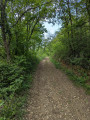
 4.23 mi
 +456 ft
 -456 ft
 2h 20
2h 20
 Easy
Easy
 Departure from Trept (Isère)
A pleasant route around the Grands Communaux de Trept, a typical landscape where limestone slabs outcrop and the Pierre de Dieu and the Pierre du Diable stand tall. Almost entirely shaded and presenting no difficulty.
Walk between Le Bourg and Trept
 4.52 mi
+440 ft
-440 ft
2h 30
Easy
Departure from Dizimieu (Isère)
4.52 mi
+440 ft
-440 ft
2h 30
Easy
Departure from Dizimieu (Isère)
A short hike through woods and fields that is also suitable for families.
Around Moras
 11.08 mi
+1,152 ft
-1,145 ft
6h 05
11.08 mi
+1,152 ft
-1,145 ft
6h 05
 Moderate
Departure from Saint-Hilaire-de-Brens (Isère)
Moderate
Departure from Saint-Hilaire-de-Brens (Isère)
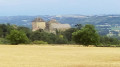
Hike around the Moras lake through the Bois de Fromentay in the Balmes Dauphinoises for a breath of fresh air, passing by the pretty 14th-century Château de Montplaisant.
Around Salagnon
6.60 mi
+430 ft
-443 ft
3h 25
Easy
Departure from Salagnon (Isère)
A short hike to keep fit around Salagnon, a commune in northern Isère located in the Bourgoin-Jallieu, Crémieu and Morestel triangle.
Through the woods of Perrier and Fontenaille
 5.13 mi
+633 ft
-610 ft
2h 55
Moderate
Departure from Dizimieu (Isère)
5.13 mi
+633 ft
-610 ft
2h 55
Moderate
Departure from Dizimieu (Isère)
This is a pleasant hike that can also be done in hot weather as 90% of the route is in the shade of the woods.
 Mountain biking on the Crémieu Plateau and around the Lemps Pond
 19.89 mi
+794 ft
-791 ft
3 hrs
Moderate
Departure from Soleymieu (Isère)
19.89 mi
+794 ft
-791 ft
3 hrs
Moderate
Departure from Soleymieu (Isère)
Route starting from Sablonnières on good paths with no technical difficulty.
Around the Moras Pond
 4.37 mi
+325 ft
-299 ft
2h 20
Easy
Departure from Vénérieu (Isère)
4.37 mi
+325 ft
-299 ft
2h 20
Easy
Departure from Vénérieu (Isère)
An easy little walk for a Sunday afternoon.
Vénérieu and the Moras Pond
 8.09 mi
+883 ft
-856 ft
4h 30
Moderate
Departure from Vénérieu (Isère)
8.09 mi
+883 ft
-856 ft
4h 30
Moderate
Departure from Vénérieu (Isère)
Walk near the CAPI, mainly in the woods. In the first part, there are beautiful views of the Bourbre valley, Bourgoin-Jallieu and Isle d'Abeau. On the way back, you walk along the Étang de Moras, but the reeds prevent you from seeing the shore. A few communal ovens and wash houses adorn the route.
Yellow signposts throughout the route. Allow between 3 and 4 hours depending on your pace and photo stops.
Siccieu - Cessieu
 15.56 mi
+1,749 ft
-1,270 ft
8 hrs
15.56 mi
+1,749 ft
-1,270 ft
8 hrs
 Very difficult
Departure from Siccieu-Saint-Julien-et-Carisieu (Isère)
Very difficult
Departure from Siccieu-Saint-Julien-et-Carisieu (Isère)
Sixth stage of the Way of St James. A route offering ever-changing landscapes between the Lyon plain and the Alps, with glimpses of the Alpine range.
Short tour of the Siccieu and Saint-Julien lakes
 7.71 mi
+581 ft
-581 ft
4h 05
Moderate
Departure from Siccieu-Saint-Julien-et-Carisieu (Isère)
7.71 mi
+581 ft
-581 ft
4h 05
Moderate
Departure from Siccieu-Saint-Julien-et-Carisieu (Isère)
This circuit will take you to several ponds around Siccieu and Saint-Julien and offer superb views of the foothills of the Bugey and, on a clear day, the Alps.
Stone and earth heritage of Saint-Chef
7.43 mi
+164 ft
-164 ft
3h 35
Moderate
Departure from Saint-Chef (Isère)
This route, created by the culture and heritage committee of the commune of Saint-Chef, is designed to showcase the last remaining vestiges of palis (flat standing stones), as well as dwellings and farm buildings constructed from raw earth (rammed earth), and small rural heritage sites. Mostly south-facing, on the slopes of Chamont and Trieux, this hike is very pleasant between September and June but should be avoided in the intense heat of summer. The first part, between points (1) and (2), along the Ver stream, may include muddy sections during periods of heavy rain. A significant part of the route is on tarmac roads. However, most of these roads are old connecting roads with very little traffic. Only the Chamont road requires particular caution between points (4) and (5).
Saint-Hippolyte via the Gorges de la Fusa
 3.30 mi
+266 ft
-266 ft
1h 45
Easy
Departure from Crémieu (Isère)
3.30 mi
+266 ft
-266 ft
1h 45
Easy
Departure from Crémieu (Isère)
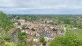
Explore Saint-Hippolyte by following the Ruisseau de Vaud through the Gorges de la Fusa, whilst discovering Fontaine Martine and the Resistance’s clandestine printing press.
Stroll through the medieval town of Crémieu
 3.58 mi
+331 ft
-325 ft
1h 55
Easy
Departure from Crémieu (Isère)
3.58 mi
+331 ft
-325 ft
1h 55
Easy
Departure from Crémieu (Isère)
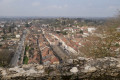
This circuit offers a glimpse of the medieval town of Crémieu.
Loop between Crémieu and Dizimieu
 7.99 mi
+866 ft
-863 ft
4h 25
Moderate
Departure from Crémieu (Isère)
7.99 mi
+866 ft
-863 ft
4h 25
Moderate
Departure from Crémieu (Isère)
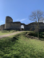
A route with changing landscapes between the Lyon plain and the Alps, shaded in summer with glimpses of the Alps.
Walk around Optevoz between paths and woods
10.36 mi
+538 ft
-518 ft
5h 15
Moderate
Departure from Optevoz (Isère)
A pleasant little walk passing by three ponds.
Circular route starting from Villemoirieu
8.64 mi
+1,083 ft
-1,063 ft
4h 55
Moderate
Departure from Villemoirieu (Isère)
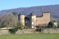
Circular route with both covered and open sections, views of the beautiful Manoir de Mallin, views of Lake Moras, views of the Alps, passing through hamlets with old stone houses, and a spring hidden in a cave.
Villemoirieu Tower
 8.09 mi
+604 ft
-610 ft
4h 15
Moderate
Departure from Villemoirieu (Isère)
8.09 mi
+604 ft
-610 ft
4h 15
Moderate
Departure from Villemoirieu (Isère)
We will tour the hamlets of this unusual commune, where the town hall, school, church, cemetery and village hall are located outside the residential areas. We will discover several châteaux, a bread oven and panoramic views of the Ain plain.
The Bois d'Yvrard and the Rivier ridges from Saint-Chef
5.96 mi
+738 ft
-768 ft
3h 25
Easy
Departure from Saint-Chef (Isère)
This route is best enjoyed from spring to autumn. The forest sections are pleasant in hot weather. In its upper section, the route offers panoramic views of the mountain ranges from Bugey in the north to Mont Blanc in the east. The descent to the village of Saint-Chef offers a pleasant view of the castle district and the abbey. A significant part of the route is on tarmac roads. However, most of these roads are old connecting roads with very little traffic.
From Saint-Chef to the Château de Chapeau-Cornu
 7.05 mi
+709 ft
-728 ft
3h 50
Moderate
Departure from Saint-Chef (Isère)
7.05 mi
+709 ft
-728 ft
3h 50
Moderate
Departure from Saint-Chef (Isère)
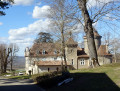
This is an easy, well-known walk that allows you to discover the surroundings and heritage of Saint-Chef. In particular, it takes you past the abbey church.
Canal des Moines and Grand-Champ ridges from Saint-Chef
6.53 mi
+413 ft
-417 ft
3h 20
Easy
Departure from Saint-Chef (Isère)
This route is best enjoyed from spring to autumn. The forest section is pleasant in hot weather, but can be damp after a period of rain. It runs alongside the Canal des Moines, a remnant of medieval construction. In its upper section, the route offers panoramic views of the mountain ranges from Bugey in the north to Vercors in the south, including Mont Blanc, Vanoise, Belledonne and Chartreuse. It also offers unobstructed views of the surrounding hills and the Pilat and Ardèche mountain ranges to the west. The balcony path above the village of Montcarra and the descent to the village of Saint-Chef offer pleasant views.Apart from the start and end (urban sections), this route is largely on unpaved paths. In the upper section, the high-voltage power line is a significant drawback, but the route keeps as far away from it as possible.
Circular starting from Saint-Chef
5.73 mi
+623 ft
-646 ft
3h 10
Easy
Departure from Saint-Chef (Isère)
Saint-Chef, a large village in the Dauphiné region, is well known to fans of Frédéric Dard, author of the adventures of Commissioner San Antonio. This circular route allows you to follow in his footsteps and discover the beautiful Château de Chapeau Cornu halfway through the walk.
The Crucilleux ridges from Saint-Chef
7.58 mi
+830 ft
-817 ft
4h 15
Moderate
Departure from Saint-Chef (Isère)
This route faces south, on the slopes of Crucilleux. Very pleasant between September and April/May, it allows you to enjoy every ray of sunshine. Avoid during the hot summer months. It allows you to discover varied landscapes and cross the Balmes Dauphinoises vineyards on the slopes of Crucilleux and Choulin. As you pass through the hamlets of Crucilleux and Arcisse, you can admire beautiful adobe buildings and local heritage sites (calvaries, wash houses, fountains, palisades). The path along the ridges of Mont de Crucilleux offers panoramic views of the mountain ranges from Bugey in the north to Vercors in the south, including Mont Blanc, Vanoise, Belledonne and Chartreuse.Half of this route is on paths and half on small country roads, most of which have little traffic.
Courtenay - the Lemps pond
 5.09 mi
+154 ft
-148 ft
2h 30
Easy
Departure from Courtenay (Isère)
5.09 mi
+154 ft
-148 ft
2h 30
Easy
Departure from Courtenay (Isère)
A lovely circuit in Île Crémieu with a visit to the Lemps Pond nature reserve. This circuit is open to all and presents no difficulty.
Between Poizieu and Moras
 8.88 mi
+942 ft
-942 ft
4h 55
Moderate
Departure from Chozeau (Isère)
8.88 mi
+942 ft
-942 ft
4h 55
Moderate
Departure from Chozeau (Isère)
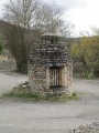
This circuit will take you to Lac de Moras and, on a clear day, there is a superb view of the Alps and the lake from the Moras cemetery.
Around Veyssilieu
 6.10 mi
+784 ft
-784 ft
3h 30
Moderate
Departure from Veyssilieu (Isère)
6.10 mi
+784 ft
-784 ft
3h 30
Moderate
Departure from Veyssilieu (Isère)
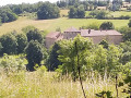
A circular walk starting from Veyssilieu to discover some panoramic views and the chapel of Notre-Dame de la Salette at the summit of Mount Chatelan.Note: this circular walk follows the routes shown on the large map by the roadside, namely: Cros de Lavan, Les Gorges, Frétignier, Seuillere, Floutier and back to Veyssilieu.
Short walk around Passins Castle
 2.10 mi
+230 ft
-233 ft
1h 10
Easy
Departure from Passins (Isère)
2.10 mi
+230 ft
-233 ft
1h 10
Easy
Departure from Passins (Isère)
From the edge of the woods to its heart, this charming walk is sure to delight everyone.
The Lemps Pond
1.49 mi
+13 ft
-13 ft
0h 40
Easy
Departure from Optevoz (Isère)
A lovely family walk around a pond classified as a nature reserve, equipped with observation points for viewing local wildlife.
Walk to Mont Patichou
4.41 mi
+371 ft
-364 ft
2h 20
Easy
Departure from Passins (Isère)
On the edge of the Bois de Montolivet, in its heart and along the country lanes, discover the surroundings of the Château de Passins (Montolivet).
Loop around Chozeau
 6.49 mi
+614 ft
-630 ft
3h 30
Moderate
Departure from Chozeau (Isère)
6.49 mi
+614 ft
-630 ft
3h 30
Moderate
Departure from Chozeau (Isère)
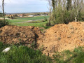
This pleasant little walk will allow you to enjoy a mix of woods, meadows and crops. It will also enrich your photo album, as you can capture the wildlife on the Varnieu pond, located on this route, and the original architecture of Bourcieu Castle.
Surroundings of Panossas
 8.90 mi
+679 ft
-666 ft
4h 40
Moderate
Departure from Panossas (Isère)
8.90 mi
+679 ft
-666 ft
4h 40
Moderate
Departure from Panossas (Isère)
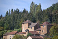
A short walk that takes us to Mont Morel and Étang de Charamel via the Tilleul de Sully, with a glimpse of the archaeological site of Panossas.
Tour of Mont Chanzet starting from Panossas
 5.85 mi
+774 ft
-758 ft
3h 20
Moderate
Departure from Panossas (Isère)
5.85 mi
+774 ft
-758 ft
3h 20
Moderate
Departure from Panossas (Isère)
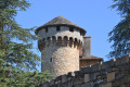
A short, easy walk to explore the wooded area overlooking the villages of Panossas and Chozeau. The walk follows part of the GR®422, in the footsteps of Charles IX, which runs from Lyon to Valence. The route passes by Poizieu Castle, whose tower, covered in machicolations, dominates the landscape.
Chapelle de Leyrieu
 5.18 mi
+728 ft
-741 ft
3h 00
Moderate
Departure from Leyrieu (Isère)
5.18 mi
+728 ft
-741 ft
3h 00
Moderate
Departure from Leyrieu (Isère)
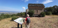
This shaded trail leads to the top of the cliff at the Leyrieu Chapel and offers superb views of the Lyon plains and the Pilat massif. On a clear day, you can see the Alps and the Vercors massif.
Woods and marshes at Passins
 2.90 mi
+98 ft
-102 ft
1h 25
Easy
Departure from Passins (Isère)
2.90 mi
+98 ft
-102 ft
1h 25
Easy
Departure from Passins (Isère)
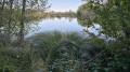
A short warm-up hike through the woods, marshes and hamlets of Passins. The terrain varies between cycle paths, tracks, trails and roads. In autumn, the landscape is very colourful.
Circulars around Saint-Romain-de-Jalionas
 4.07 mi
+98 ft
-98 ft
1h 55
Easy
Departure from Saint-Romain-de-Jalionas (Isère)
4.07 mi
+98 ft
-98 ft
1h 55
Easy
Departure from Saint-Romain-de-Jalionas (Isère)
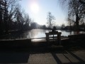
This short route will take you to the archaeological site of Villa du Vernai, along a gravel pit that has been transformed into a small lake, and to the Étang du Peillard.
Plateau des Aviateurs from Vernas
 7.15 mi
+902 ft
-902 ft
4h 05
Moderate
Departure from Vernas (Isère)
7.15 mi
+902 ft
-902 ft
4h 05
Moderate
Departure from Vernas (Isère)
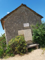
This is a very pleasant circular walk starting from the pretty village of Vernas, which takes you along attractive paths and trails, often shaded by trees, to the Plateau des Aviateurs, where a military aircraft crashed in 1944 and another in 1969. A small chapel, commemorative plaques and a sign commemorate these events. Wide panoramic views of the Rhône plains and the Alps in the distance can be enjoyed throughout the walk.
Circular route from the Larina plateau to Vernas
 5.87 mi
+922 ft
-912 ft
3h 30
Moderate
Departure from Vernas (Isère)
5.87 mi
+922 ft
-912 ft
3h 30
Moderate
Departure from Vernas (Isère)
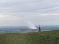
A circular route around the charming village of Vernas and across the Larina plateau. The viewpoint at the archaeological site offers magnificent views of the Jura, the Monts du Lyonnais and the Rhône plain. Further south on the plateau, on a clear day, you can see the Pilat and the Alps. A walk amidst the traces of human history from antiquity to the modern world.
From Bois de la Casse to Loudon
 7.22 mi
+725 ft
-696 ft
3h 55
Moderate
Departure from Ruy (Isère)
7.22 mi
+725 ft
-696 ft
3h 55
Moderate
Departure from Ruy (Isère)
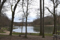
Hike around Montbernier, between forest and plateau. A lovely, gentle route around Montbernier. Beautiful views of the surrounding area as you walk across the plateaus. A shaded route that combines forest and field paths.
Around Poleyrieu
 5.40 mi
+223 ft
-223 ft
2h 40
Easy
Departure from Creys-Mépieu (Isère)
5.40 mi
+223 ft
-223 ft
2h 40
Easy
Departure from Creys-Mépieu (Isère)
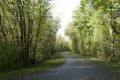
Walk around the hamlet of Poleyrieu. The route starts at a quarry and climbs gently through woods and meadows to the hamlet of Poleyrieu, with views of the mountains from Bugey to Chartreuse. In the distance, you can see the Belledonne mountain range. On the way back, it passes through woods, without any clearly visible trail (GPS or Visorando app useful) to reach a wild pond, the Étang Flocarde. It returns via the Devin plain.
North of Crémieu - From the Larina plateau to the Chapelle des Aviateurs in Leyrieu
 9.02 mi
+1,424 ft
-1,424 ft
5h 25
Moderate
Departure from Vernas (Isère)
9.02 mi
+1,424 ft
-1,424 ft
5h 25
Moderate
Departure from Vernas (Isère)
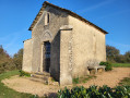
From medieval Vernas to ancient Larina and back via the limestone plateau to the Chapelle des Aviateurs (a memorial to two plane crashes), return to the Middle Ages via the fishpond at the Château Delphinal de Vernas.
Circular around Montcarra
 7.11 mi
+774 ft
-755 ft
3h 55
Moderate
Departure from Montcarra (Isère)
7.11 mi
+774 ft
-755 ft
3h 55
Moderate
Departure from Montcarra (Isère)
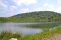
An easy route accessible to families with children, offering varied landscapes: woods, meadows and villages. Views of the Alps.
Around the Etang de Rosière
 2.84 mi
+397 ft
-397 ft
1h 40
Easy
Departure from Bourgoin-Jallieu (Isère)
2.84 mi
+397 ft
-397 ft
1h 40
Easy
Departure from Bourgoin-Jallieu (Isère)
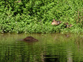
This is an easy, short hike offering superb views of the Vercors and Chartreuse mountains once you reach the plateau.
The route takes us through wooded areas and agricultural plateaus, mixing shade and light.
Best done in good weather to enjoy the coolness of the forest and the unobstructed view.
Circular route on the Montcarra plateau starting from Vignieu.
8.68 mi
+417 ft
-404 ft
4h 20
Moderate
Departure from Vignieu (Isère)
An easy, exotic and family-friendly route to discover the plateau, which offers superb views of the Alps in good weather. Views of the valleys of Saint-Chef and Montcarra.
A short walk around the Trois Vallons in Isle-d’Abeau
4.20 mi
+322 ft
-315 ft
2h 15
Easy
Departure from L'Isle-d'Abeau (Isère)
A short walk around the Trois Vallons neighbourhood of Isle-d’Abeau, offering a mix of tarmac and dirt tracks, partly shaded in the Bois de Montgeard. Starts and finishes at Isle-d’Abeau station, with free parking.
Wild nature between Saint-Alban and Four
9.08 mi
+837 ft
-843 ft
4h 55
Moderate
Departure from L'Isle-d'Abeau (Isère)
You don't have to go to the ends of the earth to get away from it all. In the first part of this route, you will discover wild and little-used paths before a more sedate second part.