Pérollier, Tabor, Piquet de Nantes traverse

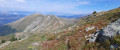
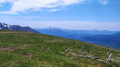
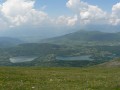
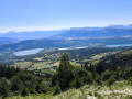
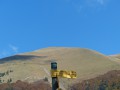
Three peaks in one hike: this beautiful circular route uses a variety of paths to combine the routes to several peaks, offering unobstructed views of the surrounding mountain ranges and overlooking the Mathésine and its lakes.

Details

n°10598176
Creation:
Last update:
Last review:
  • Walking
    Activity: Walking
  • ↔
    Distance: 9.32 mi
  • ◔
    Average duration: 7h 40 
  • ▲
    Difficulty: Difficult

  • ⚐
    Back to start: Yes
  • ↗
    Ascent: + 3,911 ft
  • ↘
    Descent: - 3,904 ft

  • ▲
    Highest point: 7,825 ft
  • ▼
    Lowest point: 4,777 ft

Photos

Description of the walk

From Pierre-Chatel or La Mure, head to Saint-Honoré and continue along the D115C, which climbs to the former Saint-Honoré 1500 ski resort (La Chaud). Park in the circular lay-by at the end of the road.

(S/E) Immediately to the east of the car park, signposts indicate the various destinations: head towards Le Pérollier, which descends into the meadow on the left and joins a stony forest track. Follow it to the right, heading north-east, first slightly downhill and then uphill.

(1) Reach and wade across the Jonche stream.

(2) The “Sentier du Diable” starts at the Pracouiret crossroads; it climbs to the right in hairpin bends through the forest and then, out into the open, up to the gullies of Côte Dure.

(3) Cross this section, which changes after every storm, and continue up the switchbacks; the climb is not difficult, though the slopes are steep. These switchbacks lead to the Pérollier ridge, where you simply follow the grassy ridge to the right, running alongside a ski lift, up to the summit.

(4) Descend the ridge path, heading south-east, to reach the Col de l’Ollière.

(5) From the pass, head south down the track to the first hairpin bend. You can either:
- continue along the track to Lac Charlet.
- but if you wish to minimise the loss of altitude (see GPS track), leave the track and continue southwards across the grassy sections, descending as little as possible: climb slightly to pass an old stone enclosure, then descend as the terrain dictates, cross the first stream and continue on level ground towards a second stream. The Sentier du Tabor, which you need to join, is just after you cross the stream.

(6) Take this marked and cairn-marked path on the left, which climbs southwards along the left bank of the stream; at one point, it crosses the stream and veers left, heading east then north-east. It climbs up steeper, rockier slopes before emerging onto a grassier plateau, leading easily to a pass, the lowest point of the ridge separating the Oreille du Loup from the Tabor.

(7) Follow the ridge path to the right, heading south; it climbs gradually and passes the junction with the Crête des Barres.

(8) Reach the summit of the Tabor.

(9) Retrace your steps down to the junction.

(8) Turn left onto the Crête des Barres ridge path: there are several possible routes:
- either a better-marked path, closer to the ridge line, with some ascents;
- or a narrow track that cuts across the north-western flank, avoiding the climb, and joins the ridge further down, just before a small pass.

(10) The path drops down below Le Banc, on the eastern slope, to reach the grassy pass signposted ‘Chaurousse’.

(11) Continue southwards to climb, via a grassy ridge, to the Piquet de Nantes.

(12) Descend northwards to the Col de Chaurousse.

(11) Turn left to cross over to the western slope and make your way across to the grassy slopes of Chaurousse, criss-crossed by avalanche barriers. The path descends to join these structures, following them via switchbacks that become increasingly wide and gentle. The path passes through the Combe de l’Allier.

(13) Continue to the Aux Allisiers junction with the path leading up to Lac Charlet.

(14) Turn left at the hairpin bend and:
- either continue along the path;
- or turn right onto a path that takes a shorter route down to a reservoir. Continue the descent towards the south-west. A wide bend leads to the meadow, below the car park where you started (S/E).


Waypoints

  1. S/E : mi 0 - alt. 4,908 ft - Circular car park at the end of the D115C
  2. 1 : mi 0.6 - alt. 4,898 ft - Ford on the - Jonche (cours d'eau) - Affluent du Drac
  3. 2 : mi 0.93 - alt. 5,079 ft - Pracouiret junction
  4. 3 : mi 1.61 - alt. 5,722 ft - Côte Dure
  5. 4 : mi 2.59 - alt. 7,152 ft - Summit - Le Pérollier (2183m)
  6. 5 : mi 2.85 - alt. 6,637 ft - Col de l'Ollère (2023m)
  7. 6 : mi 3.28 - alt. 6,447 ft - Junction with the Tabor path
  8. 7 : mi 4.08 - alt. 7,474 ft - Pass between the Oreille du Loup and the Tabor
  9. 8 : mi 4.29 - alt. 7,730 ft - Junction with the Crête des Barres
  10. 9 : mi 4.35 - alt. 7,825 ft - Summit of the - Le Tabor (2389m)
  11. 10 : mi 4.99 - alt. 7,300 ft - Crête des Barres
  12. 11 : mi 5.34 - alt. 7,116 ft - Chaurousse signpost pass
  13. 12 : mi 5.76 - alt. 7,251 ft - Summit - Piquet de Nantes (2214m)
  14. 13 : mi 8.57 - alt. 5,413 ft - Combe de l’Ellier
  15. 14 : mi 8.91 - alt. 5,289 ft - At Les Allisiers
  16. S/E : mi 9.32 - alt. 4,908 ft - Circular car park at the end of the D115C

Notes

Apart from a short traverse near Lac de Charlet to avoid descending too far (see photo marker), the entire route follows well-marked or obvious paths.
Please note: however, before June, snowfields may make the ascent to Tabor (north-west face) more difficult.

Worth a visit

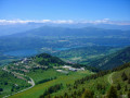
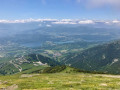
There are beautiful views from each of the peaks over the surrounding mountain ranges.

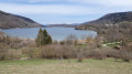
Much of the route offers views of the Mathésine Lakes plateau.

Reviews and comments

5 / 5
Based on 2 reviews

Reliability of the description
5 / 5
Ease of following the route
5 / 5
Route interest
5 / 5
XFandre
XFandre

Overall rating : 5 / 5

Date of your route : Oct 06, 2026
Reliability of the description : ★★★★★ Very good
Ease of following the route : ★★★★★ Very good
Route interest : ★★★★★ Very good
Very busy route : Yes

I actually did the Pérollier – Oreille du Loup (more or less a round trip) – Tabor route and avoided the Piquet de Nantes (which I’d already seen in winter, from the Tabor, in fact).
The ‘Devil’s Path’ leading up to Pérollier is nothing like hell: plenty of hairpin bends, a gentle slope. I descended back to the pass and from there tackled the ridge leading to the Dent du Loup. There’s a clear track; it’s steady going but not too demanding. It was only once I reached the summit that things got complicated. In a guidebook, I’d read: “Find a small gully to bypass the rocky outcrops on their eastern slope”.... But there are several gullies… Several notches… A PGHM officer I met up there didn’t know the way, and my GPS wasn’t precise enough to guide me. I tried one route, then gave up.
I descended from the ridge until I veered off to the left (there was no way I was going back down to the lake!): via a long, ascending traverse with no defined path, crossing damp or even wet areas, and feeling my way along the rock with some harmless scrambling, I eventually found the normal route again. At around 2,100 metres, below point 7 (the pass between the Oreille du Loup and the Tabor). The summit isn’t far now.
So I head back down via the Crête des Barres and, at Chaurousse, return to the starting point. It’s worth noting that after a while the path turns into a wide grassy track that barely descends at all! It’s a long way!!!!
A very beautiful route which would be perfect if one could get from the Oreille du Loup to the pass before the Tabor without taking any reckless risks. It would be classified as ‘Very Difficult’, or even ‘Extremely Difficult’, but it would be quite a challenge.
I’ve labelled it ‘very busy’, even though you’re not exactly stepping on each other’s toes, but I’ve been on far more deserted routes.

Machine-translated

Sandrine san
Sandrine san

Overall rating : 5 / 5

Date of your route : Nov 08, 2024
Reliability of the description : ★★★★★ Very good
Ease of following the route : ★★★★★ Very good
Route interest : ★★★★★ Very good
Very busy route : No

The route involved first climbing up to Le Perollier, then heading back down to Lake Charlet (I wanted to see it up close), before climbing up again to Le Tabor and Piquet de Nantes.
Stunning views 😀

Machine-translated

Gigi38
Gigi38

A lovely walk with stunning scenery – and we even saw some chamois
Good GPS route
I recommend this walk (IBP137)

Machine-translated

Other walks in the area

For more walks, use our search engine .

The GPS track and description are the property of this route's author. Please do not copy them without permission.