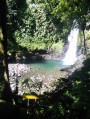
Trail leading to the wreck of the Soufrière DC-3

A unique hike offering the chance to discover the wreck of the DC3 that crashed in 1971.
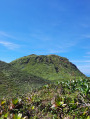
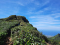
Magnificent views of La Soufrière and Petit Cul-de-Sac Marin on a clear day, with the option to add a circular route to the summit of La Soufrière.

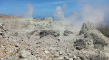
Please note that a large section of this route is currently closed to the public due to the risk of rockfalls and increased volcanic activity.

Details

33423743
Creation:
Last update:
Last review:
  • Walking
    Activity: Walking
  • ↔
    Distance: 5.34 mi
  • ◔
    Average duration: 4h 30 
  • ▲
    Difficulty: Difficult

  • ⚐
    Back to start: Yes
  • ↗
    Ascent: + 2,365 ft
  • ↘
    Descent: - 2,362 ft

  • ▲
    Highest point: 4,626 ft
  • ▼
    Lowest point: 3,140 ft

Photos

Description of the walk

Car park at Les Bains Jaunes above Saint-Claude. It’s best to arrive early in the morning to find a space easily.

(S/E) From Bains Jaunes, take the Sentier du Pas du Roy eastwards, which then turns north. Join the D11 road (closed to traffic).

(1) Follow it to the right until you reach the Savane car park at Mulets.

(2) After the car park, take the Chemin des Dames, which branches off to the left towards the volcano, then skirts around it to the west.

(3) At the large fault line, take the Trace Carmichaël, which heads north. There are three hills to cross, with a mix of ascents and descents.

(4) Look for a narrow track on the right that descends towards the wreck. Be careful: there are no markings or signposts, so I recommend following the GPS track. The descent becomes difficult as the path is sometimes very narrow, muddy (even in dry weather) and you’ll be navigating through a tangle of branches and roots.

(5) DC3 wreck. The return to Les Bains Jaunes (S/E) follows the reverse route of the outward journey.

Waypoints

  1. S/E : mi 0 - alt. 3,143 ft - Bains Jaunes
  2. 1 : mi 0.56 - alt. 3,645 ft - Pas du Roy junction / road
  3. 2 : mi 0.71 - alt. 3,740 ft - Savannah at Mulets
  4. 3 : mi 1.52 - alt. 4,505 ft - The Great Fault - Soufrière (la)
  5. 4 : mi 2.36 - alt. 4,557 ft - Path to DC3 - Carmichaël
  6. 5 : mi 2.67 - alt. 4,167 ft - DC3 wreck
  7. S/E : mi 5.34 - alt. 3,143 ft - Bains Jaunes

Notes

It’s best to download the GPX track to find the start of the final section (4), which isn’t signposted.
Check the weather forecast before setting off.
Make sure you have good walking boots and plenty of water.
The final section is quite tricky as there is a lot of mud (you can sink up to your thighs) and you have to make your way through a tangle of branches and roots.
Ideally, you should undertake this walk after a few days of dry weather.
We completed the walk in 5 hours in clear weather with a relatively dry path.

Worth a visit

There are beautiful views of La Soufrière and the small marine cul-de-sac on a clear day.
(3) You can also extend the route to climb up to La Soufrière.

Reviews and comments

4.3 / 5
Based on 2 reviews

Reliability of the description
5 / 5
Ease of following the route
5 / 5
Route interest
3 / 5
Annie971
Annie971

Overall rating : 4.3 / 5

Date of your route : Jun 02, 2025
Reliability of the description : ★★★★★ Very good
Ease of following the route : ★★★★★ Very good
Route interest : ★★★☆☆ Average
Very busy route : Yes

The story of these two pilots is an interesting one. On 9 September 1971, the Douglas R4D-6 (DC3) operated by CARIB WEST AIRWAYS was flying from Port of Spain in Trinidad to Canefield Airport in Dominica. Whilst the flight was being diverted to Raizet Airport in Guadeloupe due to a late arrival and the lack of night-time lighting at the airport in Dominica, the aircraft never reached Pointe-à-Pitre, as it crashed into the slopes of La Soufrière. The wreckage was found four days later, on 13 September 1971, with both pilots dead. They had been crushed by their cargo of 800 kg of copper boat parts and one tonne of sliced bread and live chickens, which were never found!!) .

Machine-translated

OLIVIER RIGAUX
OLIVIER RIGAUX

Overall rating : 4.3 / 5

Date of your route : Dec 31, 2024
Reliability of the description : ★★★★★ Very good
Ease of following the route : ★★★★★ Very good
Route interest : ★★★☆☆ Average
Very busy route : No

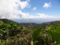
lovely views of the ridge of the Basse-Terre massif (Nez-Cassé, Grande Découverte, Sans-Toucher, Montagne de Capesterre, etc.)
There are no restrictions on this route.
Only if you reach La Soufrière via the ‘Trace des Géologues’ (alternative route)!

Machine-translated

Other walks in the area

For more walks, use our search engine .

The GPS track and description are the property of this route's author. Please do not copy them without permission.