Rocher des Taillades

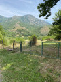
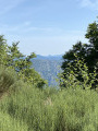
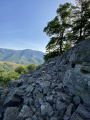
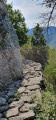
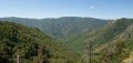
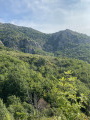
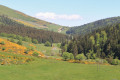
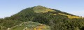
The Rocher des Taillades, one of the peaks of the Serre de la Croix de Bauzon at an altitude of over 1,400 metres, offers a unique view of the upper Ardèche valley.

Details

n°59856971
Creation:
Last update:
Last review:
  • Walking
    Activity: Walking
  • ↔
    Distance: 8.04 mi
  • ◔
    Average duration: 6h 15 
  • ▲
    Difficulty: Average

  • ⚐
    Back to start: Yes
  • ↗
    Ascent: + 2,910 ft
  • ↘
    Descent: - 2,910 ft

  • ▲
    Highest point: 4,803 ft
  • ▼
    Lowest point: 1,883 ft

Photos

Description of the walk

Park at Mayres on the Place du Chambon.

(S/E) Head towards the Ardèche and cross the Pont de la Vierge to reach the starting point, which runs parallel to the river on the right bank. Turn right and walk for about 300 m.

(1) Take the yellow-marked path on your left: a signpost reads ‘Les mines, le Rieu’. Opposite, on the other bank, you can see the Roche Trouée, a natural wonder and the pride of the village. The well-graveled path climbs gradually up to a chestnut tree with a sign reading ‘chemin d’en haut, chemin d’en bas’ (upper path, lower path), as the trail splits into two.

(2) It doesn’t matter which one you take; both paths lead to the same place and are identical: the route described here follows the lower path. After passing the ruins of the Rieu barns, a reminder of times gone by, the path joins the forest track.

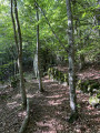
(3) After crossing the track on the left-hand side, the path, signposted ‘Rocher des Taillade, Tour des Poignets’, continues to the right into the woods. It crosses a stream then turns left through a cluster of stone huts before joining an old track abandoned by cars but open to walkers. Please note: this track is rarely used and the pedestrian crossing is poorly marked. Turn right.

(4) Please note: at this point the track splits into two; the number 48 is marked on a tree on the left. Do not turn left but carry on straight ahead; a yellow marker indicating the direction is painted on a rock to the left of the track immediately after the junction.

(5) Once you reach the summit, on the flat area, turn right onto the yellow and white signposted path marked ‘Mayres via the Bois des Rabeyres’. Once past the highest point, the path descends towards the Col des Pergeyres.

(6) Once you reach the pass, take the marked path “Mayres via Cautet” which branches off to the right. A long descent with tight hairpin bends ends on the forest road.

(7) The route to follow continues along the track and not along the path shown on the IGN map: the latter has been abandoned due to the difficulty of maintaining it. Therefore, continue down the track.

(8) After about 500 m, take the path branching off to the left signposted ‘Cautet – Mayres’. This path ends at the tarmac track, at the southern entrance to the hamlet of Cautet.

(9) Walk through the hamlet to the last house, situated at a bend in the road.

(10) Take the path on the right: please note that a gate blocks access, so do remember to close the gate behind you. To the left, opposite, at the foot of the mountain, stand the ruins of the Château des Montlaur and the Chapelle Saint-Médard. A little further on, the ruins of old mines line the path.

(1) Continue straight on. Cross the Pont de la Vierge again and you’ll reach the Place du Chambon (S/E).


Waypoints

  1. S/E : mi 0 - alt. 1,893 ft - Place du Chambon
  2. 1 : mi 0.26 - alt. 1,919 ft - Start: Chemin du Rieu, junction of the circular route
  3. 2 : mi 0.38 - alt. 2,008 ft - Three-way junction: upper path, lower path
  4. 3 : mi 1.63 - alt. 3,212 ft - Forest track
  5. 4 : mi 2.84 - alt. 4,442 ft - The track splits
  6. 5 : mi 3.56 - alt. 4,747 ft - Rocher des Taillades
  7. 6 : mi 4.19 - alt. 4,560 ft - Col des Pergeyres
  8. 7 : mi 5.45 - alt. 3,058 ft - Back onto the forest track
  9. 8 : mi 5.99 - alt. 2,890 ft - Turn left at the fork towards Cautet
  10. 9 : mi 6.7 - alt. 2,343 ft - Cautet
  11. 10 : mi 6.94 - alt. 2,208 ft - Entrance to Chemin de la Prade
  12. S/E : mi 8.04 - alt. 1,893 ft - Place du Chambon - Ardèche

Notes

For more information on walking routes around Mayres, I invite you to visit the ‘Amis de Mayres’ website: ‘https:// www.lesamisdemayres.org’.

Wearing suitable walking shoes is recommended. Remember to bring some food, a warm jumper and water, especially in summer when springs may have run dry.

Please note that you will be passing through an area known as the RBI (‘Integral Biological Reserve’) of the Ardèche springs. You can find further information on this at (5). In the meantime, please respect the natural environment: do not light fires, avoid making too much noise, stay on the paths and, of course, do not litter.

Worth a visit

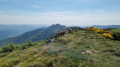
Once you reach the Rocher des Taillades, you’ll be able to see, in the distance ahead of you, the famous Mont Gerbier de Jonc and Mont Mézenc.
At the far end of the valley, to the west, lies the Col de la Chavade.
A little further on, on the other side to the south, you’ll see the Croix de Bauzon ski resort.

Reviews and comments

4.7 / 5
Based on 2 reviews

Reliability of the description
4 / 5
Ease of following the route
5 / 5
Route interest
5 / 5
tarrayre
tarrayre

Hello Yvon,

I’m delighted that you enjoyed this walk. Due to the heatwave, I think the path hasn’t been maintained as well as it should have been. I’ve taken note of your comment about the route and will pass it on to the ‘Les amis de Mayres’ association, whose volunteers look after the paths.
In the meantime, enjoy your walks and see you soon on our trails. The other side, towards Chaumiene, is different but just as lovely. If you get the chance, start from the village rather than from Vieux Mayres, as indicated in some magazines. The descent is very difficult that way.
Kind regards
Vincent

Machine-translated

pouget yves
pouget yves

Overall rating : 4.7 / 5

Date of your route : Sep 21, 2026
Reliability of the description : ★★★★☆ Good
Ease of following the route : ★★★★★ Very good
Route interest : ★★★★★ Very good
Very busy route : No

A lovely walk with a wonderful climb through the woods before reaching the forest track…After that, it’s a good path that takes us to the summit (though the path doesn’t always follow the marked route) and offers a lovely view of the whole mountain range. The descent is a bit slippery at times because of all the leaves. After the path, there’s a less pleasant descent to the hamlet of Cautet, then back along the very beautiful Ardèche Gorges.
This route is signposted in yellow and white throughout.

Machine-translated

JODIDO
JODIDO
• Edited:

Overall rating : 5 / 5

Date of your route : Oct 23, 2024
Reliability of the description : Not used / Not applicable
Ease of following the route : Not used / Not applicable
Route interest : ★★★★★ Very good
Very busy route : No

-The route differs from the one given in the description, as I’ve included the Rocher d’Abraham to create this long circular route of nearly 20 km, which I’d recommend to anyone who enjoys a fairly challenging walk-

Before setting off on my walk, I met a member of the “Les Amis de Mayres” association, who gave me a leaflet on walks starting from the village and advised me to do a circular walk.
The climb up to the Col d’Abraham (1,312 m) is quite steep, and as the path is covered in fallen leaves, the yellow and pink markings help you stay on course.
The climb up to the statue from the Chemin des Gardes proved a bit slippery, and you really need to keep an eye out for the markings (three yellow dots). It took me 2 hours 45 minutes from the village, including a 20-minute break.
Magnificent views for kilometres in every direction. I was very tempted to climb to the top of the Rocher, but that will have to be for another time. Several comments on the subject put me off trying to go up there in shoes with well-worn soles. So I headed back down to the Chemin des Gardes, went round the Rocher d’Abraham to reach the Col de Mendras, and then followed the Crêtes to reach the Tour des Poignets and the Rocher des Taillades. A long descent from the Col des Pergeyres. The path was covered in fallen leaves, but the yellow paint marks helped me stay on the right route. When I reached the track, I encountered the only problem of the day. Apart from a small wooden sign saying ‘Pergeyres’ and indicating to turn left, there was no mention of ‘Cautet’ or ‘Mayres’. So, on seeing two yellow crosses, I turned right onto the section where the path climbed, but as I couldn’t see any yellow markings, I turned back and eventually reached the DFCI track sign pointing towards Cautet and Mayres. I then rejoined the path marked in yellow to reach Cautet, and then Mayres.
I crossed the Pont de la Vierge to get back to my car, which I’d left in front of the church.
In total, nearly 20 km, with 1,200 metres of elevation gain. 7 hours 40 minutes, including a good hour’s break.
A lovely hike that will have me returning to Mayres to go on more walks in this area.

Machine-translated

Other walks in the area

For more walks, use our search engine .

The GPS track and description are the property of this route's author. Please do not copy them without permission.