


rioufredo

 Visorando Member
 Premium user
 - Location: Sarrians (84260)
- Gender: man
Sign up:
Published route(s)
 Saut du Chien waterfall
 2.91 mi
 +463 ft
 -463 ft
 1h 45
1h 45
 Moderate
 Departure from Saint-Symphorien-de-Thénières (Aveyron)
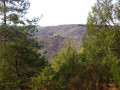
Hike near Entraygues-sur-Truyère. Route through forests and meadows on forest trails and tracks leading to the waterfall.
Lanarce peat bogs
 10.05 mi
+666 ft
-663 ft
5h 10
10.05 mi
+666 ft
-663 ft
5h 10
 Easy
Departure from Lanarce (Ardèche)
Easy
Departure from Lanarce (Ardèche)
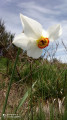
This route, starting from Le Taillet, passes through peat bogs and forests, with views of the Gerbier des Joncs.
Mont Mézenc
 3.98 mi
+856 ft
-863 ft
2h 35
Moderate
Departure from Les Estables (Haute-Loire)
3.98 mi
+856 ft
-863 ft
2h 35
Moderate
Departure from Les Estables (Haute-Loire)
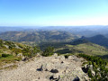
Climb Mont Mézenc from the Croix de Peccata - car park.
Mal Cros Canal starting from Chaillol 1600
 4.40 mi
+814 ft
-781 ft
2h 45
Moderate
Departure from Saint-Michel-de-Chaillol (Hautes-Alpes)
4.40 mi
+814 ft
-781 ft
2h 45
Moderate
Departure from Saint-Michel-de-Chaillol (Hautes-Alpes)
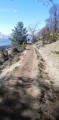
Hike along the remains of the Mal Cros Canal, starting from Chaillol 1600. This canal supplied water for irrigation in the area from a glacier above the Champoleon valley (Drac Blanc).
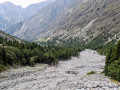
Champoléon Valley
 5.69 mi
+1,165 ft
-1,148 ft
3h 40
Moderate
Departure from Champoléon (Hautes-Alpes)
5.69 mi
+1,165 ft
-1,148 ft
3h 40
Moderate
Departure from Champoléon (Hautes-Alpes)
A peaceful exploration of the upper Champoléon valley, on either side of the Drac de Champoléon or Drac Blanc torrent in the heart of the Champsaur Massif, to the Pré de la Chaumette refuge on the edge of the Écrins National Park.
⚠️ 15/09/2025: Left bank impassable due to a landslide. The route is a return trip 1-4-3 to the refuge on the GRP®. Please read the notices carefully.
The sources of the Lot
 4.54 mi
+571 ft
-568 ft
2h 35
Easy
Departure from Cubières (Lozère)
4.54 mi
+571 ft
-568 ft
2h 35
Easy
Departure from Cubières (Lozère)
Walk along the first few kilometres of the Lot to its source, between forests and meadows.
Combeau Valley
 4.37 mi
+843 ft
-843 ft
2h 45
Easy
Departure from Treschenu-Creyers (Drôme)
4.37 mi
+843 ft
-843 ft
2h 45
Easy
Departure from Treschenu-Creyers (Drôme)
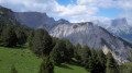
A remarkable family walk in the southern part of the Hauts Plateaux du Vercors Nature Reserve.Vast lawns on the plateau and views of the Trièves and Mont Aiguille, the foothills of the Oisans and the Dévoluy.
The mountain pastures of Vallon du Fleyrard starting from La Jarjatte.
 4.37 mi
+1,302 ft
-1,312 ft
3h 10
Moderate
Departure from Lus-la-Croix-Haute (Drôme)
4.37 mi
+1,302 ft
-1,312 ft
3h 10
Moderate
Departure from Lus-la-Croix-Haute (Drôme)
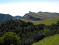
Balcony hike on the transhumance mountain pastures at the bottom of the Jarjatte valley, cul-de-sac and sources of the Buëch.
Beautiful panoramic views.
Access: from Luz la Croix Haute, go to the end of the Jarjatte road.
 Les Coux
 5.15 mi
+472 ft
-469 ft
2 hrs
Easy
Departure from Saint-Martial (Ardèche)
5.15 mi
+472 ft
-469 ft
2 hrs
Easy
Departure from Saint-Martial (Ardèche)
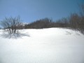
An easy snowshoe route to explore the snow-covered Ardèche plateau, near the Gerbier des Joncs.
'Les Coux' is a small volcanic knoll rising from the plateau, near the 'Gerbier des Joncs'.
Car park at the cross-country skiing chalet on the Lachamp Raphael – Gerbier des Joncs road (1 km).
Mont Ventoux - le Rat
 5.93 mi
+548 ft
-574 ft
3h 10
Easy
Departure from Bédoin (Vaucluse)
5.93 mi
+548 ft
-574 ft
3h 10
Easy
Departure from Bédoin (Vaucluse)
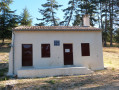
Discover the vegetation's biodiversity of the Mont Ventoux.
From Bedoin, take the road (by car) leading to the Mont Ventoux.
Cross the remarkable cedar's forest then the beech forest will appear.
Continue (approx. 10km) until you find a car park on the right-hand side. (Jas des Melettes)
Combe d'Ansis Mont Ventoux
 6.21 mi
+1,522 ft
-1,522 ft
4h 10
Moderate
Departure from Bédoin (Vaucluse)
6.21 mi
+1,522 ft
-1,522 ft
4h 10
Moderate
Departure from Bédoin (Vaucluse)
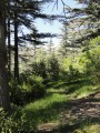
A walk in the foothills of Ventoux near Bédouin allows you to discover the rich vegetation of the southern slope.
Departure from the hamlet of Les Baux, on the Mont Ventoux road via Bedoin, on the left - car park near the cemetery.