


No description
Tour Lac Annecy jour 3 - L'Empreinte Baroudeuse
Details
Creation:
Last update:
-
 Activity: Walking
 -
 Distance: 13.45 mi
 -
 Average duration: 9h 20
 -
 Difficulty: Difficult
 -
-
 Back to start: No
 -
 Ascent: + 3,576 ft
 -
 Descent: - 3,793 ft
 -
-
 Highest point: 4,862 ft
 -
 Lowest point: 1,470 ft
-
 Country:
France
Country:
France
-

-
 City:
Entrevernes (74410)
City:
Entrevernes (74410) -
 Start: N 45.756229° / E 6.176068°
 -
 End: N 45.824219° / E 6.262489°
 -
 IGN map(s): Ref. 3431OT, 3431OTR, 3432OT, 3432OTR
 -


 Hour-by-hour weather
Description of the walk
Waypoints
- S : mi 0 - alt. 4,278 ft
- E : mi 13.45 - alt. 4,062 ft
This route passes through a protected area, which may be subject to special regulations:
Other walks in the area
Between Roc des Boeufs and Montagne du Charbon
 Visorando Member
 10.71 mi
+3,356 ft
-3,330 ft
7h 50
Difficult
Departure from Lathuile (Haute-Savoie)
10.71 mi
+3,356 ft
-3,330 ft
7h 50
Difficult
Departure from Lathuile (Haute-Savoie)
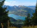
This circular route allows you to admire not only the Roc des Boeufs and the Montagne du Charbon, but also much of the Bauges massif, Lake Annecy, the Bornes massif, the Aravis range, etc. Don't hesitate to turn around regularly to fully enjoy all these landscapes.
Le Roc des Bœufs
 4.99 mi
+2,480 ft
-2,480 ft
4h 25
4.99 mi
+2,480 ft
-2,480 ft
4h 25
 Moderate
Departure from La Chapelle-Saint-Maurice (Haute-Savoie)
Moderate
Departure from La Chapelle-Saint-Maurice (Haute-Savoie)
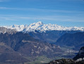
The Roc des Bœufs ridge offers magnificent views of the Bauges peaks and the Annecy basin.
Tour of Montagne du Charbon, via Banc Plat and Dent des Portes
 11.16 mi
+4,465 ft
-4,465 ft
9h 00
11.16 mi
+4,465 ft
-4,465 ft
9h 00
 Very difficult
Departure from Bellecombe-en-Bauges (Savoie)
Very difficult
Departure from Bellecombe-en-Bauges (Savoie)
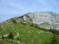
A beautiful, long circular loop around Montagne du Charbon. Starting from Petit Reposoir (Bellecombe-en-Bauges), climb to Col de Bornette then take the path carved into the cliff. At the Refuge de la Combe, climb to the Pointe de Banc-Plat for your first 360° viewpoint, descend to the Chalets du Rosay and Planay, then climb up the opposite side to the Charbonnet. Follow the ridge to climb the Dent des Portes, your second 360° viewpoint, before returning via the classic route through the Golet de Doucy.
Le Golet, Col de Bornette and Crêt du Char from Mont devant
 7.34 mi
+1,854 ft
-1,854 ft
5h 00
Moderate
Departure from Bellecombe-en-Bauges (Savoie)
7.34 mi
+1,854 ft
-1,854 ft
5h 00
Moderate
Departure from Bellecombe-en-Bauges (Savoie)
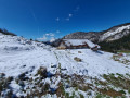
A hike that’s very well-known locally and as beautiful as ever! You set off from Mont-devant to reach Le Golet first, then follow theGRP® trail through the Bauges Massif with stunning views to reach the Col de Bornette. Finally, you’ll climb the Crêt du Char to admire the view over the Bauges, passing through Le Mollard, which offers a magnificent view of Lake Annecy.
This hike completes two circular loops around the Col de Bornette. Depending on your fitness level, you can shorten the route by doing just one circular loop or by focusing on the view from Le Mollard.
Le Roc de Four Magnin
6.39 mi
+2,277 ft
-2,290 ft
4h 55
Moderate
Departure from Bellecombe-en-Bauges (Savoie)
This is an extension of the snowshoe circuit described this winter.
The Roc de Four Magnin is not named on IGN maps, but the 1645m point is marked.
If necessary, here are its GPS coordinates: UTM E 0280 525; N 5069 500.
Roc du Four Magnin
 5.48 mi
+2,234 ft
-2,231 ft
4h 30
Moderate
Departure from Bellecombe-en-Bauges (Savoie)
5.48 mi
+2,234 ft
-2,231 ft
4h 30
Moderate
Departure from Bellecombe-en-Bauges (Savoie)
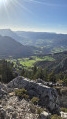
This summit (1,645 m) is little known in Les Bauges. The route is partly aerial and off-trail, requiring you to tackle a few rocks without too much difficulty. The summit offers views of Les Bauges, La Tournette, Lake Annecy, Mont Blanc and more.
Combe refuge - Le Reposoir
 6.84 mi
+2,021 ft
-3,307 ft
4h 55
Moderate
Departure from Chevaline (Haute-Savoie)
6.84 mi
+2,021 ft
-3,307 ft
4h 55
Moderate
Departure from Chevaline (Haute-Savoie)
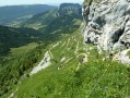
Second day of the hike: Around Charbon Mountain with a stop at Dent des Portes.
Montagne du Charbon - Pointe de Banc Plat
 8.23 mi
+2,749 ft
-2,740 ft
6h 10
Moderate
Departure from Bellecombe-en-Bauges (Savoie)
8.23 mi
+2,749 ft
-2,740 ft
6h 10
Moderate
Departure from Bellecombe-en-Bauges (Savoie)
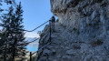
A lovely getaway in the Bauges mountains, with a round trip to the Pointe de Banc Plat (one of the two main peaks of the Montagne du Charbon). Although not very high, the Pointe de Banc Plat offers a remarkable panoramic view (the Montagne du Charbon is the northern part of the Trelod chain). The forest trail at the foot of the Montagne du Charbon is splendid.
For more walks, use our search engine .
The GPS track and description are the property of this route's author. Please do not copy them without permission.

