La Croix du Roy

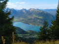
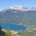
A wonderfully varied route offering stunning views, culminating in a breathtaking vista of the valley and Lake Annecy.

Details

n°50079484
Creation:
Last update:
Last review:
  • Walking
    Activity: Walking
  • ↔
    Distance: 10.54 mi
  • ◔
    Average duration: 7h 55 
  • ▲
    Difficulty: Difficult

  • ⚐
    Back to start: Yes
  • ↗
    Ascent: + 3,527 ft
  • ↘
    Descent: - 3,501 ft

  • ▲
    Highest point: 5,594 ft
  • ▼
    Lowest point: 2,208 ft
  • ⚐ Country: France
  • ⚐
    Areas: Alps, Bauges
  • ⚐ City: Lathuile (74210)
  • ⚑
    Start/End: N 45.762579° / E 6.194875°
  • ❏
    IGN map(s): Ref. 3431OT, 3431OTR, 3432OT, 3432OTR
  • Hour-by-hour weather

Photos

Description of the walk

The walk starts from the Montgellaz car park, situated beyond the hamlet of Saury, on Rue de Montgellaz, in the commune of Lathuille in Haute-Savoie.

(S/E) After parking your car, walk a few metres up the road leading to the hamlet of Montgellaz. From there, you’ll find signposts; simply follow them towards “La Croix du Roy”. Follow the forest track.

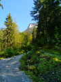
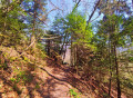
(1) Leave the track and take a path on the right. The first half of this walk takes place in the forest and alternates between forest tracks and footpaths.

(2) At the fork, turn left; at the next junction, keep to the right. You will then encounter a series of hairpin bends leading to a crossroads marked “Sous la Roche 1380 m”.

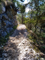
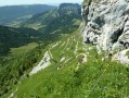
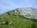
(3) Continue along the path to the left: the sign pointing towards La Croix du Roy is missing. From here, the landscape changes slightly and becomes more rocky, with the path getting a little steeper. Enjoy a lovely section carved into the rock, secured by a railing along its entire length, which offers a truly impressive view of Lake Annecy. Continue on to La Combe and the refuge of the same name.

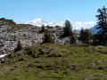
(4) Carry on along the path through this valley until you reach La Pessette (alt. 1,700 m).

(5) Leave the path and take a track to the left which leads to the Croix du Roy, about twenty minutes’ walk from La Pessette. After a few metres along this track, head for the scree slope which you will need to cross but which presents no particular difficulty.

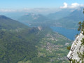
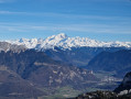
(6) Pass via the small pass of the Collet du Charbon (alt. 1,690 m) with the refuge clearly visible on the right; stay on this contour line until you reach the Croix du Roy and enjoy a breathtaking view of Lake Annecy, the surrounding peaks and Mont Blanc. Be careful not to get too close to the edge: you are on the top of a cliff.

(7) Follow the ascent route in the opposite direction to return to the starting car park (S/E).

Waypoints

  1. S/E : mi 0 - alt. 2,208 ft - Montgellaz car park
  2. 1 : mi 0.65 - alt. 2,566 ft - Path on the right
  3. 2 : mi 1.12 - alt. 2,927 ft - Junction, turn left
  4. 3 : mi 3.03 - alt. 4,455 ft - Below La Roche
  5. 4 : mi 3.77 - alt. 5,121 ft - Refuge de la Combe
  6. 5 : mi 4.69 - alt. 5,577 ft - La Pessette
  7. 6 : mi 4.88 - alt. 5,548 ft - Small Pass du Charbon
  8. 7 : mi 5.25 - alt. 5,581 ft - Croix du Roy
  9. S/E : mi 10.54 - alt. 2,208 ft - Montgellaz car park

Notes

(4) This valley is a mountain pasture for goats. They are usually guarded by livestock guardian dogs, and it is advisable to familiarise yourself in advance with how to behave in the presence of these dogs; information boards are regularly erected to inform walkers.

(3) On the way down, you can take a short detour to the left to visit the Charbon mountain hut.

Reviews and comments

4.3 / 5
Based on 2 reviews

Reliability of the description
4.5 / 5
Ease of following the route
4.5 / 5
Route interest
4 / 5
Mugnier Paul
Mugnier Paul

Overall rating : 3.7 / 5

Date of your route : Nov 04, 2024
Reliability of the description : ★★★★☆ Good
Ease of following the route : ★★★★☆ Good
Route interest : ★★★☆☆ Average
Very busy route : No

The approach walk is a bit long, so you’ll need to be in good physical shape.
Beautiful views of the Bauges massif and the lake.

Machine-translated

Edmond.D
Edmond.D

Hello.
Thank you for this review.
I’d already walked past the Chalet du Charbon many times, without realising it was there and so without going via the Croix du Roy. When I discovered it the other day, I thought it really deserved to be better known; so I’m glad that publishing this walk has been to your satisfaction.
Edmond.

Machine-translated

JAROSZ
JAROSZ

Overall rating : 5 / 5

Date of your route : May 27, 2024
Reliability of the description : ★★★★★ Very good
Ease of following the route : ★★★★★ Very good
Route interest : ★★★★★ Very good
Very busy route : No

A brilliant route, well signposted, with a good elevation gain and distance, a superb view at the cross, and a quick stop at the Cabane du Charbons is a must
Please note: this walk should not be undertaken after rainfall, as the ground is slippery

Machine-translated

Other walks in the area

For more walks, use our search engine .

The GPS track and description are the property of this route's author. Please do not copy them without permission.