Crossing the Roc de Four Magnin

A lovely walk beneath the impressive Roc des Bœufs, featuring sharp limestone pavement formations, a ‘letterbox’ and a mini cave.

Details

n°55508590
Creation:
Last update:
Last review:
  • Walking
    Activity: Walking
  • ↔
    Distance: 5.21 mi
  • ◔
    Average duration: 4h 15 
  • ▲
    Difficulty: Difficult

  • ⚐
    Back to start: Yes
  • ↗
    Ascent: + 2,133 ft
  • ↘
    Descent: - 2,126 ft

  • ▲
    Highest point: 5,394 ft
  • ▼
    Lowest point: 3,297 ft

Description of the walk

Access from Bellecombe-en-Bauges. Head towards Les Monts and park in the car park between Mont Devant and Mont Derrière.

(S/E) From the car park, take the road on the right, then turn left towards Mont derrière and, after the left-hand bend and between the houses, join the Chemin de la Frasse on the right (GRP®). Turn right and pass through Le Pontet.

(1) Ignore the return path on the left (GRP®) and turn right into the Vallon de Précheret. Pass Le Pontet and, further on, rejoin the path you left earlier (GRP®).

(2) Ignore the return path on the left (GRP®), continue straight ahead on theGRP® and reach a signpost marked ‘Sous Précheret’.

(3) Carry on straight ahead along theGRP® above the Précheret chalets until you reach the Col de la Frasse (elevation 1378).

(4) Leave theGRP®. From here, the route to the Col des Glaciers to the south-east is obvious.
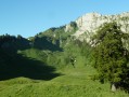
Head right along an ascending traverse, following the cows’ tracks towards the weakest point on the ridge, aiming first for three rocks below the tree line and then another slightly higher up marked with a green dot.

(5) From this rock, a track – initially barely visible – branches off to the right and leads to the Col des Glaciers.

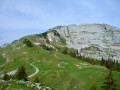
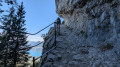
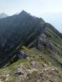
(6) Head right towards the south; numerous green markings indicate the route along the ridge. The path never strays far from it and always stays on the western side. As you approach the summit, the ridge is very narrow, but there is also a route a little lower down to the right. You will need to cross a wide fissure over large boulders, then reach the summit via two hairpin bends.

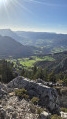
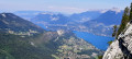
(7) From the summit, there are lovely views of La Tournette, Lake Annecy, Mont Blanc and the Bauges peaks.
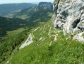
The descent follows the southern ridge down to a small grassy pass, then a second one marked by a post near the Crêt du Char. Continue straight on to a final viewpoint over the Bauges (Dent des Portes-Trélod, Dent d’Arclusaz, Colombier, Margeriaz...).

(8) Then head down to the edge of the forest and, following the cattle tracks, pass back beneath the Crêt du Char and begin the descent along a slippery path to reach Sous Précheret at the junction you passed on the way up.

(3) Continue to the left (GRP®), heading in the opposite direction to the outward journey, and reach another junction you passed on the way out.

(2) Continue to the right (GRP®) and return to the original junction.

(1) Carry on along theGRP® in the opposite direction to the outward journey to reach the (S/E).
Waypoints

  1. S/E : mi 0 - alt. 3,297 ft - Car park between the Monts
  2. 1 : mi 0.5 - alt. 3,537 ft - Initial common junction
  3. 2 : mi 0.81 - alt. 3,780 ft - Junction
  4. 3 : mi 1.29 - alt. 4,252 ft - Below Précheret. Junction
  5. 4 : mi 1.83 - alt. 4,524 ft - Col de la Frasse
  6. 5 : mi 2.11 - alt. 4,925 ft - Green mark on the rock
  7. 6 : mi 2.17 - alt. 5,043 ft - Col des Glaciers
  8. 7 : mi 2.5 - alt. 5,394 ft - Roc de Four Magnin
  9. 8 : mi 3.2 - alt. 4,783 ft - Viewpoint
  10. S/E : mi 5.21 - alt. 3,297 ft - Car park between the Monts

Notes

The walk isn’t long, so make sure you take enough water with you. The car park is spacious.

This route passes through a protected area, which may be subject to special regulations:

Worth a visit

A very interesting walk for its panoramic views, with little elevation gain for those who want to experience steep slopes, rocky sections and sharp ridges.

Reviews and comments

3.8 / 5
Based on 2 reviews

Reliability of the description
4.5 / 5
Ease of following the route
2 / 5
Route interest
5 / 5
fletcher_fr
fletcher_fr

Hello lucsaline,
I noted in the description that you need to follow the cattle tracks and then the rocks towards the gap in the ridge, as there is no proper path. I’ve marked the rock with the green symbol on the map (5) and I also mentioned that the track is barely visible to the right of the rock. I can’t do any more than that.
In any case, thank you for enjoying the walk.

Machine-translated

lucsaline
lucsaline

Overall rating : 3.7 / 5

Date of your route : Jul 18, 2024
Reliability of the description : ★★★★☆ Good
Ease of following the route : ★★☆☆☆ Disappointing
Route interest : ★★★★★ Very good
Very busy route : No

A really lovely hike, rated as difficult because it’s quite challenging along the ridge and on the final stretch to the cross (lots of scattered boulders to navigate). I wouldn’t recommend it for families with children or anyone who suffers from vertigo.
The 360-degree view from the summit is superb.
However, we couldn’t find the path after the Col des Frasses to reach point 5 (even though we were following the GPS track). So we had to cut across country to get to point 5. Otherwise, the description is accurate.
Thank you for this lovely walk

Machine-translated

Patak
Patak
• Edited:

Overall rating : 4 / 5

Date of your route : Jul 18, 2024
Reliability of the description : ★★★★★ Very good
Ease of following the route : ★★☆☆☆ Disappointing
Route interest : ★★★★★ Very good
Very busy route : No

A lovely walk, but one to avoid with young children and walkers who are prone to vertigo, as the last 100 metres are quite challenging. Once at the top, there’s a superb 360-degree view.

Machine-translated

Other walks in the area

For more walks, use our search engine .

The GPS track and description are the property of this route's author. Please do not copy them without permission.