Circular walk around Montfeulson from Rémilly-en-Montagne via Agey

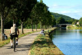
A pleasant walk through fields and woods, over hilltops and through valleys, passing through the two picturesque villages of Rémilly-en-Montagne and Agey, and alongside the lovely River Sirène.
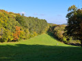
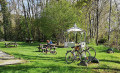
A landscape of hedgerows and woodland, with animals in the fields – cows and horses.
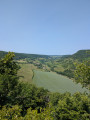
Narrow paths lined with ‘cabotes’ – small stone huts – and green meadows, offering lovely views over the Ouche and Sirène valleys, and the Côte de Sombernon.

Details

n°68971981
Creation:
Last update:
Last review:
  • Walking
    Activity: Walking
  • ↔
    Distance: 5.07 mi
  • ◔
    Average duration: 3h 00 
  • ▲
    Difficulty: Average

  • ⚐
    Back to start: Yes
  • ↗
    Ascent: + 774 ft
  • ↘
    Descent: - 787 ft

  • ▲
    Highest point: 1,755 ft
  • ▼
    Lowest point: 1,024 ft

Description of the walk

Park in the car park atthe Rémilly-en-Montagne cemetery.

(S/E) Take Rue de la Creuse (north), which climbs from the church towards Montfeulson. On the climb, veer to the right (east) then follow the forest track to the Croix de Baumotte.

(1) Continue to the right, skirting the small cliffs below the path, until you reach the junction with a footpath at the foot of Montfeulson.

(2) Take this path to the left and follow the route shown on the map to go round Montfeulson. At the end of this loop, you’ll come to a junction of paths.

(3) Head slightly left, downhill, to reach another T-junction.

(4) Turn left (north) at a 90° angle onto the Sentier Sat. Walk through a beautiful beech forest with pretty log cabins to the right of the path. Pass under a power line before reaching the junction with the Sentier des Mélèzes.

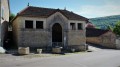
(5) Take this path to the right to head downhill and, just before the hamlet of Baumotte, you’ll come to a crossroads of paths, marked by low walls and huts.

(6) Turn slightly to the right and head towards the edge of the woods. Pass under the high-voltage power lines and cross the fields to come out onto the D9g. Follow it to the right until you reach the entrance to Agey at the crossroads by the cemetery.

(7) Turn right onto Rue de la République and continue along it until you reach Rue de la Croix de Molphey. Turn left and walk a few metres.

(8) Turn right onto the path between the houses. Go downhill and cross the Ruisseau de la Sirène via the bridge. Go back uphill and you’ll come out onto the Chemin des Ruelles.

(9) Turn right onto this path and head towards the village at the Croix de Molphey crossroads.

(10) Cross the Ruisseau de la Sirène again via the road bridge, then take the first road on the left and head uphill, keeping to the right onto the footpath. Continue uphill until you reach a fork in the path.

(11) Turn left at the crossroads marked by a cross. Then walk along the edge of the woods. At the entrance to Remilly-en-Montagne, you’ll come to the Grande Rue. Turn left onto it to reach the town hall.

(12) Turn right onto Rue des Carmes and walk up to the cemetery car park (S/E).

Waypoints

  1. S/E : mi 0 - alt. 1,293 ft - Rémilly-en-Montagne Cemetery car park
  2. 1 : mi 0.99 - alt. 1,673 ft - Baumotte Cross
  3. 2 : mi 1.27 - alt. 1,657 ft - Pied de Montfeulson No. 1
  4. 3 : mi 1.58 - alt. 1,713 ft - Pied de Montfeulson No. 2
  5. 4 : mi 1.72 - alt. 1,594 ft - Sat trail junction
  6. 5 : mi 2.08 - alt. 1,532 ft - Larch Trail
  7. 6 : mi 2.29 - alt. 1,362 ft - Crossroads with walls and huts
  8. 7 : mi 3.13 - alt. 1,109 ft - Agey
  9. 8 : mi 3.27 - alt. 1,070 ft - Rue de la Croix de Molphey
  10. 9 : mi 3.4 - alt. 1,056 ft - Chemin des Ruelles
  11. 10 : mi 3.63 - alt. 1,037 ft - Road bridge over the Sirène
  12. 11 : mi 3.9 - alt. 1,198 ft - Fork in the path. Cross
  13. 12 : mi 4.84 - alt. 1,181 ft - Rémilly-en-Montagne Town Hall
  14. S/E : mi 5.07 - alt. 1,293 ft - Rémilly-en-Montagne Cemetery car park

Notes

(7) Agey: take a break here in the shade of the lime tree and on the bench beneath it.

Worth a visit

Between (10) and (12), enjoy the pretty huts along the path and the views of the village of Rémilly, nestled on the mountainside, and the meadows of this beautiful, sweeping valley, grazed by animals, horses and cows. 

Reviews and comments

4.3 / 5
Based on 2 reviews

Reliability of the description
4.5 / 5
Ease of following the route
4 / 5
Route interest
4.5 / 5
NanaDidi
NanaDidi

Overall rating : 4.3 / 5

Date of your route : May 25, 2025
Reliability of the description : ★★★★☆ Good
Ease of following the route : ★★★★☆ Good
Route interest : ★★★★★ Very good
Very busy route : No

A very pleasant walk, with a special mention for the return journey to Remilly from Agey, with its pastures and the view of the village nestled against the hillside.
The series of short climbs can be an excellent way to get your legs going at the start of the season.

Machine-translated

Jean-Michel Rando
Jean-Michel Rando

Overall rating : 4.5 / 5

Date of your route : May 08, 2025
Reliability of the description : ★★★★★ Very good
Ease of following the route : Not used / Not applicable
Route interest : ★★★★☆ Good
Very busy route : No

A lovely little walk with no difficulties.

Machine-translated

Other walks in the area

For more walks, use our search engine .

The GPS track and description are the property of this route's author. Please do not copy them without permission.