Denis Gaulard Tower in Barbirey and Saint-Victor-sur-Ouche

This walk between two villages in the Ouche Valley, listed in the Côte d’Or PDIPR, is a variation on the Tour de Marigny. It bypasses the section running from the Table du Druide to Marigny Castle to head directly to Auvillard. This circular loop thus halves the distance, making for an easy walk of less than 7 km, comprising a slightly uphill outbound leg to Saint-Victor through woodland and meadows, and a flat return to Barbirey between the Ouche and the Burgundy Canal.

Details

2000147
Creation:
Last update:
Last review:
  • Walking
    Activity: Walking
  • ↔
    Distance: 4.03 mi
  • ◔
    Average duration: 2h 15 
  • ▲
    Difficulty: Easy

  • ⚐
    Back to start: Yes
  • ↗
    Ascent: + 486 ft
  • ↘
    Descent: - 512 ft

  • ▲
    Highest point: 1,506 ft
  • ▼
    Lowest point: 981 ft

Photos

Description of the walk

Park in the car park at the Barbirey-sur-Ouche Town Hall. The path is marked in yellow.

(S/E) From the car park, cross the Place de la Mairie. Turn right onto Rue de Jaugey. Walk past the washhouse and drinking trough towards the church. Continue for 400 metres to the Chamboran Bridge over the Gironde, where a sign points towards “Tour Denis Gaulard / Saint-Victor via Ruère”. Join the D114.

(1) After 350m, turn left onto a path that crosses a large field before climbing along the edge of the woods to the sign indicating “Viewpoint 500m / La Table du Druide / Return”.

(2) At this junction of several paths, continue straight ahead, heading south, for 1.2 km until you meet, to the north of the hamlet of Auvillard, the Tour de Marigny path coming from the left.

(3) Continue for 300m along the stony track until you reach another junction where several directions are signposted.

(4) Turn left onto the path signposted “Tour Denis Gaulard / Barbirey via the cycle route”. Head downhill to the junction with the D33 road, in the centre of Auvillard.

(5) Cross the road to reach the stone bridge over the Ouche and cross it.

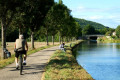
(6) When you reach the Burgundy Canal, turn left onto the old towpath. Follow it for 2 km until you reach the bridge over the D8.

(7) Turn left onto the D8 and follow it for about a hundred metres. Opposite the picnic area, turn right onto the stony track. It will cross the D33 before passing over a very old, narrow stone bridge over the Gironde. The return journey to the town hall grounds follows the dry-stone wall of the castle grounds. Before the wash house, cross the Town Hall Square to reach the car park. (S/E).


Waypoints

  1. S/E : mi 0 - alt. 1,053 ft - Clos de la Mairie car park
  2. 1 : mi 0.65 - alt. 1,089 ft - Path through a field
  3. 2 : mi 1.13 - alt. 1,506 ft - Junction of several paths in the Bois de Ruère
  4. 3 : mi 1.82 - alt. 1,125 ft - Junction of the Denis Gaulard and Marigny footpaths
  5. 4 : mi 1.97 - alt. 1,060 ft - ‘Véloroute’ signage to the south
  6. 5 : mi 2.1 - alt. 1,017 ft - Junction with the D33 at Auvillard
  7. 6 : mi 2.33 - alt. 1,004 ft - Cycle route: former towpath - Canal de Bourgogne
  8. 7 : mi 3.57 - alt. 991 ft - Bridge over the canal on the D8 road
  9. S/E : mi 4.03 - alt. 1,053 ft - Clos de la Mairie car park

Notes

The Tour Denis Gaulard is listed in the PDIPR-21

An easy walk with an elevation gain of just 80 metres over 500 metres (16%) between the D114 road and the junction of several paths in the Bois de Ruère.

(S/E) The local council has set up a refreshment point in a wing of this former wine-growing estate.

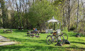
On leaving the village on the D114, next to the Chamboran bridge over the Gironde, there is a shaded car park with a picnic table.

(7) After the bridge over the canal and then the bridge over the Ouche, there is a picnic area with a shelter.

Worth a visit

(S/E) In the 18th century, the municipal complex was a vineyard estate with the manor house at its centre, now the town hall. To the west, a long row of buildings comprising: - the former wine cellars and barns, converted into a village hall; - a residential building that has become a small restaurant; - the wood-fired oven room, which was restored to working order in 2019.

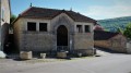
Push open the doors of the washhouse to see, on the left-hand gable, the still-legible graffiti scrawled with a piece of charcoal: ‘Hello, gossips, here we wash our clothes and make a mess of the world’.

Opposite the square is the entrance (admission fee applies) to the remarkable gardens of Barbirey Castle.

(2) A 500-metre round trip takes you to the Table du Druide. From this flat rock, there is a sweeping view of the Roche-Chèvre massif, the Gironde valley and the hamlet of Jaugey, which boasts a washhouse designated a ‘Remarkable Monument’.

(6) Between the River Ouche and the Burgundy Canal, from Lac Kir in Dijon to the port of Pouilly-en-Auxois, the old towpath has been transformed into a cycle route open to pedestrians.

Just upstream from Saint-Victor-sur-Ouche, the Écluse de la Charme offers, in season, an open-air café serving regional specialities, as well as exhibitions, entertainment and walking tours.

Reviews and comments

4.4 / 5
Based on 3 reviews

Reliability of the description
4.7 / 5
Ease of following the route
4.7 / 5
Route interest
4 / 5
NanaDidi
NanaDidi

Overall rating : 5 / 5

Date of your route : Jun 02, 2025
Reliability of the description : ★★★★★ Very good
Ease of following the route : ★★★★★ Very good
Route interest : ★★★★★ Very good
Very busy route : No

A lovely little walk for days when you’re short on time or just want to take it easy. You go uphill, then downhill, then walk on level ground. There are lots of herons along the banks of the canal.

Machine-translated

Michel GORGES
Michel GORGES

Overall rating : 3.7 / 5

Date of your route : Oct 14, 2024
Reliability of the description : ★★★★☆ Good
Ease of following the route : ★★★★☆ Good
Route interest : ★★★☆☆ Average
Very busy route : No

The marking was correct

Machine-translated

Cyberbarit
Cyberbarit

Thanks for the comment – that’s exactly right. All the best!

Machine-translated

Chabanis
Chabanis

Overall rating : 4.7 / 5

Date of your route : Aug 27, 2021
Reliability of the description : ★★★★★ Very good
Ease of following the route : ★★★★★ Very good
Route interest : ★★★★☆ Good
Very busy route : No

Despite a steep climb at the start, this walk is easy and enjoyable. It’s marked with yellow signs and very well signposted. 👏

Machine-translated

Other walks in the area

For more walks, use our search engine .

The GPS track and description are the property of this route's author. Please do not copy them without permission.