Tour of Marigny-sur-Barbirey and Saint-Victor-sur-Ouche

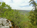
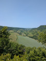
This walk passes through the Bois de Ruère, where the “Table du Druide” viewing platform offers panoramic views over the Gironde valley and the Roche-Chèvre massif. Next come the ruins of Marigny Castle. Don’t miss, after the drawbridge, the remains of the gatehouse, the dovecote and the chapel. Once you’ve crossed the Ouche at Saint-Victor, the return route follows the towpath of the Canal de Bourgogne.

Details

1921788
Creation:
Last update:
Last review:
  • Walking
    Activity: Walking
  • ↔
    Distance: 5.84 mi
  • ◔
    Average duration: 3h 20 
  • ▲
    Difficulty: Moderate

  • ⚐
    Back to start: Yes
  • ↗
    Ascent: + 722 ft
  • ↘
    Descent: - 745 ft

  • ▲
    Highest point: 1,506 ft
  • ▼
    Lowest point: 981 ft

Photos

Description of the walk

Park in the car park at the Barbirey-sur-Ouche Town Hall, 21410

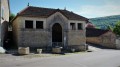
(S/E) Cross the town hall square and walk past the washhouse and drinking trough, listed as a “Remarkable Monument”.

(1) Turn right into Rue de Jaugey. Follow this road, then Rue des Lurots, until you reach the Chamboran Bridge over the Gironde. A sign points towards “Tour Denis Gaulard – Saint-Victor via Ruère”; follow the yellow markers.

(2) Head west onto the D114. After about 300 metres, turn left onto a track that crosses a large field, before climbing along the edge of the woods to the crossroads marked by a sign reading: “Viewpoint 500m – La Table du Druide”.

(3) Leave the yellow markings and continue by following the white markings of the “Tour de Barbaricum”, which passes through La Table du Druide. The path continues along a ledge before turning right onto a track heading south. After about 150 m, this leads to a stony track. Turn left onto this track. It heads east, initially on level ground for 300 m, then descends steeply in hairpin bends.

(4) After 400 m, leave the white markings for the “Tour de Barbaricum”. Turn right onto the path that climbs southwards for about 800 m to reach the ruins of Marigny Castle.

(5) Enter the enclosure without ever straying from the narrow path worn by foot traffic. It is dangerous to venture elsewhere. Exit via the gatehouse and follow the path heading north-west before turning west to reach a crossroads.

(6) Turn left onto the stony track until you reach the junction of the two towers: Marigny and Denis Gaulard, north of the hamlet of Auvillard.

(7) Turn left. From here, follow the yellow markers to the finish. Cross the D33 road in Auvillard to reach the stone bridge over the Ouche and cross it.

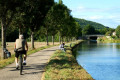
(8) When you reach the Burgundy Canal, turn left onto the old towpath. Follow it for 2 km to the bridge over the D8 road.

(9) Turn left onto the D8 and follow it for about a hundred metres. In front of the picnic area, turn right onto the stony track. This will cross the D33 before crossing a very old, narrow stone bridge over the Gironde. The return to the town hall grounds is via the dry-stone wall in the castle grounds. Before the wash house, cross the town hall square to reach the car park (E)

Waypoints

  1. S/E : mi 0 - alt. 1,053 ft - Enclosed car park at the Town Hall
  2. 1 : mi 0.08 - alt. 1,040 ft - Junction with Rue de Jaugey at the wash house
  3. 2 : mi 0.44 - alt. 1,037 ft - Chamboran Bridge car park
  4. 3 : mi 1.14 - alt. 1,506 ft - Ruère Wood crossroads
  5. 4 : mi 2.12 - alt. 1,132 ft - Path leading south to Marigny
  6. 5 : mi 2.59 - alt. 1,368 ft - Ruins of Marigny Castle
  7. 6 : mi 3.15 - alt. 1,388 ft - A stony path leading down to Auvillard
  8. 7 : mi 3.63 - alt. 1,125 ft - Junction of the “Marigny” and “Denis Gaulard” trails
  9. 8 : mi 4.16 - alt. 994 ft - Cycle route – Former towpath - Canal de Bourgogne
  10. 9 : mi 5.39 - alt. 991 ft - Bridge - Ouche (rivière)
  11. S/E : mi 5.84 - alt. 1,053 ft - Enclosed car park at the Town Hall

Notes

Standard equipment for a fairly easy walk.

(S/E) Car park at the town hall grounds.

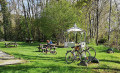
(2) Shaded car park with a picnic table at the Chamboran bridge.*

(3) Here there is a short alternative route called the “Tour Denis Gaulard”, marked in yellow. It heads due south to reach the junction (7) to the north of the hamlet of Auvillard.

(9) Next to the bridge over the Ouche, near the canal, there is a picnic area with a shelter.

Worth a visit

(S/E) In the18th century, the village complex was a wine-growing estate with the manor house at its centre, now the town hall. To the west is a long row of buildings comprising:
- the former wine cellars and barns, converted into a village hall,
- a residential building that has become a small restaurant,
- the wood-fired oven room, which was restored to working order in 2019

(1) Push open the doors of the washhouse to see, on the left-hand gable, graffiti still legible, scrawled with a piece of charcoal: “Hello, gossips, here we wash our clothes and make a mess of the world”.

(1) Opposite the square is the entrance (admission fee applies) to the Remarkable Gardens of Barbirey Castle.

(3) La Table du Druide, offering sweeping views over the Roche-chèvre massif, the Gironde valley and the hamlet of Jaugey.

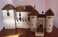
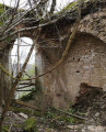
(5) The ruins of the feudal castle of Marigny. You can enter the enclosure but must never stray from the narrow, well-trodden path. After crossing the fixed bridge and then passing over the filled-in section of the moat where the drawbridge once stood, go through the gatehouse between its two towers. Note the gun ports. Follow the well-trodden path which passes in front of the ruins of the stables to reach the dovecote and the apse of the old chapel. Please note: it is dangerous to venture elsewhere.

(8) The old towpath has been transformed, from Lac Kir in Dijon to the port of Pouilly-en-Auxois, into a cycle route reserved for cyclists and pedestrians. Just upstream from Saint-Victor-sur-Ouche, the Écluse de la Charme offers, in season, an open-air café serving regional produce, exhibitions, entertainment and walking tours.

Reviews and comments

4.6 / 5
Based on 3 reviews

Reliability of the description
4.7 / 5
Ease of following the route
4.3 / 5
Route interest
4.7 / 5
NanaDidi
NanaDidi

Overall rating : 5 / 5

Date of your route : Apr 05, 2026
Reliability of the description : ★★★★★ Very good
Ease of following the route : ★★★★★ Very good
Route interest : ★★★★★ Very good
Very busy route : No

We’re big fans of the walks suggested by Cyberbarit (the choice, relevance and detail) and, once again, we were delighted.
Marigny Castle has indeed become private property, but you can still take a peek inside (or more, depending on how daring you are). That said, it seems to me to be falling into disrepair rather quickly and some restoration work would be most welcome.

Machine-translated

Cesamel
Cesamel

Overall rating : 4 / 5

Date of your route : Mar 10, 2025
Reliability of the description : ★★★★☆ Good
Ease of following the route : ★★★★☆ Good
Route interest : ★★★★☆ Good
Very busy route : No

There are few points of interest and the castle ruins are off-limits to the public (private property), but it’s a very pleasant, easy walk – perfect for getting back into walking at a leisurely pace through the woods and along the canal as soon as the sun comes out.

Machine-translated

marieofavelier
marieofavelier

Overall rating : 4.7 / 5

Date of your route : Nov 19, 2024
Reliability of the description : ★★★★★ Very good
Ease of following the route : ★★★★☆ Good
Route interest : ★★★★★ Very good
Very busy route : Yes

A lovely route – best done in dry weather (it’s very slippery when it rains in autumn, as there are leaves on the stones).

Machine-translated

Other walks in the area

For more walks, use our search engine .

The GPS track and description are the property of this route's author. Please do not copy them without permission.