Country:
 City:


Park on the outskirts of Sombernon, on the D977bis towards Echannay/Commarin, 100 metres after it branches off from the D905.
(S/E) With your back to the car park, turn left towards the village, then at the junction with the D905 turn right until you reach the start of Rue des Tuileries on the left.
(1) Walk down Rue des Tuileries towards the Brenne valley. At the bottom of this street, there is a drinking trough with a spring on the left. Continue downhill to the Brenne, taking Rue du Patis on your right. After the bridge, walk a few dozen metres to see the pretty Villotte washhouse on your right.
(2) Carry on climbing up Rue des Potiers, leave the village and, just after passing under the high-voltage power lines, you’ll reach a junction with a path. You’re now on the plateau.
(3) Leave the road and take the path on the left, which joins a tarmac road after about 500 metres. Carry on straight ahead along this road, which takes you through a small wood. As you emerge from the wood, there is a small meadow on the left, with a cadole (an old dry-stone hut), just below the road.
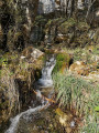
(4) Look out for the cadole and cross the meadow to the left. You’ll come to a small descending passage with a faint path running between two rocks. Use the rope provided to help you keep your balance. You’ll then arrive in the middle of a pretty little rocky cirque where the beautiful Golotte spring gushes forth. Take the path leading down to the spring.
(5) The path continues down through the woods, beyond which lies the spring and the Chapelle Sainte-Barbe. Walk for about 300 metres and stop at the chapel, which is very picturesque, set amidst lush greenery.
(6) Continue down to the village of Vieilmoulin along the tarmac road. You will then see a fountain on your left.
(7) Turn right onto Rue Haute (D9H), heading towards the opposite hillside, cross the Ruisseau de la Golotte and continue uphill. When you reach the sign marking the village exit, carry on for about sixty metres to reach the junction with the Route de Geligny.
(8) Head downhill to the left towards Geligny via the D9K and follow the D9K for about 1 km until you reach the hamlet of Geligny. You’ll arrive at the centre of the hamlet, marked by a pretty fountain.
(9) Leave the fountain on your right, turn left onto the road that crosses the River Brenne and climbs back up towards the D905. Once you’ve reached the D905, follow it to your left, towards Sombernon, for a few dozen metres. Just before a house, look out for a path on the right.
(10) It climbs steeply towards the forest covering the southern slope of the Brenne valley. Follow this lovely path for about 300 metres, until you reach a fork in the woods on the left.
(11) Keep to the left, climb for about a hundred metres, take a small path that runs along the base of the cliffs, and follow it to a large cavern.
(12) This cavern, with its impressive dimensions, was carved out during the quarrying of the cliffs for the extraction of building materials. Take a moment to admire the cavern and the cliffs (which have been equipped for rock climbing).
Head back to the previous junction.
(11) Turn left and follow the path as it climbs through the woods, above the Ruisseau de Toussot, towards the plateau. On the plateau, the path runs alongside the woods, turns sharply left, and joins the D16 (Rue Saint-Léger).
(13) Cross the road and carefully follow the D16 to the left for about 200 m. Pass Rue des Grandes Charnières on your right and, just after that, you’ll reach the bottom of a wide flight of steps.
(14) It leads up towards a housing estate. At the top, turn left and take a small path which leads straight to the car park on Avenue de la1re Armée Française (S/E).
 Visorando Member
 Moderate