Circuit of Mont Chat from Saint-Romain-de-Popey

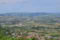
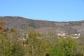
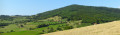
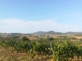
A short, varied walk through vineyards, woodland and fields.
Cows and horses will accompany you throughout the walk, much to the delight of the little ones.
Plenty of roads.
The route is signposted in yellow.

Details

29656605
Creation:
Last update:
Last review:
  • Walking
    Activity: Walking
  • ↔
    Distance: 5.57 mi
  • ◔
    Average duration: 3h 05 
  • ▲
    Difficulty: Easy

  • ⚐
    Back to start: Yes
  • ↗
    Ascent: + 630 ft
  • ↘
    Descent: - 636 ft

  • ▲
    Highest point: 1,352 ft
  • ▼
    Lowest point: 840 ft

Description of the walk

(S/E) From the car park at the Saint-Romain-de-Popey village hall, head back towards the village. When you reach the bakery, head towards Sarcey (the road leading down to the right). At the Fork in the road, turn right into Rue du Lavoir; in the bend, follow Rue de Charpenay and leave the road towards Sarcey on your left. At the next junction, take the road on the right towards Buffetières. Carry on straight ahead and leave Saint-Romain.

(1) At the hamlet of Buffetières, carry on straight ahead along the road towards Solemy and go round a bend.

(2) About ten metres further on, take a small path leading down to the left (signpost). Cross a railway line and join a road.

(3) Turn left onto this road and cross the Turdine.
When you reachthe first houses, follow the road to the right. At the next junction, take the road on the right, still heading towards Solémy, until you reach the Brosses crossroads (cross).

(4) Turn onto the road leading uphill to the left and, at the top of the hill, turn left onto the Chemin des Grandes Terres. Pass a stadium on your left

(5) At the junction, leave the road and take a path that goes straight on (yellow markings) and joins a road

(6) At the junction, follow this road to the left (Chemin du Jonchay), cross the bridge over the Turdine, before reaching the Thinot. Continue along this road, cross the railway line and carry on to La Varenne.

(7) As you leave the hamlet, turn right onto the road. At the next hamlet (Les Arnas), join the D67 and follow it for about 300 metres on the left.

(8) After passing the houses, carry on along the D67, then turn left onto a track. At the junction with a road, take this road on the left, which leads to Saint-Romain.

(9) At the junction (the first houses in Saint-Romain), turn right onto the road that goes uphill and carry on straight ahead until you reach the bakery. At the junction, turn left towards the village hall, which will be on your left along the road (S/E).

Waypoints

  1. S/E : mi 0 - alt. 1,345 ft - Village hall
  2. 1 : mi 1.27 - alt. 1,135 ft - Buffetières
  3. 2 : mi 1.48 - alt. 1,053 ft - Junction on the path
  4. 3 : mi 1.78 - alt. 853 ft - Road junction. Cross the - Turdine (rivière)
  5. 4 : mi 2.46 - alt. 1,050 ft - Brosses crossroads
  6. 5 : mi 2.94 - alt. 1,086 ft - Crossroads
  7. 6 : mi 3.2 - alt. 994 ft - Road junction
  8. 7 : mi 4.03 - alt. 1,089 ft - La Varenne
  9. 8 : mi 4.87 - alt. 1,155 ft - D67
  10. 9 : mi 5.32 - alt. 1,266 ft - Entrance to Saint-Romain
  11. S/E : mi 5.57 - alt. 1,345 ft - Village hall

Notes

Parking is available in the car park at the Saint-Romain multi-purpose hall (along the D33 towards Savigny).
There is a slightly steep descent between points (2) and (3).

Reviews and comments

4.3 / 5
Based on 2 reviews

Reliability of the description
5 / 5
Ease of following the route
5 / 5
Route interest
3 / 5
Patoop
Patoop

Overall rating : 4.3 / 5

Date of your route : Sep 20, 2024
Reliability of the description : ★★★★★ Very good
Ease of following the route : ★★★★★ Very good
Route interest : ★★★☆☆ Average
Very busy route : No

I’ve got mixed feelings about this walk. The views of the vineyards are lovely, but there are far too many roads. That’s all there is to it, apart from one section.

Machine-translated

Eve73
Eve73

Overall rating : 4.3 / 5

Date of your route : Jun 02, 2023
Reliability of the description : ★★★★★ Very good
Ease of following the route : ★★★★★ Very good
Route interest : ★★★☆☆ Average
Very busy route : No

Too much tarmac.

Machine-translated

Other walks in the area

For more walks, use our search engine .

The GPS track and description are the property of this route's author. Please do not copy them without permission.