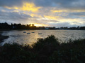
Pointe du Grand-Mont

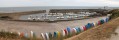
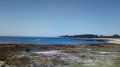
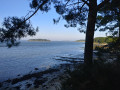
A short round-trip section of the Tour du Golfe du Morbihan (TGM): a path running the length of the Grand-Mont site, in the commune of Saint-Gildas-de-Rhuys, with views of the ocean, Hoëdic, Houat, Quiberon and Belle-Île. A very beautiful walk along the cliff.

Details

n°44084622
Creation:
Last update:
Last review:
  • Walking
    Activity: Walking
  • ↔
    Distance: 3.73 mi
  • ◔
    Average duration: 1h 50 
  • ▲
    Difficulty: Easy

  • ⚐
    Back to start: Yes
  • ↗
    Ascent: + 135 ft
  • ↘
    Descent: - 121 ft

  • ▲
    Highest point: 102 ft
  • ▼
    Lowest point: 20 ft

Photos

Description of the walk

You’ll find a fairly large car park near Govelins Beach. In summer, this can get quite full.

(S/E) With Govelins Beach and the ocean in front of you, the path heads off to the left via a flight of steps. It is virtually impossible to get lost on this signposted path, which forms part of several short and long-distance walks. Make sure you stay on the path, especially on the steep sections. There is no danger as long as you stay on the path. Continue to the junction with the access road to a private property.

(1) Turn right and head towards the Route du Grand-Mont, where you’ll find a car park and public toilets.

(2) Stay on the coastal path and continue towards the Pointe du Grand Mont orientation point. Carry on along the path.

(3) At this point, below you, lies the Saint-Gildas Devotional Fountain, which is only accessible when this short detour off the path is open. Do not take this detour after rain and/or when it is closed. Continue along the path until you reach Rue Pierre Messmer.

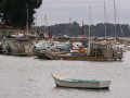
(4) There are a few parking spaces, and the small Port-Maria beach is at the end of the road which leads back up towards the village. If you wish to continue a little further, past the beach you’ll find Port aux Moines, a car park and another beach.

Turn round and follow the outward route in the opposite direction to return to the starting point (S/E).

Waypoints

  1. S/E : mi 0 - alt. 26 ft - Govelins Beach car park
  2. 1 : mi 0.83 - alt. 102 ft - Junction with a path
  3. 2 : mi 0.92 - alt. 102 ft - Route du Grand-Mont with car park
  4. 3 : mi 1.07 - alt. 52 ft - Access to the Saint-Gildas fountain
  5. 4 : mi 1.87 - alt. 36 ft - Rue Pierre Mesmer
  6. S/E : mi 3.73 - alt. 26 ft - Govelins Beach car park

Notes

Follow the path and do not stray from it where the cliff is steep.
Bring water as there are no refreshment points. However, the village of Saint-Gildas is not far away on the Route du Grand-Mont, halfway along the route (2). There is a car park with public toilets.
After heavy rain, particularly in winter, many sections are muddy. Wear high-top walking shoes or boots.

Worth a visit

Swimming is possible, particularly at Govelins beach (S/E).
Take a stroll through the little village of Saint-Gildas: bars, restaurants and a beautiful abbey church.
If you’re lucky, you might spot some dolphins during your walk.
Near (2), at Pointe du Grand-Mont, an orientation board shows the locations of the islands and coastal landmarks. Take your time to admire the scenery, particularly the light at sunrise and sunset.

Reviews and comments

5 / 5
Based on 1 review

Reliability of the description
5 / 5
Ease of following the route
5 / 5
Route interest
5 / 5
Valerie44
Valerie44

Overall rating : 5 / 5

Date of your route : Jul 01, 2024
Reliability of the description : ★★★★★ Very good
Ease of following the route : ★★★★★ Very good
Route interest : ★★★★★ Very good
Very busy route : No

A very beautiful section of the Customs Officers’ Path.

Machine-translated

Other walks in the area

For more walks, use our search engine .

The GPS track and description are the property of this route's author. Please do not copy them without permission.