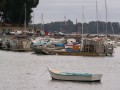
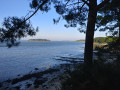
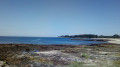
From Port aux Moines Beach, in the commune of Saint-Gildas-de-Rhuys, to Pointe de Saint-Jacques and its harbour, in the commune of Sarzeau. Views of the ocean towards the islands of Houat, Hoedic and Belle-Île. A lovely walk along numerous beaches, so there are opportunities for a swim! The path runs the entire length, even at high tide during spring tides. On windy days, the route is very exposed.
You will find a fairly large car park between Port-aux-Moines and its beach. From mid-July to mid-August, it can be full and the beaches along the walk can be very busy.
(S/E) Facing the ocean, the path heads off to the left (east). It is virtually impossible to get lost on this signposted path, which forms part of several walks, hikes and GR® routes. Make sure you stay on the path and not on Port-aux-Moines beach, as it is not easy to get back up from the end of the beach. You’ll arrive at Poulgor Beach, which is quite sheltered.
(1) Unless you stop for a break, continue along the coastal path. The coast is rocky throughout this section and relatively high above sea level.
(2) Following the path, as you approach Kercambre Beach, go down a flight of steps leading onto the rocks and then onto the beach. Cross the beach and rejoin the path a little further on (depending on the tide). Follow it along the rocky foreshore, which is walkable at low tide. The coastal path continues without any notable junctions as far as Saint-Jacques Beach. On the landward side, it is bordered by fields and woods.
(3) Walk past the beach (you can stop for a swim in the summer). Turn back immediately or carry on to Pointe de Saint-Jacques, not far away, just a stone’s throw from the harbour. After enjoying the spot, return to the Port-aux-Moines car park by following the outward route in the opposite direction (S/E).
Waypoints
S/E : mi 0 - alt. 36 ft - Port-aux-Moines car park
1 : mi 0.28 - alt. 26 ft - Poulgor Beach
2 : mi 0.6 - alt. 20 ft - Kercambre Beach
3 : mi 1.98 - alt. 20 ft - Saint-Jacques Beach
S/E : mi 3.92 - alt. 36 ft - Port-aux-Moines car park
Notes
The walk is very easy and can be done in ordinary trainers. Bring water as we did not see any refreshment points between Port-aux-Moines and Saint-Jacques. However, there are public toilets at both locations and facilities to refill water bottles. This walk can be done all year round. Do, however, take care in the event of high tides or rough seas. In 2023, a storm destroyed the path near Saint-Jacques Beach. After heavy rain, particularly in winter, many sections are muddy. In summer, particularly from mid-July to mid-August, the path and beaches can be very busy. There are few shaded areas.
Worth a visit
The walk connects beaches separated by long rocky stretches (mostly not very steep). You can therefore swim at several spots, weather and sea conditions permitting! As the beaches are somewhat sheltered, they are relatively protected from westerly winds, though this is relative. There is a sailing school with equipment hire available at Saint-Jacques Beach. You can also eat and have a drink there, as well as at the harbour (numerous bars and restaurants, though mostly open during the tourist season). Our tip => Take your time to admire the scenery, particularly the light at sunrise and sunset! On a round trip, the outward journey is always different from the return, particularly because of the light.
Reviews and comments
4.7 / 5
Based on 2 reviews
Reliability of the description 5 / 5
Ease of following the route 5 / 5
Route interest 4 / 5
julienmarchais
Hello and thank you for your feedback. I’ve amended the route, which wasn’t starting from the right place!
Machine-translated
Cabus Jean-Xavier
Overall rating :
4.7 / 5
Date of your route : Apr 30, 2026 Reliability of the description : ★★★★★ Very good Ease of following the route : ★★★★★ Very good Route interest : ★★★★☆ Good Very busy route : No
An easy coastal path along the ocean, though unfortunately the sea mist prevents a clear view. Return via the same route. The car park is located further up than indicated in the description.
Machine-translated
kerna.net
Overall rating :
4.7 / 5
Date of your route : Sep 15, 2024 Reliability of the description : ★★★★★ Very good Ease of following the route : ★★★★★ Very good Route interest : ★★★★☆ Good Very busy route : Yes
An easy route that’s straightforward to follow. The only thing that might cause you to miss the starting point is the lack of road signs.
To open this route on your smartphone, you must have the Visorando app installed. If not, got to the Apple Store (iPhone) or Google Play Store (Android) to download the app.



 Country:

 City:
City:




 Visorando Member

 Difficult
  Moderate