Country:
 City:
City:


Access:
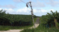
From Capesterre, take the N1 towards Pointe-à-Pitre and, as soon as you exit, take the Route de Cambrefort (as the name suggests, the climb is steep). Just before the barrier marking the boundary of the Ferme des Hauts de Cambrefort estate, leave your car at the entrance to a farm track on the left-hand side of the main road.
(S/E) Continue westwards along the road and pass through the gate, which is only open on weekdays before 4.30 pm. In any case, there are footpaths on either side of the gate. The official entrance to the estate is clearly marked by coconut palms.
Immediately on the right, you’ll see one of the entrances to the Neuf-Château site of CIRAD (Centre for International Cooperation in Agricultural Research for Development), a world-leading centre of excellence for research into banana cultivation.
N.B. Do feel free to walk over to the administration building to find out about the aims of the work being carried out on the site and to explain to the manager that you are not one of the many walkers who have strayed onto the road leading to the third Carbet waterfall.
Continue westwards between the administration block and the banana processing shed.
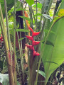
(1) About 250m past thefirst junction, take a path leading off to the left between two buildings. At the T-junction, turn left. At the next junction, turn right. Soon after, head down into the forest. Notice the change in vegetation, with balisiers replacing banana trees, as well as the change in birdsong.
(2) Cross the Guy Balaou Ravine via a bridge and head back up a farm track. After about 300m, you’ll emerge from the forest and come across banana trees again.
(3) Let the farm track climb to the right and cross the meadow to the left for about 30 metres. You will then find a gap in the hedge separating the two estates. Depending on the time of year, you may come across cattle grazing on a tether or goats: look out for their chains and work out how to get round them safely.
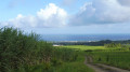
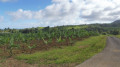
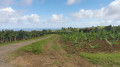
Head for the end of a wire conveyor belt for bananas; you may sometimes have to make your own way for about twenty metres through reeds or sugarcane. Once you’ve rejoined the concrete farm track, you’ll soon reach an area with coconut palms.
(4) Turn right and head downhill, with the forest on your right.
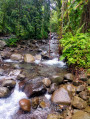
(5) At the bottom, turn right and follow the Rivière de Capesterre through the forest until you reach the sign prohibiting access to the water catchment area. Then retrace your steps.
(5) Continue eastwards and head downhill to the bridge over the Ravine Guy Balaou, amongst the bamboo groves. Once you’ve crossed the ravine, climb up a steep slope (15% or more) for about 400 metres.
(6) At the junction, head straight on along a path (not shown on the map) through the banana trees. You’ll come out onto a track; follow it to the left, climbing slightly. Wind your way through the banana trees and sugar cane for about 800 metres, ignoring a turn-off on the right. At a T-junction (coconut palms), turn right and you’ll soon reach the car park (S/E).

 Visorando Member
 Difficult
 Moderate