Walk around the Bois au Duc from Quarré-les-Tombes

This walk will take you round the village via the south and the Bois au Duc.
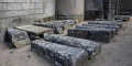
The village takes its name from the numerous stone vaults surrounding the church.
You’ll walk past the fallow deer park. The deer aren’t shy, and you can often spot one or two.
A fairly family-friendly route. Don’t forget to wear suitable footwear.

Details

47572450
Creation:
Last update:
Last review:
  • Walking
    Activity: Walking
  • ↔
    Distance: 4.05 mi
  • ◔
    Average duration: 2h 15 
  • ▲
    Difficulty: Easy

  • ⚐
    Back to start: Yes
  • ↗
    Ascent: + 486 ft
  • ↘
    Descent: - 495 ft

  • ▲
    Highest point: 1,608 ft
  • ▼
    Lowest point: 1,247 ft

Photos

Description of the walk

This walk starts in the centre of Quarré-les-Tombes.
Parking spaces are usually available. Please note that parking will soon be prohibited on Tuesday and Sunday mornings (market days). You can park behind the church or next to the community hall.
This walk follows a short section of theGR® Tour du Morvan.

(S/E) As you leave the car park, take the path on the right, cross the D55 – taking care – and continue along the road opposite. Cross the Ru Tancoin and look out for the start of a path on the right.

(1) Turn onto it and carry on until you reach a junction with a road.

(2) Return to the road, ignore the one on the left (Croix Chassignot) and carry on straight ahead to the crossroads at Busson-le-Bas

(3) Follow Rue de la Vernoie to the left, which continues as a footpath. Pass close to a wildlife park and head towards the fallow deer park car park.

(4) Cross the car park and take the track opposite. At Champlois, turn left, then right, and you’ll reach the D10.

(5) Follow the D10 to the left for about 150 metres, then take the track on the right. Follow it until you reach the D55.

(6) Turn left towards the centre, go round the church and return to the square (S/E).

Waypoints

  1. S/E : mi 0 - alt. 1,512 ft - Parking near the church
  2. 1 : mi 0.63 - alt. 1,302 ft - Road junction
  3. 2 : mi 0.87 - alt. 1,385 ft - Junction after the Ru de Tancoin Edit
  4. 3 : mi 1.33 - alt. 1,247 ft - Busson-le-Bas crossroads
  5. 4 : mi 2.51 - alt. 1,601 ft - Deer park car park
  6. 5 : mi 2.95 - alt. 1,509 ft - D10 junction
  7. 6 : mi 3.62 - alt. 1,483 ft - Crossroads
  8. S/E : mi 4.05 - alt. 1,512 ft - Parking near the church

Notes

At point (3), you can take the road or the path on the left to head into the woods and make your way to the ‘fairy rocks’.

Worth a visit

Although it is a small village, the village centre is home to two butchers and two chocolate shops. You can also stop at the bakery and the bar to top up your energy.

Always be cautious and plan ahead when you're outdoors. Visorando and the author of this route cannot be held responsible for any accidents occurring on this route.

The GR® and PR® markings are the intellectual property of the Fédération Française de Randonnée Pédestre.

Reviews and comments

4.3 / 5
Based on 3 reviews

Reliability of the description
4.3 / 5
Ease of following the route
4 / 5
Route interest
4.7 / 5
Rico89
Rico89

Overall rating : 5 / 5

Date of your route : Dec 31, 2024
Reliability of the description : ★★★★★ Very good
Ease of following the route : ★★★★★ Very good
Route interest : ★★★★★ Very good
Very busy route : No

A superb walk in the Morvan, with the fallow deer park as an added bonus.
A reliable and precise route, with no particular terrain challenges.

Machine-translated

Agenceur
Agenceur

Overall rating : 4 / 5

Date of your route : Jul 22, 2024
Reliability of the description : ★★★★☆ Good
Ease of following the route : ★★★★☆ Good
Route interest : ★★★★☆ Good
Very busy route : No

A lovely walk through the woods. The section between point 1 and point 2 is a bit tricky as the path is overgrown with brambles and stinging nettles. We didn’t see any animals in the deer park. And, in my opinion, it’s better to set off from the wildlife park car park (point 4), taking a path on the left after a short stretch of tarmac road to make the detour to the Roche des Fées, rather than trying to find it from point 3.

Machine-translated

gloumeaud
gloumeaud
• Edited:

Overall rating : 4 / 5

Date of your route : May 20, 2024
Reliability of the description : ★★★★☆ Good
Ease of following the route : ★★★☆☆ Average
Route interest : ★★★★★ Very good
Very busy route : No

In this area, where I had no guidebook or GPS tracks on my Garmin, the app enabled me to complete this beautiful hike safely. Thank you, Visorando. The app is a bit tricky to use at first, but with a bit of practice and trial and error, it works quite well. Thank you, Jean-Pierre.

Machine-translated

Other walks in the area

For more walks, use our search engine .

The GPS track and description are the property of this route's author. Please do not copy them without permission.