Country:

 City:
City:


Car park at Place de Saint-Léger.
(S/E) From the car park, head east along Rue du Montoir, ignore a turning on the left and continue to a junction where you join the GRP® Tour du Morvan.
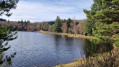
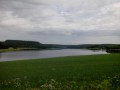
(1) Take a grassy path to the right (signposted ‘abbaye’), go round the Étang du Roi and join a small road near another pond.
(2) Continue along the small road, pass the hamlet of Le Bouchot and arrive at a junction.
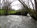
(3) When two houses come into view on the right, turn left at the second house, then take the path leading uphill to the right towards the woods. Follow it south-east to a river.
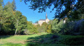
(4) Turn left before two large fir trees. Follow the “Chemin pèlerin” signs. 300 m further on, turn right after passing the large pine tree (larger than the previous ones) and head towards the abbey.
(5) After the abbey, leave the GRP® markings and walk alongside the buildings, taking the road uphill to the next hamlet.
(6) When the farm (belonging to the abbey) comes into view, take the first path on the right. Walk along the edge of the woods to go round a field. The path may not be clearly visible. Continue until you reach a road.
(7) Turn left, cross La Provenchère and continue for 1.8 km through the Forêt de Saint-Léger on a road called Traversée du Morvan.
(8) Before a junction, take the path on the right going downhill. There are paths not marked on the maps. Keep heading north-northeast and cross the small stream. Pass near the Étang des Genièvres and arrive at the hamlet of the same name.
(9) At the hamlet, turn left and walk along the edge of the pond. Continue along the path which turns right after the pond and joins a forest track.
(10) Follow it to the right and reach a crossroads near the hamlet of La Come (signpost).
(11) Turn right then left, cross the small road, keep to the left of the hamlet’s only building and continue along a path that leads to a road near a cross.
(12) Turn left and follow it straight on to the Place de Saint-Léger-Vauban (S/E).

 Visorando Member
 Easy
Easy