Country:
 City:
City:


Park in the Mazelle car park, or in the car parks around Metz railway station, which is located near the starting point, Place Mazelle.
(S/E) Starting from Place Mazelle, walk past the right-hand side of the Mazelle car park towards the Plantières underpass, which takes you under the railway lines, and on to a roundabout. Taking care to use the pedestrian crossings, go round the roundabout on the left to reach the Pont de la Seille.
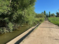
(1) Leave the bridge on your left (the return route), cross over and take a footpath lined with distinctive street lamps. Follow this path, keeping the Seille on your left. After the dog park, you’ll come to a Fork in the road.
(2) Take the path that descends slightly to the left. Stay on the path closest to the Seille and walk the length of Jean-Marie Pelt Park (Parc de la Seille). You’ll come to four rows of wooden steps running alongside a hop garden; climb them.
(3) Follow the path that branches off to the left towards the sports area; pass the basketball court on the right until you reach Rue Lothaire. Cross the road carefully, then take the bridge on the left until you reach a junction.
(4) Cross Rue Georges Ducrocq and follow this road, staying on the pavement with the street on your left, then turn left onto Rue des Prés, followed by Rue de Tivoli. Stay on this street and walk alongside Square Grandmaison until you reach Rue des Déportés.
(5) Follow it to the left, going uphill until you reach the Collège Philippe de Vigneulles, and go past the car park
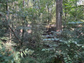
(6) At the bend in the road to the left, take the path leading off to the right into the woods, then take the path branching off immediately to the left, heading uphill. When you reach the back of the war memorial, take the path leading off to the right. Keep Fort Queuleu on your left for about 700 m, until you reach a junction.
(7) Follow the path leading off to the right to join a wider forest track called the Sentier du hêtre pourpre. When you reach a three-way junction, take the path leading down to the left – a cobbled track – until you reach the edge of a field.
(8) Take a short path, turning 90° to the right, which leads to a large field, and go round it on the right, following the path. You’ll reach a wider track, which is often muddy. Head off to the left, keeping the field on your left, and follow this path, which climbs very steeply, to enter the Pas du Loup park and reach a plateau.
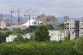
(9) Ignore the path leading straight ahead and take the small uphill path on the right. When you reach a stone bench, take in the view of the city of Metz as it changes with the seasons. Ignore all the paths branching off to the left and stay on the path which descends in a wide curve to the right, leading into the woodland at a junction.
(10) Take the path that descends steeply to the right. Walk past the beehives and join the three-way junction that crosses Rue de la Vachotte, then Rue Sur le Gué. Cross the latter to reach the path that runs alongside the Seille.
(11) Follow this path, turning right and keeping the Seille on your left. Stay on this path, ignoring all the tracks branching off to the left, until you are about a hundred metres from the Pont Lothaire, which you crossed earlier.
(4) Stay on the paved path that passes under the bridge, keeping the Seille on your left, heading due north for 1.2 km. Ignore the footbridge leading off to the left, and join Rue Georges Ducrocq at a bus stop. Continue straight on until you reach Avenue de Plantières, then turn left to cross the Pont de la Seille.
(1) Take the same pavements on the right as on the way there, but in the opposite direction, to reach Place Mazelle and the car park (S/E).


 Visorando Member

 Moderate