Country:
 City:
City:


Parking is available at Place Saint-Louis.
The Metz bus network
(S/E) From Place Saint-Louis, head towards Rue du Change and turn right. At the end, turn left onto Fournirue, then turn right onto Jurue; you’ll arrive at Place Sainte Croix. Walk along Rue du Haut Perrier, past the Église des Trinitaires, then past the entrance to the Musée de la Cour d’Or, the first exhibition venue. Work: “Echoes of Ice” by Philipp Frank.
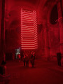
(1) As you leave the museum courtyard, walk past the Église des Trinitaires to admire “Frame Perspective” by Olivier Ratsi.
(2) On leaving, take Rue des Trinitaires on the left, then Rue Marchant. Turn left onto Boulevard Paixhans and you’ll reach the Pont des Grilles. Then turn right onto Avenue de Blida. There you’ll find BLIIIDA, home to “Flux” by the Scale collective.
(3) Then retrace your steps back to the previous junction. Across the road, take Rue Chambière. Turn right under the blocks of flats and head towards Square Jacqueline Picard, then left into Square Fleurette, then walk round Saint-Clément Church via Allée Alexis de Tocqueville to reach the Hôtel de Région. In its cloister you’ll find “Dandelion”, by Module and Nicolas Paolozzi.
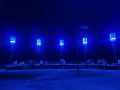
(4) As you set off again, cross the Pont Moreau via the street of the same name and turn left. In the Jardin Fabert you’ll find “Sentinels”, by Benjamin Nesme and Marc Sicard.
(5) Retrace your steps towards Place Jean-Marie Rausch. Then cross Place de la Préfecture and Place de la Comédie, walking past the Protestant church to reach the Jardin d’Amour. It is home to the artwork “Prismatica” by RAW Design.
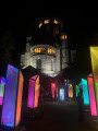
(6) As you leave the garden, after the church, cross the Pont des Roches to the right. Once you reach Place de Chambre, turn left and then right onto Rue d’Estrées. You’ll arrive in front of Saint-Étienne Cathedral, where a video mapping show is taking place.
(7) After the show, walk across the width of the Place d’Armes and, via Fournirue and then Rue du Change, make your way back to the Place Saint-Louis (S/E).
 Visorando Member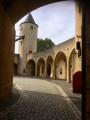

 Moderate